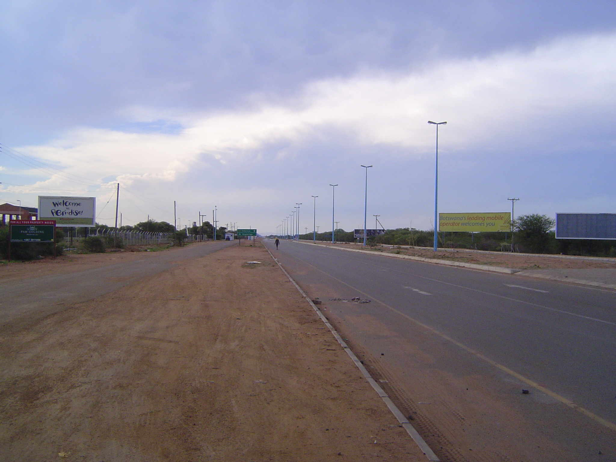
The Bechuanaland Protectorate, established in 1885, was administered from Mafikeng (now Mahikeng), just across the South African border. With independence approaching, the Bechuanaland Protectorate Legislative Assembly recommended in 1961 the construction of a capital at what was then called Gaborones. Work on the town began in 1964, two years before independence, when the name was changed to Gaborone (the "g" pronounced like an "h"and the final "e" getting its own subdued syllable). Fast forward 50 years, and there's a sprawling city of at least 300,000. It's an African Singapore, impressively clean, depressingly boring. Considering the usual alternative in Africa, maybe that's not such a bad tradeoff.
Go outside of town a few miles, stop the car, and walk into the bush. Only a field ecologist could get excited.
Can pictures mislead? Try this one, within the miniscule Gaborone Game Reserve.
Colonel Frederick Carrington arrived in Bechuanaland in 1884, during the Second Matabele War. He was told to build a fort and left this earthwork near a crossroads close to the Ngotwane River. It was called Fort Gaborones after Chief Gaborones, who had settled here in 1887 after migrating from South Africa. The chief lived on until 1932, long after Carrington's death in 1913.
In 1890 an Assistant Commissioner was posted here, and around his residence Gaborones Village arose.
A jail was required, and survives.
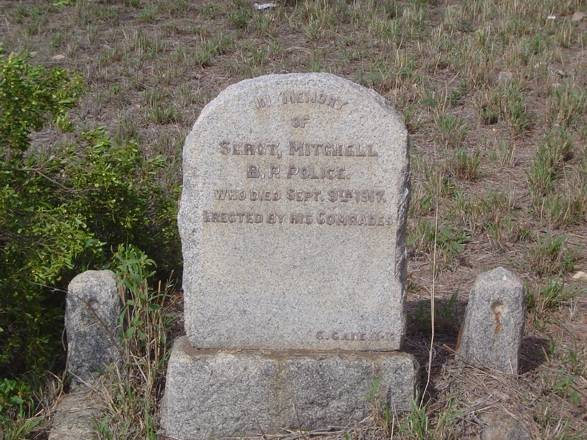
Police were required and provided. A cemetery, too.
The cemetery got off to a good start with the Boer War.
Age seems to have been no bar.
You know it's a major war when grave markers are standardized. Here's the Boer War version. "For King and Empire. Trooper L.H. Dahl, Southern Rhodesian Volunteers, February 2, 1900."
Nurses, too.
Peace didn't save everyone.
The cemetery is a historical monument in a country where the European past is paper-thin.
Half a dozen years after the creation of Fort Gaborones (or Gaberones, as it was often spelled), the railroad to Rhodesia was pushed through in record time, taking two years to reach Bulawayo from Mafikeng, over 400 miles away. The line skirted the southern edge of Bechuanaland, which had (and has) no other railroads. Any capital chosen for the independent country would likely be along the line, and so it proved to be.
Botswana had two things going for it. The first was Seretse Khama, a leader in the Mandela mold. Here he stands gazing at the National Assembly building.
The other was diamonds, discovered in 1967 at what became the Orapa Mine. Looking back in 1990, the minister of mineral resources, A.M. Mogwe, said, "The diamond mines were a Godsend." This is the Orapa Building, designed to allow indirect light into the diamond-sorting rooms.
It could have been another chapter in the saga of the resource curse, but the country had Khama. Transparency International in 2013 ranked Botswana the least corrupt country in Africa.
Where could the money from the sale of diamonds be spent? One obvious answer was infrastructure. Here: the four-lane road between Gaborone and the South African border at Tlokweng.
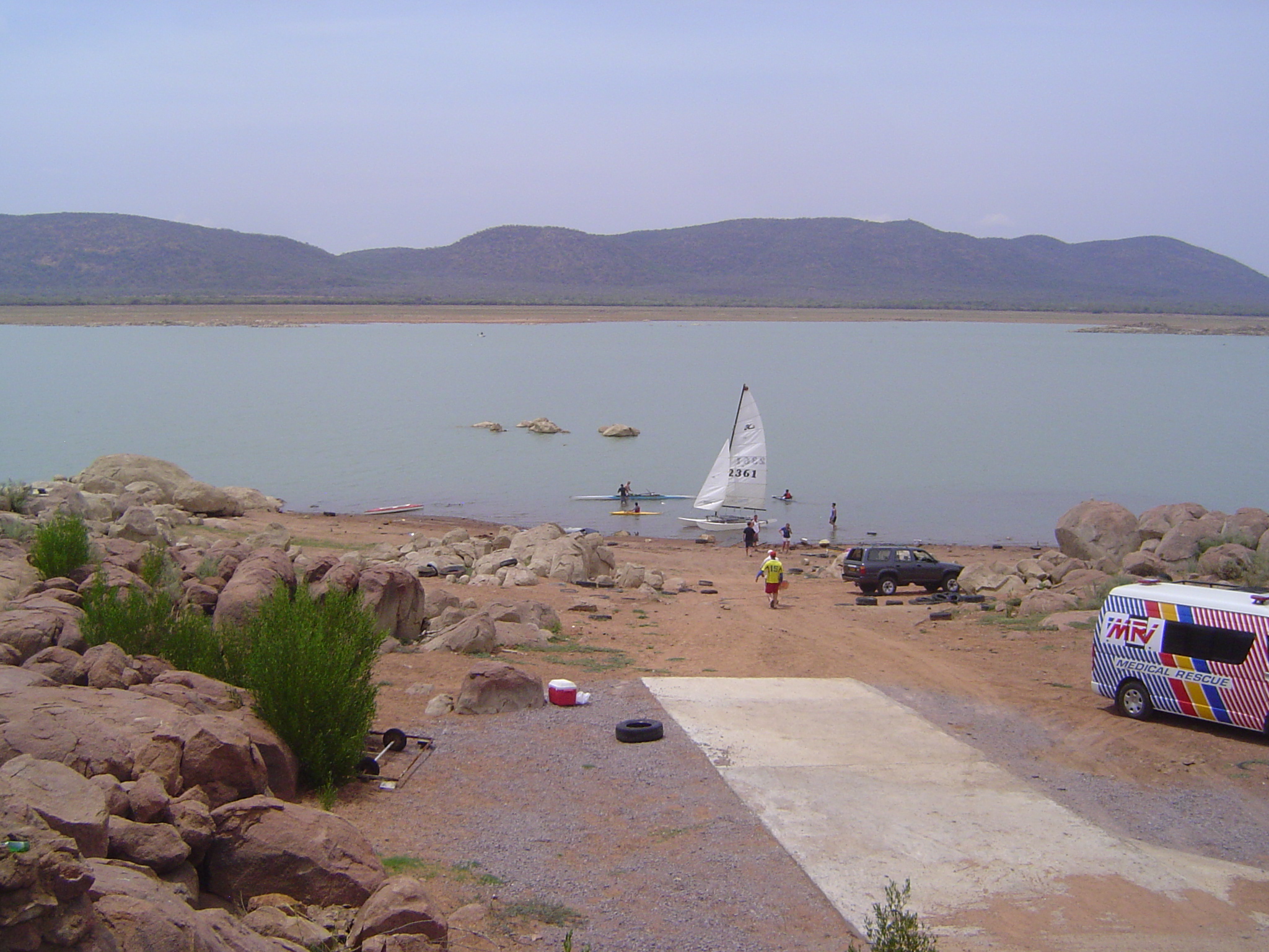
Another imperative was water, and work began on Lake Gaborone in 1964, two years before work began on the town proper. The dam (the long earthfill structure in the distance) was completed quickly and raised further in 1985. Perhaps the hydrologists were too optimistic, because drought and urban growth have put a severe strain on the water supply. One result: the boat-launching ramp in 2013 was a long way from the edge of the water. (Swimming is prohibited. If the crocodiles don't get you, schistosomiasis may.)
A dock, high and dry.
See it there?
The city planners anticipated a small town, dominated by officials. Starting at a point adjoining the railroad track, they laid out a semicircular government enclave, Farther from the center, two concentric semi-circles on the same center were laid out to embrace residential areas. The first was Independence Avenue and the second, Ring Road. Maybe the name Ring Road was a placeholder waiting for a national hero, but it stuck. A third and outer ring road couldn't make up its mind: different sections are named for Nyerere, Mobuto, and Machel. A commercial mall extended like a radius east from the government enclave through the residential areas. Later, superblocks would be added, basically residential islands boxed in by four- or six-lane highways. At the center of the pattern was this, the National Assembly building, about as typical of the 1960s as a building could be.
The finest jargon money can buy. Still, this is a country where foreigners can drive without being shaken down for bribes every five minutes. That's worth at least one sign's worth of jargon.
An example of the city's first-generation government buildings.
Another.
The central bank.
Here's the central mall, reaching out into the residential area. Ghost town? No, just early Sunday.
Just a few people around.
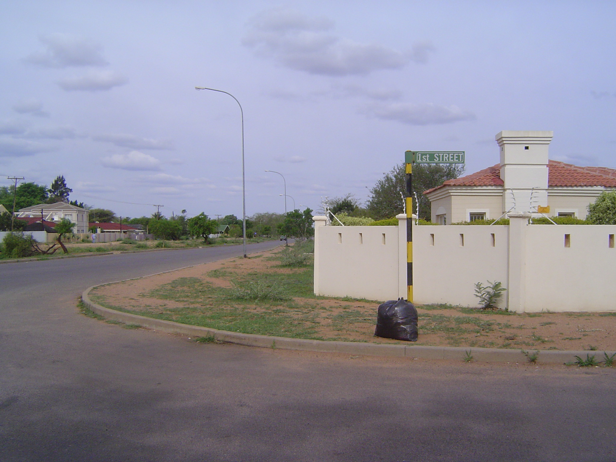
A bit of President's Drive, with a lineup of ambassadorial residences, sadly but not surprisingly walled off, with electric fencing atop the masonry.
The best thing about Gaborone is that it is very short on slums. We can go looking for them, but we'll have a hard time. Instead, there's lots of middle-class housing, defined (a cynic might say) by the absence of expensive walls and electric fences. We're in the neighborhood called Bontleng, conceived originally as housing for construction workers.
Same as the last? Not quite: this is what construction guys consider elegant variation.
Down-market duplex.
A little improvised protection against careless drivers.
Old Naledi is the neighborhood that grew up to house construction workers before the government stepped in with Bontleng. Old Naledi was supposed to be cleaned up, but too many people needed housing, and so it survives.
This is as bad as it gets, and it's a lot better than the slums in other African capitals.
Many of the town's rich have headed to suburbia.
Welcome to traffic.
Apparently people here know about big-city tricks.
Here we are, first stop in Phakalane.
Presto. Nice electric fencing.
A cleaner esthetic.
Ouch.
A homeowner who hasn't forgotten his roots or a foreigner who's caught the Africa bug?
Knee bone connected to the thigh bone, and suburbs connected to automobile dealerships.
Cell phones, of course.
Once upon a time, there was a company called...
The old central mall won't cut it any more. The tourism ministry writes that "Gaborone now boasts four, large American-style malls...."
And it has some American fast-food chains.
What would Herbert Morton Stanley have said if somebody in 1880 had told him Africa would look like this?
What do we need?
But of course: everything for security gates and electric fencing.
Notice the big boxes at the lower right: "Electric Fence Starter Kit."
Building supplies to match every pocketbook. Here's a middle-class home, painstakingly neat and with its own spiral column.
They must be in vogue.
The generations passeth, and governments need new buildings. What's this one?
There you go.
Here are the administrative offices of Debswana, the partnership between DeBeers and the government.
Here's the home of the department of taxes and the attorney-general.
Once an architect discovers curves, there's no straightening him out. Just beyond the tracks is Universal Plaza, whose promoters know the lingo. They advertise "security, a platform for interaction and communication, multi-functional facilities that celebrate diversity, operational and management efficiency, green technology and services, sustainability and access to natural light."
This architect must, on a trip to Paris, have stopped at La Défense.
Yet another mixed-use project rising from the scrub.
It's the Masa Center, the word meaning "new dawn."
And yet another.
It's part of the Fairscape Precinct.
Here it is in context.
Quite the transformation, no?