During the 1990s, a sleepy, dusty, and crumbling South Bohemian town somewhere near the border became a living town once again.... (The Story of the Town of Ceský Krumlov, 2009, published for the city's 700th birthday).
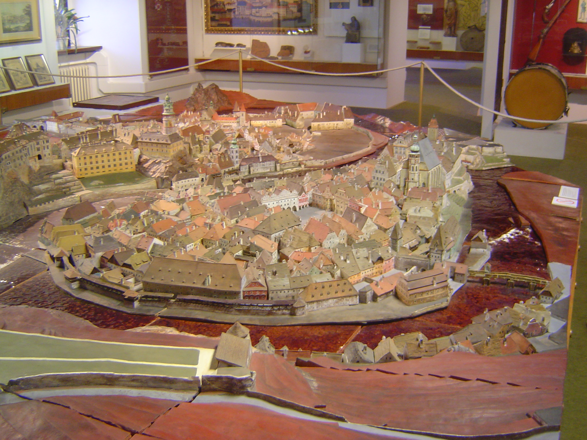
The town's museum has a splendid ceramic model of the town as it was in the year 1800, when it was (as it remained until World War II) the property of the Schwartzenberg family. Their castle stands in several sections to the left of the higher green-topped tower in the background. The model shows several features no longer extant, such as the towers over the entrance gate at the lower right and, above them, the green, bulbous tower at the Church of St. Vitus, which was replaced about 1900 by a gothic spire. The town square shows up, too. All told, there are about 800 structures in the model, each one made separately. The river enclosing the town is the Vlatava, known in German as the Moldau. German, by the way, was the language spoken by most people here until 1945, when the town's German population was deported.
Here's the neck of the meander. Water at high levels can still cross it. The bridge over the neck is shown with an entrance gate that no longer exists. The two water-level bridges do exist, though very few vehicles have permission to enter the area. The church on the right, St. Just, was desanctified in 1787 and since then has been everything from shops and restaurants to a casino.
The view from over and behind the castle, which was built around a series of courtyards. Note the extraordinary Bridge of Cloaks, on the right, a bit like a Roman aqueduct linking parts of the castle.
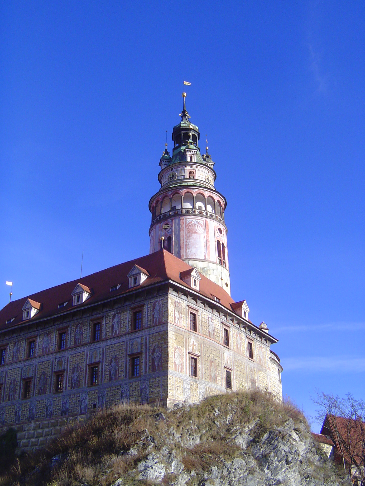
We'll leave the model and look at the real thing, here with the upper arc of the river. The weir is one of two that formerly diverted water into mill races. The bridge is new, of course, and the gates that used to stand on the town side are gone. The gothic spire of St. Vitus is at the center, and the handy way-finding tower of desanctified St. Just stands to the right of the castle tower and just manages to peep over the intervening buildings.
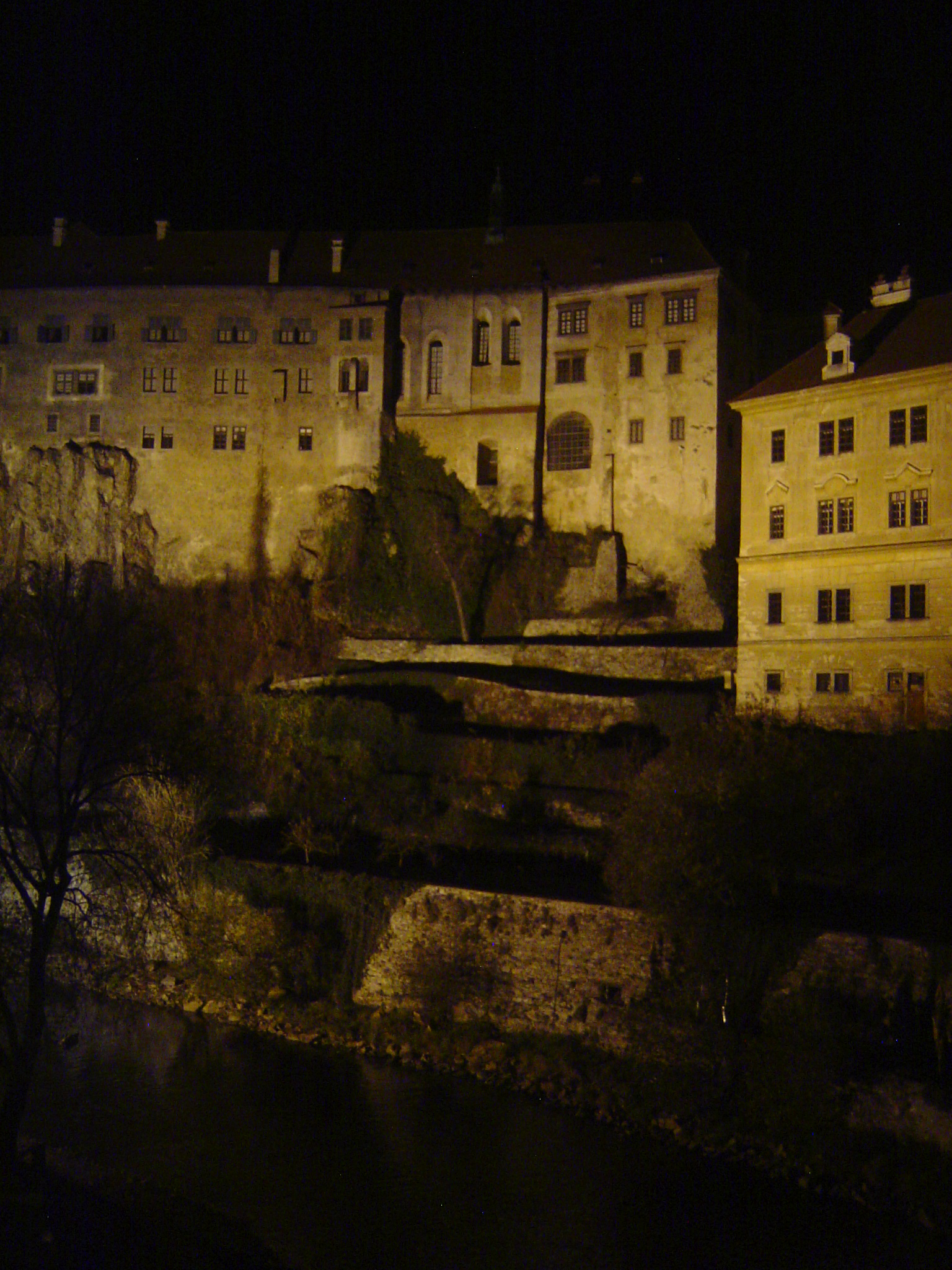
Looking downstream from about the same position, with a good view of the river and much of the castle, as well as the steep and almost inaccessible (because walled off at the top) slopes on the left bank. The river is clean but until recently was heavily polluted by paper-mill effluent. Earlier still, rafts of logs were floated downstream.
This was a working river, in other words, in this case with the second weir diverting water to a mill.
The site of the mill has found a more lucrative use, though a water wheel is a reminder of the past.
The old mill race survives, with a fine view of the castle tower.
Here's the mill race seen from the castle, with the Lazebnicky Bridge and downstream from it the flood-prone district called Parkan.
The view from a new, pedestrian-only bridge leading under the "aqueduct" to—modern necessity—a parking lot. Free? Dreamer! Tick-tock, tick-tock. Dig a little deeper.
A view down to the same pedestrian bridge.
A bit of the upper castle wall.
Decoration inside one of the castle courtyards. The aristocracy had a thing about hunting, after all, though the last of the Schwartzenbergs, Adolph, had the guts to post a sign at his public garden. This was 1938, and the sign read, "Jews Welcome." Hitler visited Cesky Krumlov that year, and Schwartzenberg refused to invite him into the castle. Shortly thereafter, Schwartzenberg left for Italy and then the United States, where he died in 1950.
Parts of the castle seen from across the river.
And at night.
The oldest part of the castle, with the tower, was renovated in 1580; the paint is from the mid-1990s.
This is the lower castle, but it's still perched on a crag.
St. Just. Bits of the nave survive, but good luck trying to see it.
The landward approach is all shops. The street, by the way, is the main one passing through the neighborhood called Latran, which grew up at the toe of the castle. Straight ahead and you're at the Lazabnicky Bridge; turn around and walk a few minutes back the other way and you're at... another parking lot. Tick-tock, tick-tock.
Back to the model for a moment, just to get our bearings before we walk across the arched bridge.
Here it is, the Upper Gate, minus the gate towers that show up in the model.
Another view. The building on the right houses the museum where the town-model is housed. The building originally was a Jesuit seminary, built about 1650. The Jesuits were evicted in 1774, and the building became a German high school. When the Germans were deported, the building became the museum, which opened in 1952.
The gate here is gone, but just as a hint of what it looked like, here's the town's one surviving gate, the I Budejovica Gate, in Latran.
Another view of the seminary-turned-museum.
Across the street is a former Jesuit college, now the Hotel Ruze.
Just down the street is the Church of St. Vitus, and attached to it is the local archive, formerly the prelature, roughly the bishop's palace.
From the prelature there's a good view of the wickedly raking roof of the church, along with its replacement spire.
There's a curate's residence too, with this decorative corner.
Back to the model for another moment: the town square, with the light-colored Rathaus facing a plague column, built in thanks for being spared. The Rathaus stands on the site of two or three early gothic houses there were connected to one another about 1500; the classical facing is from about 1800.
The Rathaus.
The facing side of the square.
The plague column.
Out of step with the rest of square: this is the New Savings Bank, from about 1900. In 1949, there was a much more jarring change: the "socialization" of all the town's businesses.
Until 1960, the town's main bus stop was here in the square. With the development of heritage tourism, the buses were evicted.
Instead of buses, there are crowds on a scale not to be underestimated.
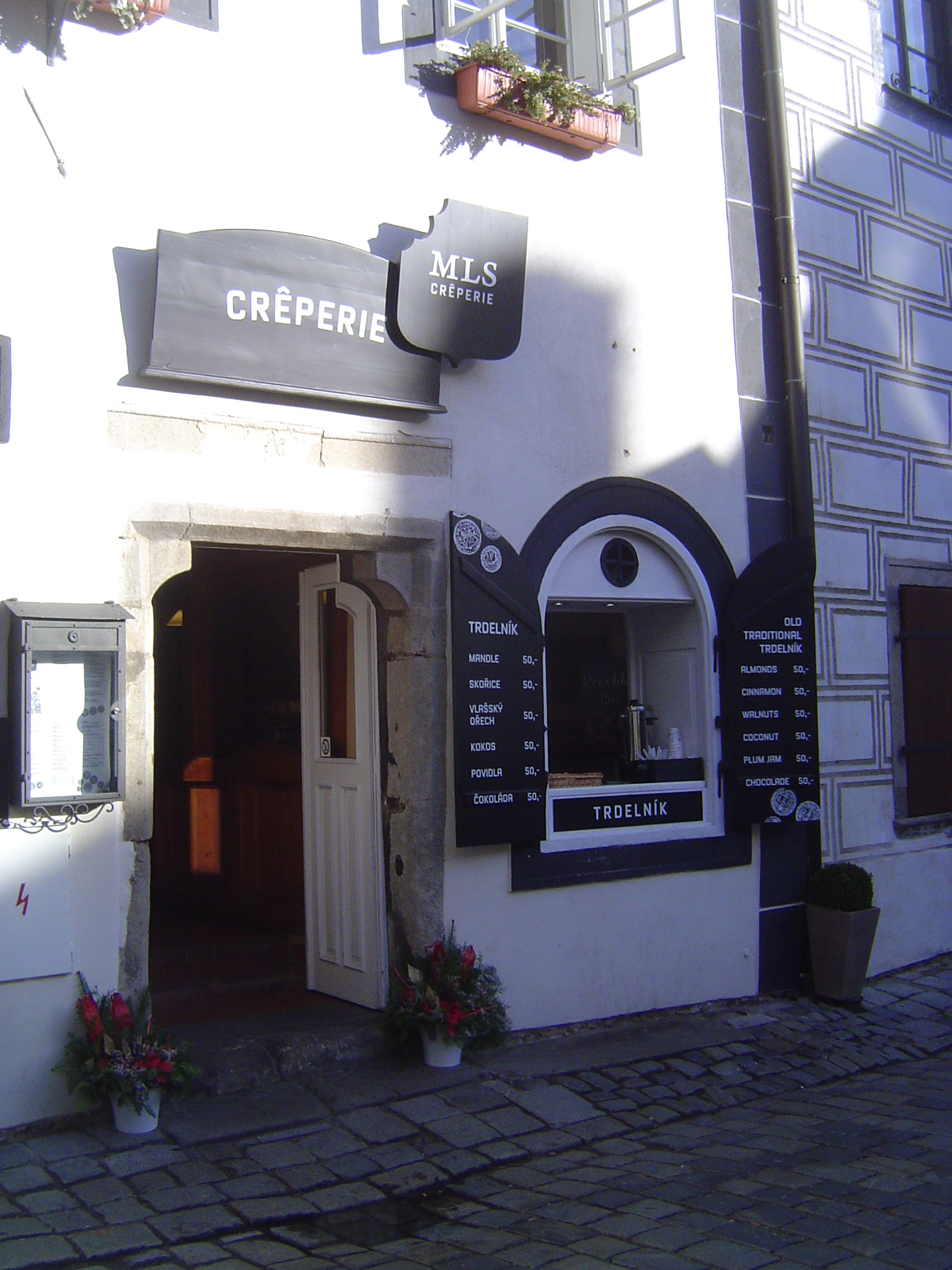
Nor is the number of businesses catering to them.
Attention, all Rick Steves fans.
A hotel from the era of the town-square savings bank. Hitler, who came this way on his 1938 visit, had plans to build a modern thoroughfare through the old city. It's odd, given his general devotion to all things folkish.
Want to escape the tourists? You can try a side street, like this one, Parkan.
Is it too pretty? Photos taken in 1976 by Ales Motejl show an almost monochromatic landscape, with roofs patched and fading. Cesky Krumlov was declared a "state historical reservation" in 1963, however. A plan was prepared, and restoration begun in 1971. It would be another 21 years before the town made it to UNESCO's World Heritage list.
A hotel on the same street; it's the Moldau Hilton. "Where are our lawyers?"
Want something a bit less dolled up? Here we are down at the water level at the neck of the meander. A cranny to explore.
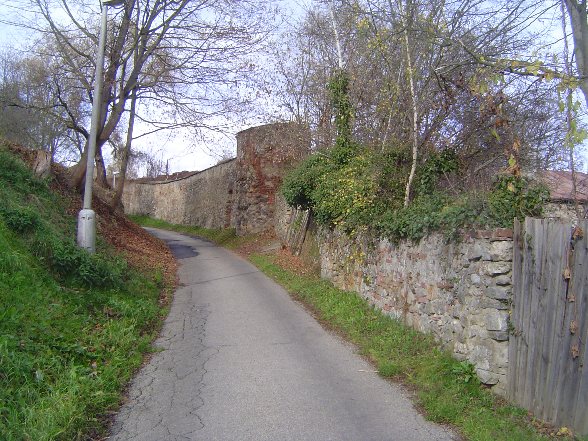
Here we are high above the river on the left bank. It's tough to see over the walls, but there are a few spots.
Like this one, a still life with apples.