Home UpGuyana: the Water's Edge
Two of the three old colonial Guianas are now independent countries. Guyana, formerly British Guiana, is slightly larger than the other two, which are French Guiana, still French, and Dutch Guiana, now Suriname. Guyana still looks dinky on a map of South America, but it's half again as big as New York State or Pennsylvania. It's also home to fewer than a million people, almost all of whom cling to the swampy coast and hope that the ocean stays where it belongs.
Face-saving hint: the people of Guyana pronounce the first syllable to rhyme with "why," not "he."
Who ever heard of the Essequibo River? Answer: almost nobody without some connection to Guyana. But, then, how many Americans can label Guyana on an outline map? Some think it's in Africa; others remember only Jim Jones and his cult. Here, through an airplane glass darkly, is the Essequibo near its mouth, busy with islands partly reclaimed from forest and cultivated.
Rainforest blankets most of Guyana. That's super—we all love the rain forest—but put us down on the ground with just the clothes on our back, and that attitude would change fast.
And here is the mouth of the Essequibo's much smaller neighbor, the Demerara. We're in Georgetown, on the river's eastern bank. Mighty wide for a river that's only about 200 miles long? Yes, but average rainfall approaches 100 inches annually.
(Americans are likely to think of Guyana's coast as extending north and south of Georgetown, but locals see it as west and east, which makes sense if you look only at the orientation of the country's coast and forget about the continent's overall shape.)
In case you're curious, that closer ship was built in 2014 and is listed as a research/survey vessel operated by Vestland Offshore, a Norwegian company. Why here? Guyana in 2020 was on the edge of a tsunami of money from offshore oil fields. The Stabroek Block, about a hundred miles offshore, was estimated by Exxon to hold eight billion barrels of recoverable oil. Now if only we can forget about climate change....
The ship's neighbor was a dredger built in 1983. What's to dredge? The Demerara is navigable for 60 miles or more to Linden, a bauxite-mining town, but a bar accumulates at the river's mouth, reducing the depth to eight feet. Until dredging came along, ships unloaded onto lighters.
We're about 10 miles north of the mouth of the Demerara; you can see a building there in the distance: it's a Marriott hotel. This image is not likely to entice tourists, but the coast of Guyana is subject to flooding at high tides, which is why nearly the entire coast is rimmed with a sea wall.
The same spot, but looking landward. Those houses would be in trouble without the wall.
The sea wall also blocks the scores (or more likely, hundreds) of ditches or sluices built by the Dutch (or, more exactly, their slaves) to drain the sugarcane fields planted just inland. Those ditches were always equipped with so-called "kokers," gates raised at low tide so the cane fields could drain at low tide. Here's a koker built in the sea wall itself.
Same place as last photo but looking upstream to include other kokers.
Homeowners wisely build on stilts for a little extra insurance. Sometimes the ground floor is walled and made into storage space that can be emptied when floods threaten.
Construction of the sea wall began in the 1850s with convict labor placing blocks of granite floated down from quarries on the Mazaruni, a tributary of the Essequibo. Here's an even earlier bit of wall, part of the battery built by the Dutch for Fort William Frederick, at the mouth of the Demerara. Almost nothing else survives of that fort.
Here, a couple of hundred meters down the coast from the old battery, is another section of the wall. The blocks in the foreground and distance house memorial plaques. The shelter between them is a reminder that the wall and beach used to be regarded as amenities. Not so much today. Godfrey Chin writes that "during the banlon years of the seventies, choke and rob raised its ugly head in our once peaceful society, and the Sea Wall become less popular as a local oasis." (See https://www.stabroeknews.com/2011/07/17/features/the-romance-of-the-sea-wall/)
Chin makes Guyana in former times seem idyllic, and other authors have suggested the same—among them, Anthony Trollope in his The West Indies and the Spanish Main (1859). On the other hand, and thinking largely of yellow fever, the historian and botanist James Rodway (1848-1926) wrote that "so bad was the name of Demerara that sailors absolutely refused on any terms to ship for the port. Some whom the Doctor met said they had been deceived by statements that the vessels were bound elsewhere" (The Story of Georgetown, p. 63).
The nearer and earlier monument. The British took over in 1815 and left in 1966. Their interest in the place? Chiefly sugar, including that fine variety of coarse brown sugar called Demerara. The name comes from the river but also from the Dutch colony of that name. The British combined that colony with two neighbors to form British Guiana in 1831.
Under the administration of his excellency, Lieut. Governor W. A. G. Young, CMG, the last part of this sea wall was completed April 1882. The wall was subsequently extended much farther, both north and south of the river.
Here's the inland view from the same point. Much of the fill for this stretch of wall was excavated from a pond on the site of the cylindrical building, the Pegasus Hotel, which opened in the 1970s as the Le Meridien Pegasus, the city's first international and probably its first air-conditioned hotel.
With the oil boom, the owners of the Pegasus are building this adjoining office and apartment building.
Here's the competition, the government-owned but money-losing Marriott, which opened in 2014 on a site formerly occupied by a public swimming pool. It's also adjacent to the long-gone Fort William Frederick, just beyond the view here.
Let's work our way up the river.
A landmark from 1830.
A weed-eater clears the ground around a koker.
Time to raise the gate.
Same gate a moment earlier.
Much but not all of the waterfront is derelict. Here's the John Fernandes Port, begun by a Portuguese maker and seller of firewood and charcoal. During World War II, Fernandes became a lumber exporter.
Until a pontoon bridge opened in 1978 a few miles upstream, a ferry carried vehicles across the river. The bridge destroyed the ferry business, but nobody's destroyed the old dock.
Watch your step.
Maybe we should just go the other way.
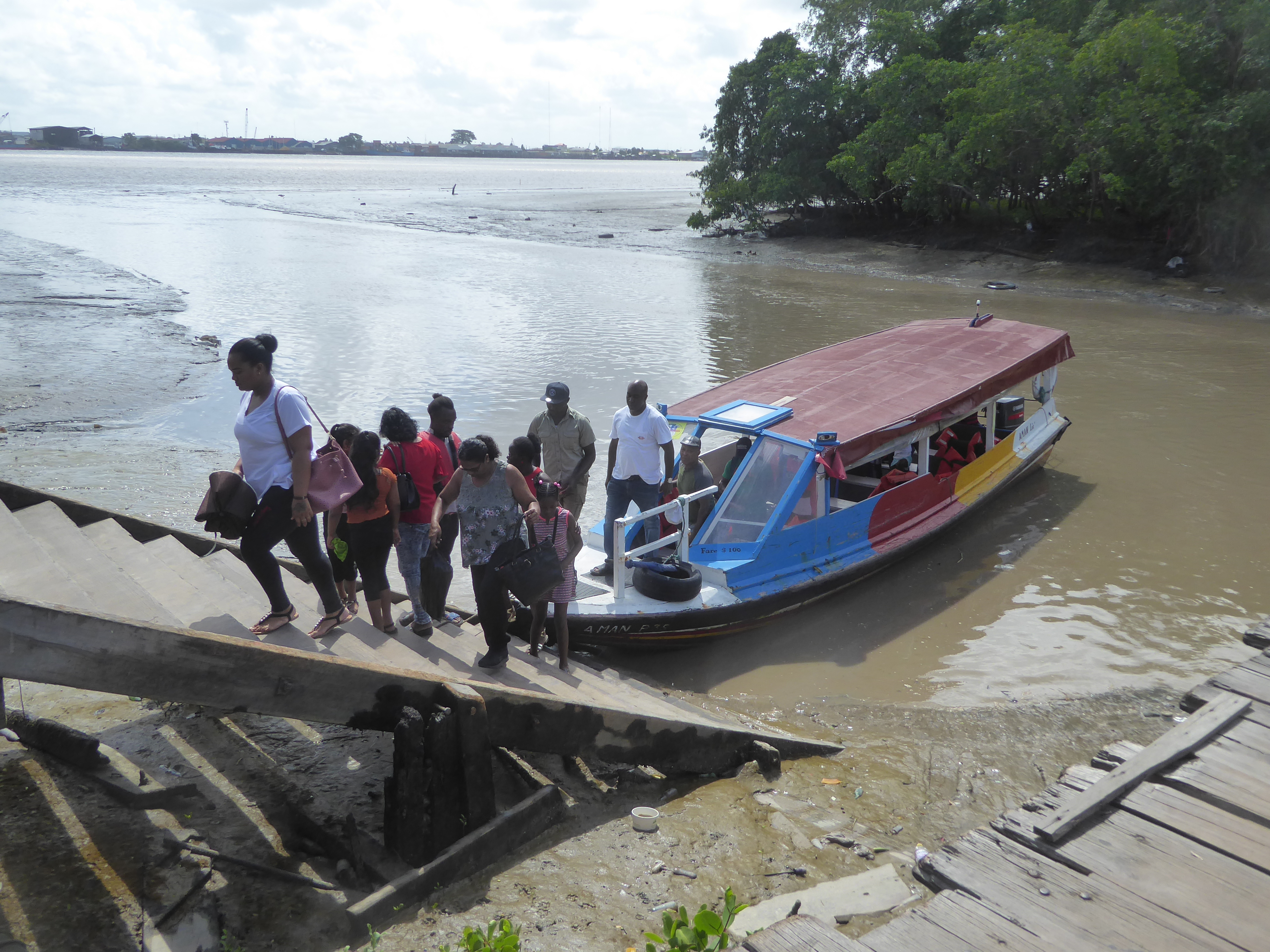
For foot-passengers, small ferries are much quicker than going upstream to the bridge, not even visible here.
In case faith proves insufficient, passengers are required to wear life vests.
Is there a dock on the other or western side? Of course. Welcome to Vreed-en-Hoop, "Peace and Hope," the name of a plantation established by an indentured laborer who got lucky in a land auction.
The dock is now a parking lot with a lineup of boutiques.
There's lots of foot traffic, a messy business when rain makes the stairs slippery. A handrail would be nice.
No need to wonder any longer why the river's so muddy.
In the days of car ferries, foot passengers used these stairs.
The blue hulk of the Marriott marks the river's mouth. The pyramidal tower at the right center is the Stabroek Market, which is the location of the the stellung or landing place on the other side.
Here's the bridge, built 40 years ago and intended to last ten. It floats on pontoons.
Part rotates to allow large ships to pass; another part is humped for smaller vessels.
A good view of the structure.
Since we're over here, we'll look a bit more at the coastal fringe. Of course it has kokers.
And ditches or sluices leading to them, along with rough tracks to the back of the holding, usually about a kilometer from the coast.
Same sluice, with bridge and homestead.
Plantation economics were rocky, as suggested by some of the plantation names, in this case "despite everthing" and "more worries."
Labor came from African slaves, then from emancipated slaves, then from indentured workers imported from India. Small barges pulled by donkeys were handy for moving labor gangs as well as harvested cane.
The plantations were privatized shorly after independence, so this old private factory, once run by the Booker Group, is now run by the Guyana Sugar Corporation. Acreage hasn't changed much: British Guiana had about 80,000 acres of cane in 1900, and Guyana had a bit over 90,000 in 2017.
Here's some managers' housing on the same estate, which despite changes in ownership still carries its original name, the cryptic Uitvlugt or "out quickly." As in "make our fortunes and go home"?
Until about 1900, the staple food of workers here was plantains, but that shifted after 1900 to rice, perhaps inevitably as African labor was replaced by Indian. Rice acreage rose to 134,000 acres in 1952, roughly half again as much as the cane acreage, and it has continued to rise to about 425,000 acres in 2017. So the mill in the background?
Indian-immigrant success story.
The large white bags are filled with consumer-sized packets of white rice.
Across the road, housing presumably for managers.
And presumably for the mill owner.
This unusual monument to Hanuman suggests that the village is home not only to an Indian community but a Hindu rather than Muslim one.
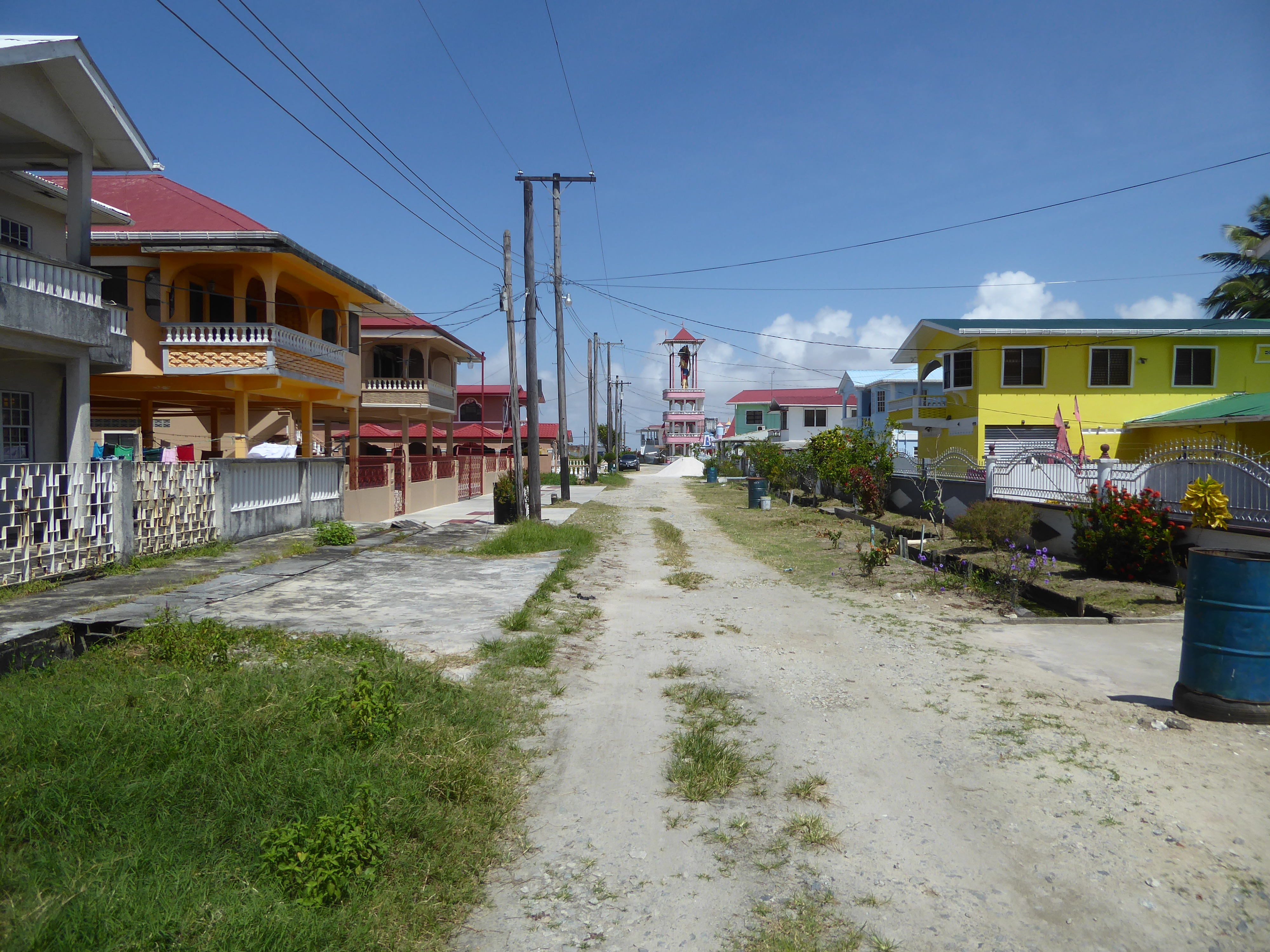
How many of these houses are occupied, and how many were paid for with money sent home from other countries? Good questions, not answered here, unfortunately.
There's an investment opportunity in these villages.
Trademark infringement goes unpunished.