Home UpIsrael and the West Bank, 2019
We start in Tel Aviv, go up to Jerusalem, then down to Bethlehem, Battir, and Hebron. That's the itinerary. Elsewhere on this site, under West Bank instead of Israel, there are a lot of pictures of the West Bank from the 1990s.
It's about 2,000 miles to Gibraltar, so the waves have plenty of room to grow. They finally break here at the hill of old Jaffa, which was Jonah's home and the spot where Perseus saved Andromeda. In other words, there's been a town here for a long time, while everything in the distance is the sprawl of upstart Tel Aviv, "spring hill." No point in looking for a hill there.
The Turkish warehouses at the bottom of the Old Jaffa hill have become apartments.
Nice ones; the corbelled supports are specially nice.
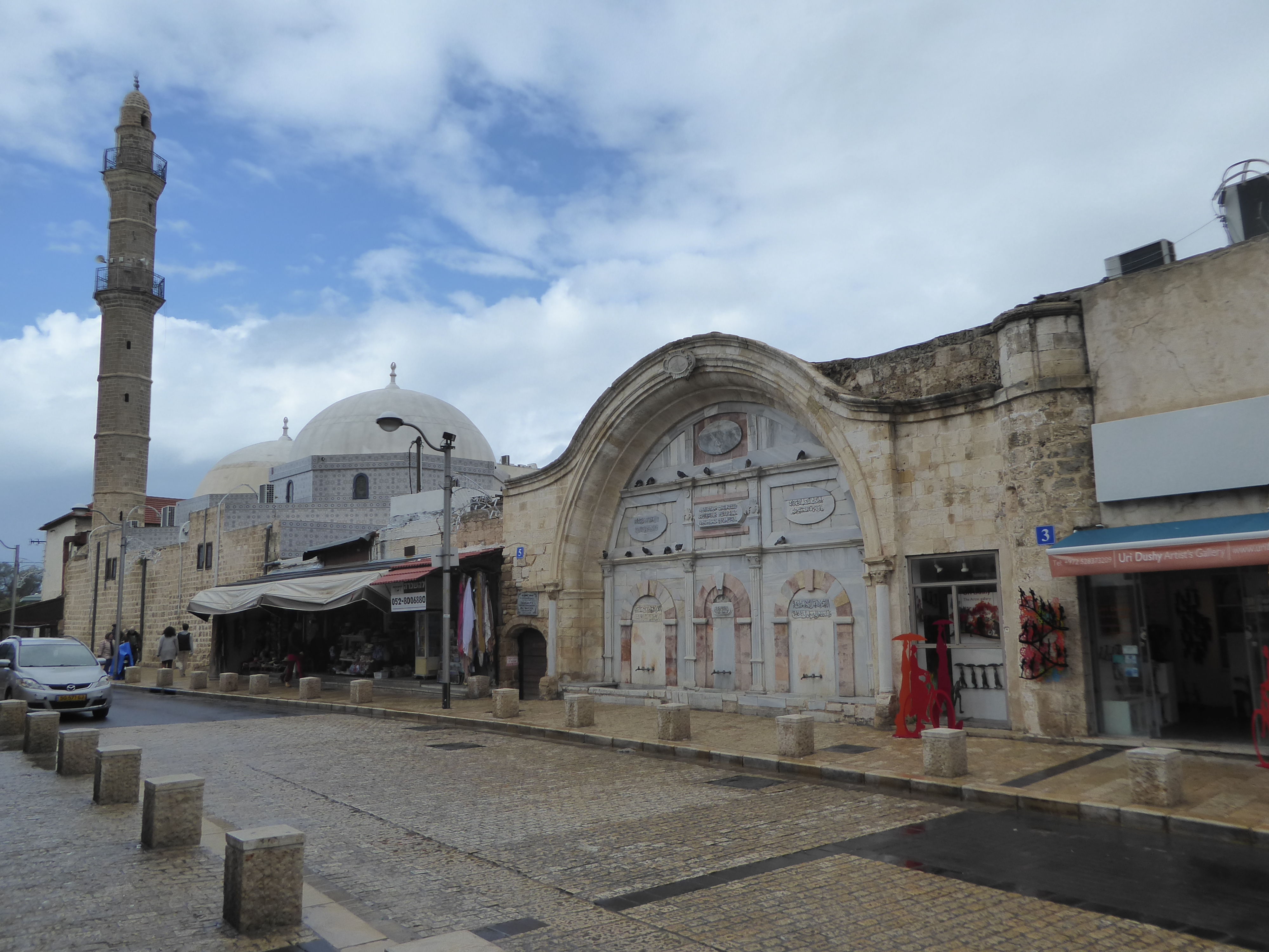
One easy way up the hill is from the north end at the Turkish clocktower and then through the opening in the wall to the right.
It still hints at the damage suffered in 1948.
Once through the gap, and before we start to climb, there's an old bathhosue and mosque. That curve is perhaps the nicest in town.
You'll want to explore the old Saraya, the one-time palace of the Ottoman governor. Even in Turkish times it was obsolete and became a soap factory.
No dice. We have to settle for imagining Jose Ferrer wearing a fez and stroking his lips.
Up top, Jaffa is one of the most ambiguous places you'll ever find. On one hand, it's a charming and respectfully modernized Muslim city. On the other hand, there are no Muslims, either to frighten anyone or to be frightened.
What slippers once scampered and trudged here, replaced now by Adidas?
We've moved about half a mile to the north. This is the train station from which narrow-gauge trains ran to Jerusalem from 1892 until 1948. Notice the simple big-box-and-small-box design.
Before I forget, here's the Jerusalem station, with the same big-box-little-box concept, though in this case the British came along after 1917 and added a pediment and a pair of scrolls from Home Depot. Both stations have been repurposed as entertainment venues.
Welcome to Neve Tsedek, the "Abode of Justice." It's just north of the Jaffa railroad station, and the name refers to God, as per Jeremiah 50:7. This was the first Jewish settlement outside Jaffa. Call it the precursor of Tel Aviv, founded about 20 years later in 1909.
Neve Tzedek's buildings are respectable. Even liberals usually vote conservative when it's time to build their house.
Neve Tsedek was eventually bypassed, and it deteriorated until Tel Aviv had become so unremittingly devoted to the Bauhaus style that people began to look for alternatives. Rundown properties in Neve Tsedek suddenly looked beautiful.
Here's a wall oozing authenticity. Think it's still a wreck on the other side?
This door suggests otherwise.
An open shutter reveals a toney nook, a pool, a bit of lawn, and a sprinkler.
Neve Tzedek grew slowly enough that it acquired some examples of the Bauhaus style that by the 1930s dominated Tel Aviv. In the distance is the Neve Tzedek Tower, God's Tower, if you please. Check Airbnb for listings.
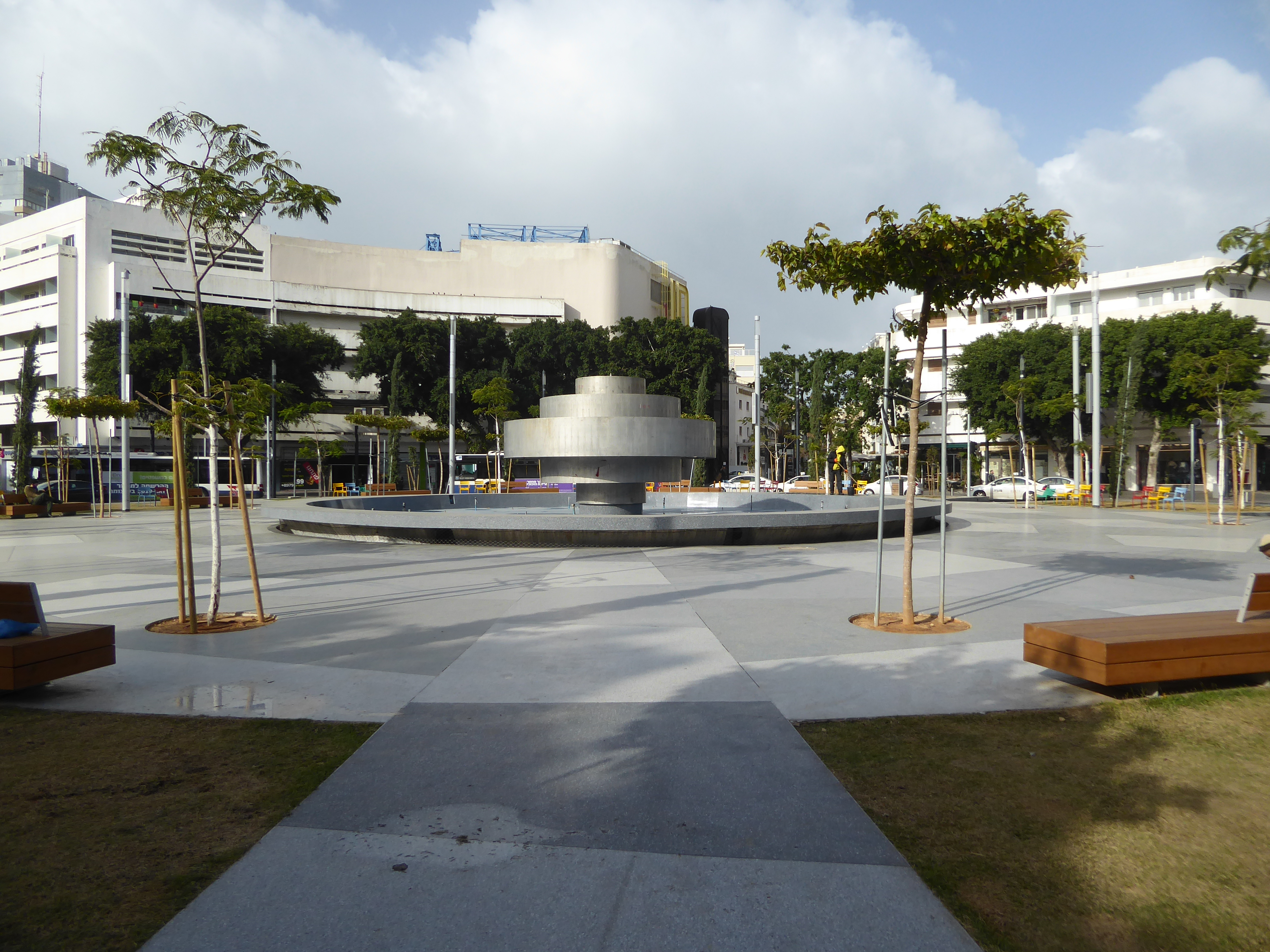
Dizengoff Square, a mile to the north, was created in the 1930s to a design by Patrick Geddes. It's been modified a lot, particularly with a reduction in greenery and the addition in 1986 of the "Fire and Water Fountain," but the basic idea of a traffic circle surrounded by Bauhaus-styled buildings survives.
To explore Bauhaus Tel Aviv, see the Tel-Aviv-Yafo Preservation Map and Guide, published in 2018 by the Bauhaus Center, which is only a block from Dizengoff Square and is a mine of information.
The buildings around the circular square include the former Esther Cinema, which opened in 1939 as an air-conditioned cinema showing Snow White. Closed in 1998, the building became mostly a hotel in 2000. Its long-time owners were immigrants from Aden who had arrived in 1924.
Here, at Bialik 18, is a good example of the Bauhaus style. Lots of balconies, lots of simple curves glued onto blocks, and vegetation to soften the brutality. It does seem the perfect style for anyone learning to build architectural models.
Here's a 1935 apartment house at 87 Ha Yarkon. Units here don't come cheap, as the 2012 addition suggests.
One reason they don't is that we're only a block from the sea.
Too bad the view is blocked by a hotel.
A so-called ladder staircase makes Rothschild 118 more interesting than it would otherwise be.
Here's a more modest block, at Pinsker 23. The main staircase, behind the glass, is the most visually surprising detail.
This was never housing for the rich, but its designer offered a note of elegance that has been lost with deferred maintenance.
The stairs from the inside.
The lights are tripped by your presence, which means you're always thinking about them instead of possibly appreciating the mustard-yellow tiles.
There's so much Bauhaus stuff in the core that traditional buildings begin to seem radical. Here, at King Albert Square, the so-called Pagoda House was built as a private residence in 1924 but subsequently divided into apartments.
The most expensive apartment in Israel in a recent year was a three-floor penthouse that sold for 200 million shekels. That's $50 million in real money. The apartment was in the building—the nearest of the three here—called Meier on Rothschild. It's another case of naming a building after its architect.
The Sea Pearl Tower, the Royal Beach Hotel, and 10 Herbert Samuel at least have views of the water. Maybe they're high enough to overlook the traffic.
We're jumped a bit over 30 miles to the southeast and climbed 2,000 feet to the plateau separating the Mediterranean from the Dead Sea. This is the misnamed David's Tower/ The name comes from the Byzantine Christian belief that David's palace had been on this spot at the western side of the Old City. The Mamluks in 1260 destroyed the Byzantine citadel on the citadel, built their own in 1310, and rebuilt it in 1545. The minaret came in 1655. The British made the city walls a tourist attraction, but the Jordanians made the tower once again a military post.
The wall has grown by accretion, which might make it seem slapdash but doesn't.
We could even stretch the facts to say that the wall has grown from the underlying rock.
Nobody can say that the Israelis ignore the history of the land they hold.
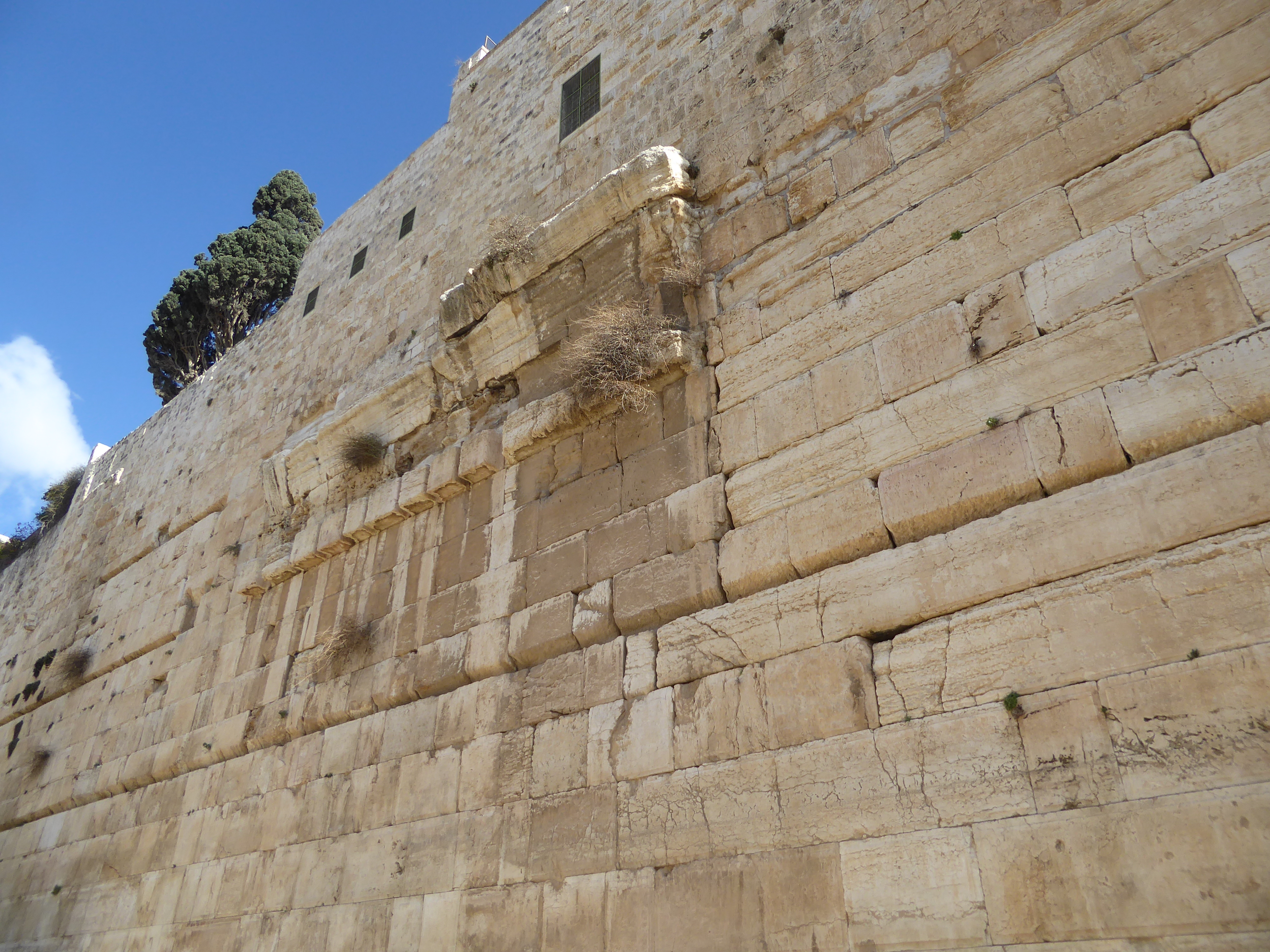
We've come around to the south side of the Old City's wall and then to this wall within the wall. It's the southwest corner of the Haram esh-Sharif or Temple Mount. That's the minaret of the Aqsa mosque peeping over the top. Note the curved blocks protruding from the wall midway up.
The stones are the only surviving bit of Robinson's Arch, which once supported a huge flight of stairs rising from the left. Built by Herod and about five meters wide, the staircase was destroyed in A.D. 70. And Robinson? That would be Edward Robinson (1794-1863), one of many Americans drawn to the Holy Land at a time when you could take a shovel and not provoke a riot.
Around the corner, the Triple Arch once was the south-side entrance to the temple mount. Blocked up when the Aqsa mosque was built, nobody's dug here since the 1860s, when Charles Warren, a British soldier by occupation and a Biblical archaeologist by avocation, came by, dug a bit, and found passages under the gate.
Here's another blocked up entrance, part of the so-called Hulda or Double Gate, just to the west of the triple gate. Those "amphitheater benches" were once stairs leading up to the entrance. Notice the size of the blocks to the right of the arch.
Ottomon fortifications seem lightweight in comparison.
You can barely make out the triple gate's arches, just above the modern platform.
We're returned to the west side to enter the Old City at the Jaffa Gate, where the afternoon light is kind to the Grand New Hotel of 1884. It's the Imperial now in recognition of the visit of Kaiser Wilhelm in 1898. The hotel is reportedly the property of the Greek Orthodox Church.
Never mind the crowds in the courtyard outside the Church of the Holy Sepulcher. Just touch the columns flanking the door.
The church here was consecrated in 335 but destroyed in 614, rebuilt, damaged again and ordered destroyed in 1009. It was rebuilt again but this time only with the Resurrection Rotunda, which stands just west of the former church, which was never rebuilt. The dome collapsed in 1807 and was rebuilt in an Ottoman style, which was subsequently restored in 1868 and again in the 1980s. Is it new or is it old? Hard to say. Maybe new in tangible fact but old in associations.
Under that dome, the Franciscans rebuilt the aedicula that stands over Christ's supposed tomb, but it too has been modified over the centuries, most recently in 2017.
So has the Old City's other chief monument, the Dome of the Rock, whose aluminum-bronze roof was installed by the Jordanians and then gilt. The Jordanians were replacing lead plates that replaced tiles that replaced wood in this, the first major sanctuary of the Muslim world. In case you have any doubt, yes, it's Friday afternoon, and the Western Wall is busy. That bent structure on the right is the only entrance to the Temple Mount that non-Muslims can use.
Once there, they aren't allowed to enter the Aqsa. Call it payback.
The building's architecture in any case is no match for the building's importance.
A peek inside, with columns donated by Mussolini and ceiling paintings from Egypt's Farouk. Nothing remains of the original mosque. Were its doors, like these, also painted in the prophet's color?
A closed door on the east side might be older than the others.
Each of the eight stairways leading to the platform of the Dome of the Rock has an arcade called a mawazim, or scale, in the belief that at the end of the world scales will hang here to weigh souls. Want to go inside? Sorry; no dice. Wasn't that way as late as the 1990s.
Here's a door at the northwest corner of the enclosure. It leads to the Cotton Suq or market opened in 1336 by Tankiz, a long-serving Turkish viceroy of Syria. Tenure didn't help him; after 28 years in post, he was brought to Egypt and executed in 1340. The market here has had its own rough patches.
Neatly inlaid limestone in red, black, and yellow.
The ingenious pocket doors are copies installed by the British. The Turks during World War I had burned the doors to keep warm.
In the early years of the British mandate, the market not only sold cloth but supported weaving and other crafts. Cheaper imports decimated the craft economy within a couple of decades. Are these penny candies made locally? Good question.
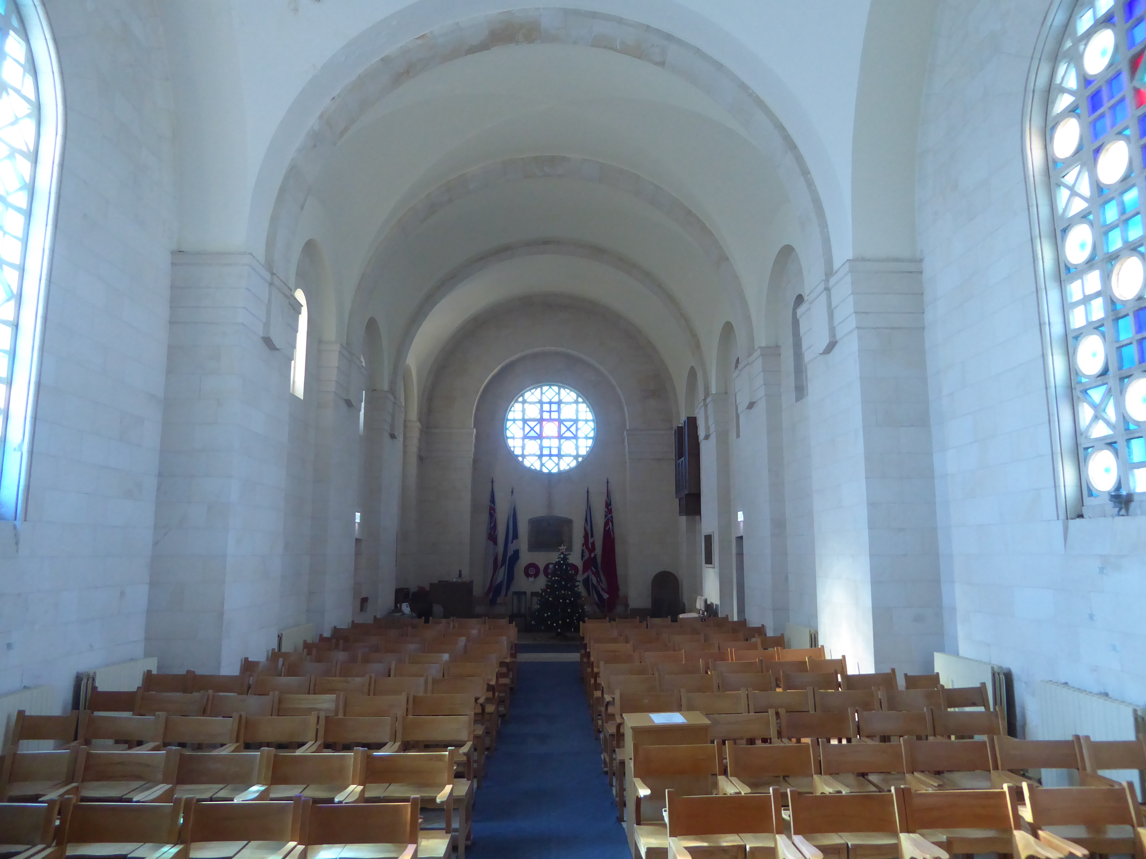
Just outside the Old City, there's a large cemetery full of the graves of British policeman. The city also has a couple of British churches, including St Andrew's, close to the cemetery and even closer to the train station.
Consecrated in 1930, St. Andrews is as cold as deep space.
The altar and apse are no warmer.
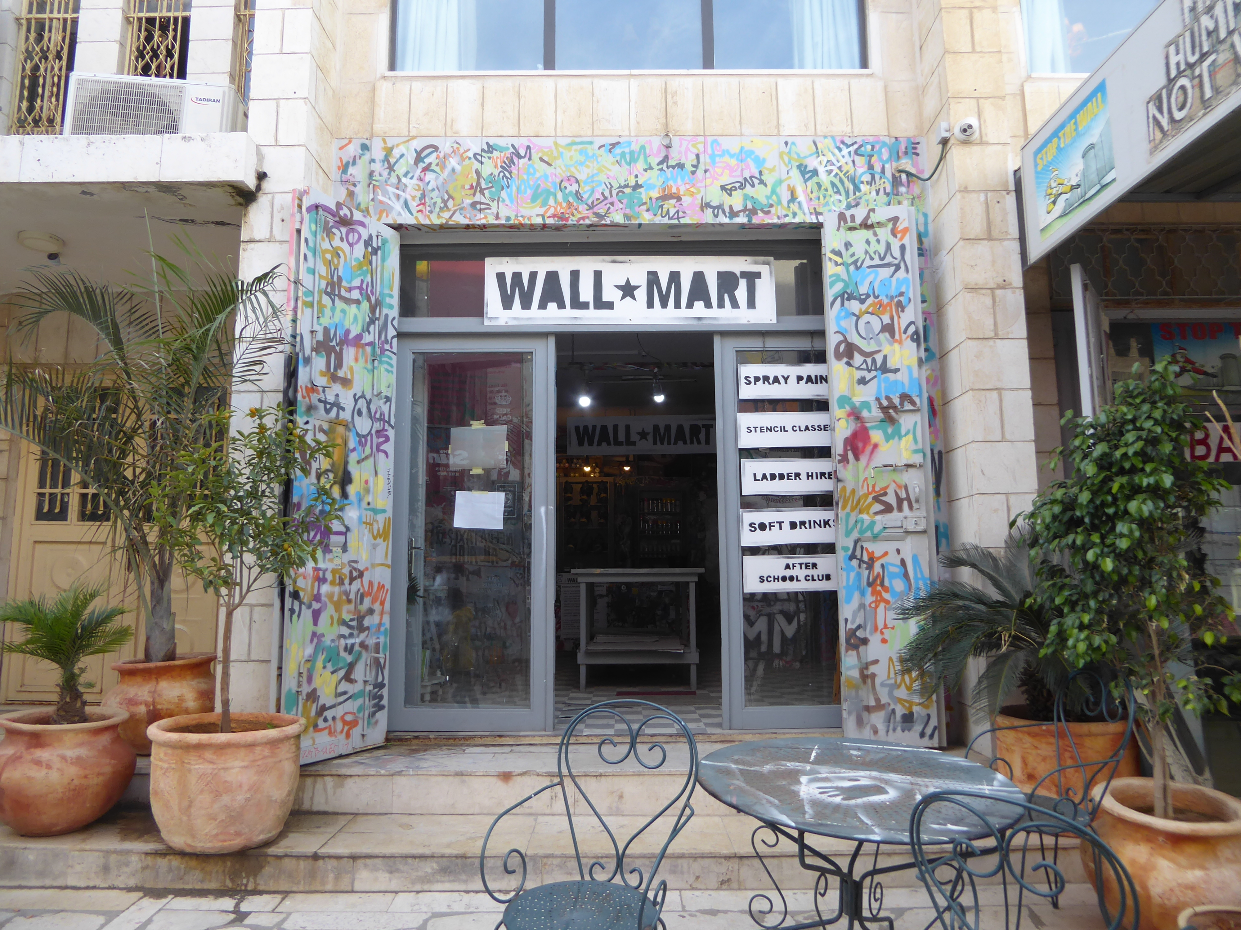
Speaking of bleak, we've crossed into Bethlehem. In this land of monuments that last for centuries, do we now have another?
The graffiti are often grimly funny.
How do you live with this in your frontyard?
You joke about getting out.
You resist with paint. This hotel, which opened in 2017, was partly financed by Banksy.
Here's the crossing point into Jerusalem. There are no checks coming the other way. The sign restricts traffic to authorized vehicles, defined as tourist buses, cars with Israeli plates, and "senior religious vehicles," whatever that means.
Pedestrians coming into Israel pass this way, with turnstiles ahead and document checks.
Bethlehem itself, ironically, is a lot like old Jaffa, with idiosyncratic patterns executed in materials that last forever.
Every twist and turn is unique.
Speaking of twists, this traffic jam is caused by everyone bending down to enter the Church of the Nativity. The heavy lintel is a reminder that the door in the sixth century was about 15 feet high. The Crusaders lowered it to the arch, and the Mamluks lowered it yet again.
The door is said to impose humility on everyone who enters, but more likely it was built to keep Bedouin out.
How's this for security? Just because a land is holy doesn't mean it's safe.
Apart from the roof, which has been replaced more than once, the structure is as Justinian left it.
The limestone pillars came from an even older church.
The mosaics date from a restoration in the 12th. Those are angels up top, and the figure third from the right has some letters behind his feet: they spell Basilius Pictor and amount to the artist's signature.
The figures at the base are the ancestors of Jesus according to Matthew (reading from right to left, Axor, Zadok, Achim, Eliud, Eleazar, Matthan, Jacob, and Joseph). The texts above them record decisions of the Councils of Antioch (341) and Serdica (343).
Fourth-century floor mosaics from Constantine's church are mostly covered up.
Steps near the altar lead down to one of many small caves.
The crowd here in the so-called Birth Cave is trying to see Christ's manger. Anything flammable from long ago was lost in a fire in 1869. Still, people crowd in.
We're jumped three miles to Solomon's Pools, actually Roman constructions.
An aqueduct, much of which can be traced today, brought water from here to Jerusalem.
There are three pools, once fed through tunnels that reach several miles upstream. The building is a pumphouse built by the British to bypass the aqueduct and push water in a pipe. When was it abandoned? Another good question. There are so many.
With Palestinian sovereignty of this area, fences went up around the pools. Caption: "The Israelis aren't the only ones who can build fences!"
Downstream a few hundred yards is the rapidly growing town of Artas, hardly separable from Bethlehem now.
The greenhouses belong to the convent that's been here since about 1900.
The center of Artas is its mosque, and the mosque is located close to the town's germinal spring, now sadly barred.
We're heading three miles to the northwest and to Battir, a village just above the old railroad line to Jerusalem. Getting there from Solomon's Pools is a circuitous business, and you have to ignore signs like this, which dot the West Bank top to bottom.
Doesn't seem to say anything about foreigners.
Life here isn't a bowl of cherries, but people do use trash bins. That's a good sign.
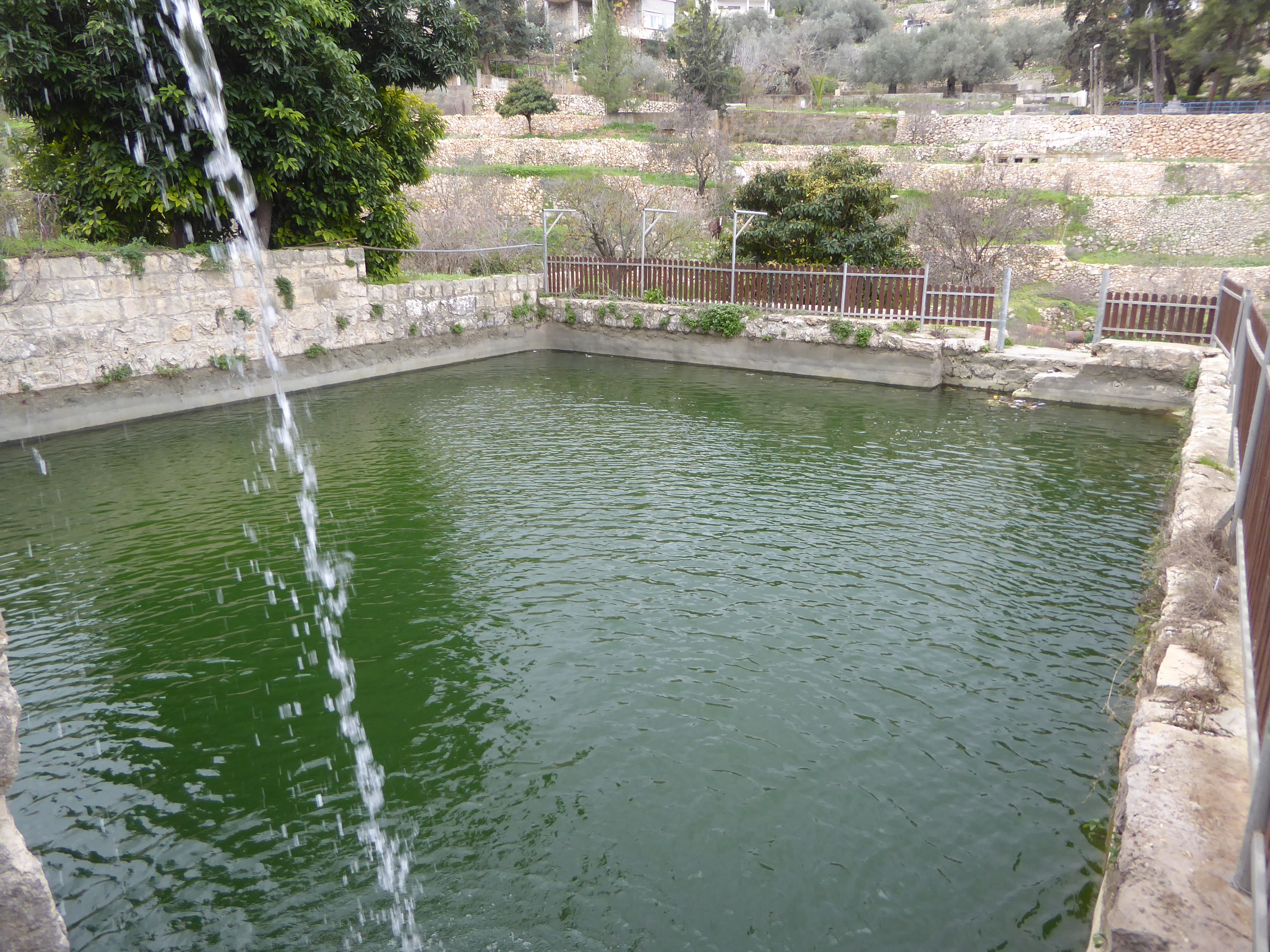
The town is built around a narrow valley terraced in Roman times and irrigated by a spring that flows even now, though almost nobody cultivates the terraces. People need money, and there isn't much in cucumbers and tomatoes.
Mint used to be grown for sale in Jerusalem back in the days before 1948, when villagers could take it there by train.
Here's the spring, pouring into what is described as a Roman bath. Was it in fact? Hmmm.
The water then runs into a pool, where it is held overnight for use the following day.
Down at the bottom of the valley, there's no grim wall as at Bethlehem.
There are only modest fences, warning signs, and patrol vehicles on the Israeli side.
We've jumped again, this time a dozen miles to Herod's wall around the Cave of Machpelah. The wall apparently was built as an enclosure around the supposed tombs of the patriarchs; entrances and a church were added a thousand years later.
Although it's just a miniature of the <i>Haram</<i>in Jerusalem, it's also the only surviving intact work of Herod. The minarets were added much later. So was the puny cap on the wall and the structure plastered against the side. It supposedly houses Joseph's tomb, though the Bible points to Nablus.
Jews were excluded from church-turned-mosque and were allowed only to peep through a crack in the wall. The crack was mostly plugged in 1967, but observant Jews still pray at that point, where they get a peek at Isaac's cenotaph.
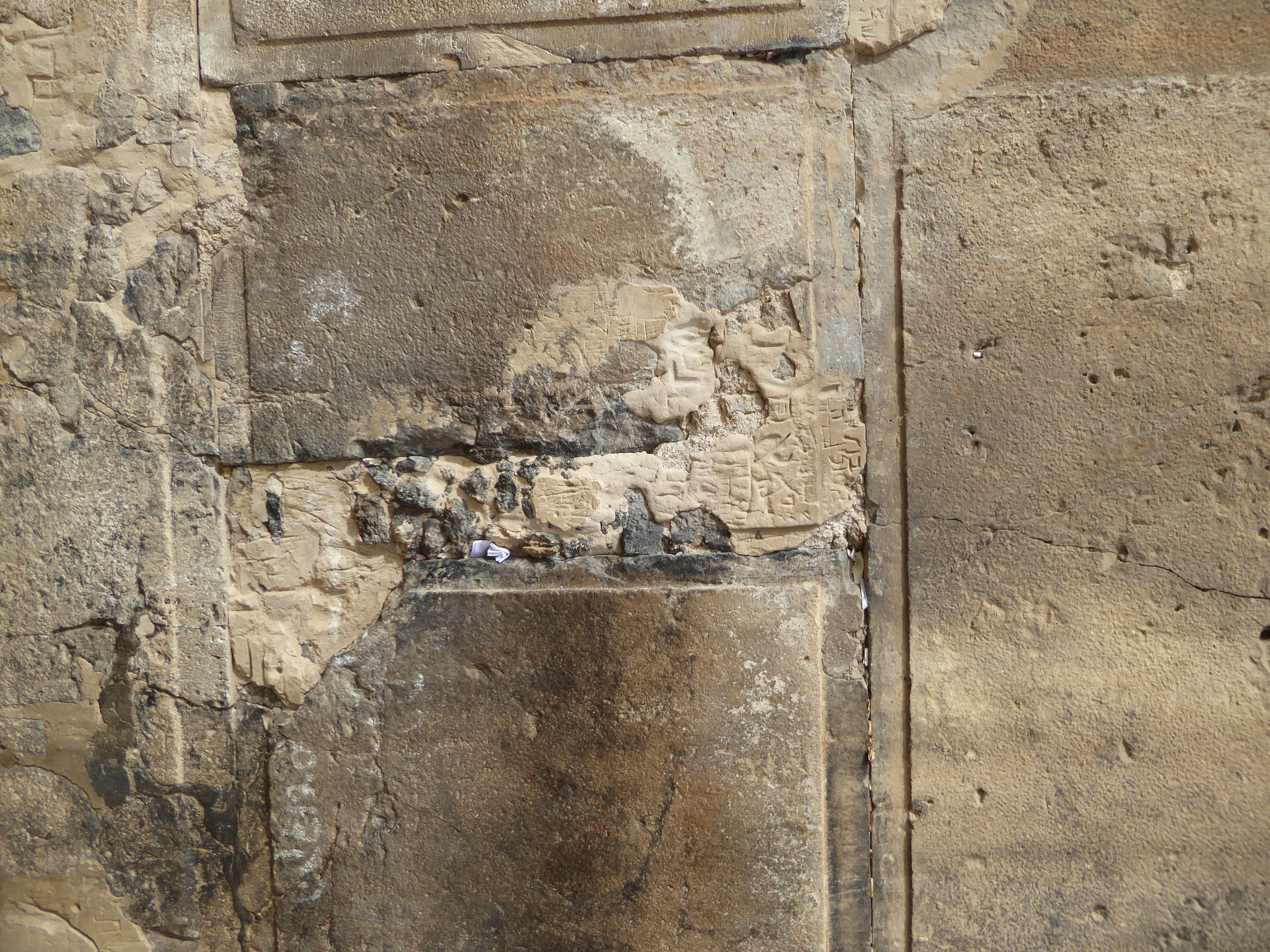
The edges of the blocks are trimmed to emphasize their size. The pilasters emphasize the wall's heights.
Look, Ma, no mortar. Despite cementing the crack, notes still get squeezed in, just as at Jerusalem's Western Wall.
The entrance to the mosque inside the enclosure is through these steps that hug the wall.
There aren't many visitors.
Come on in.
At the point where we step through the gap in the enclosure wall, shoes come off.
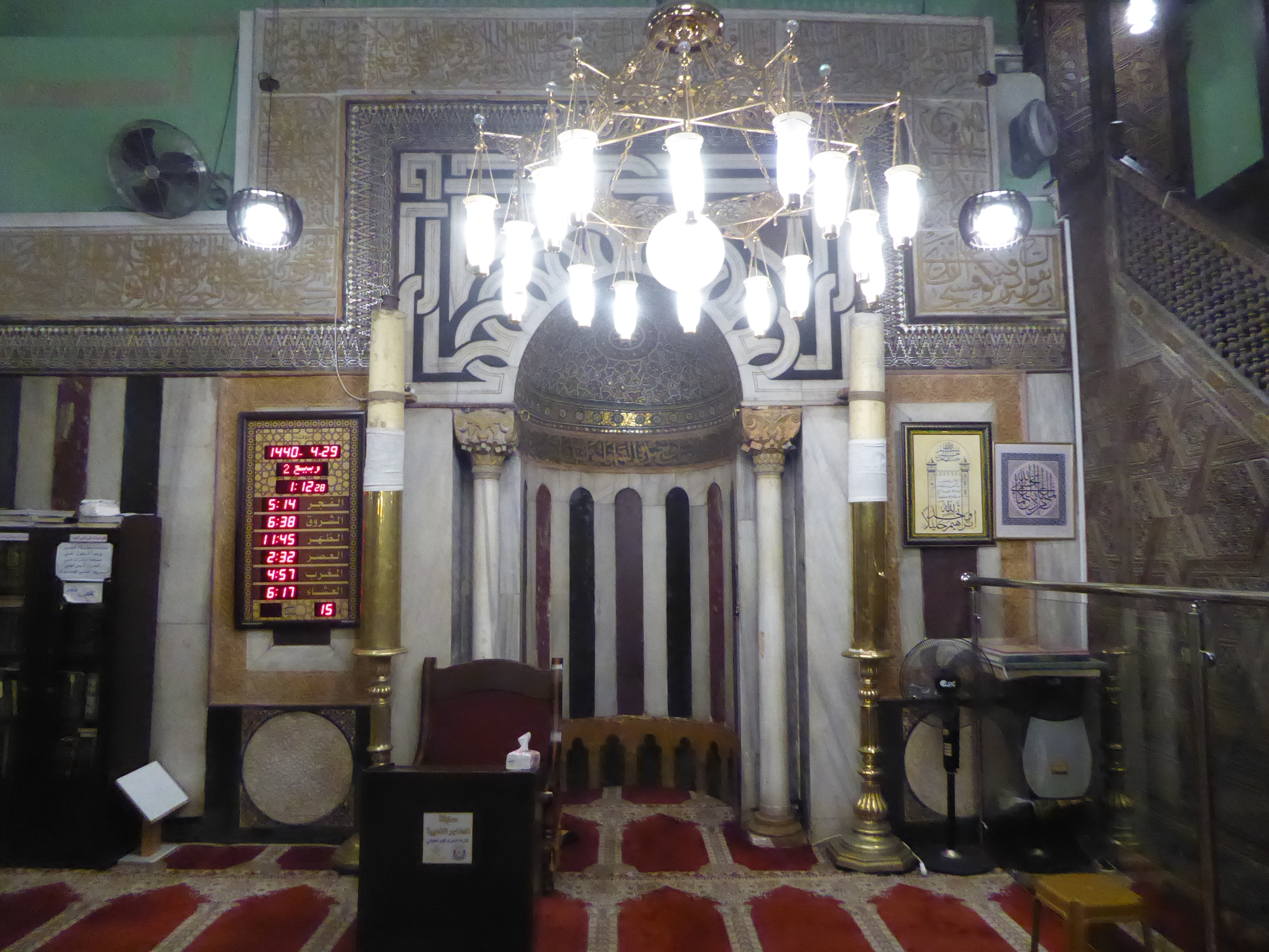
We're in what originally was a church built by Baldwin II between 1118 and 1131. During its construction, a cave was found. It was open to visitors for a bit over a century, then closed in 1250. By 1490 everyone was excluded, and visitors had to content themselves with cenotaphs built by Tankiz in 1332. Presumably, they're at least approximately over the cave. This is Rebecca's, with Isaac's over at the right.
Tankiz also added the bands of colored marble to the church. How old is the ceiling paint job? Good question.
Here's the mihrab, pointing to the southeast and only approximately in the direction of Mecca. The orientation is forced by the building, whose altar was replaced by the mihrab.
Think the gold leaf is real? I'm betting it is.
We're spun around 180 degrees. Abraham's cenotaph is on the other side of the wall. See that man scrutinizing it?
Here he is on his knees. The domed structure to his left is over a metal plate that sits stop a shaft leading into the cave below. Almost the first thing the Israelis did when capturing Hebron in 1967 was find someone—a girl, it happened—thin enough to slip through the shaft and explore the cave. She didn't find much, but the moment must have been a tense one.
In 1326, before even partial access to the caves was stopped, Ibn Batutah came by. He writes: "You may descend by solidly built marble steps, leading to a narrow passage, and this opens into a chamber paved with marble. Here are the cenotaphs of the three tombs. They say that the bodies lie immediately adjacent beneath, and hereby was originally the passage down to the blessed cave. At the present time, however, this passage is closed. To the first chamber I myself descended many times."
Tadaa!
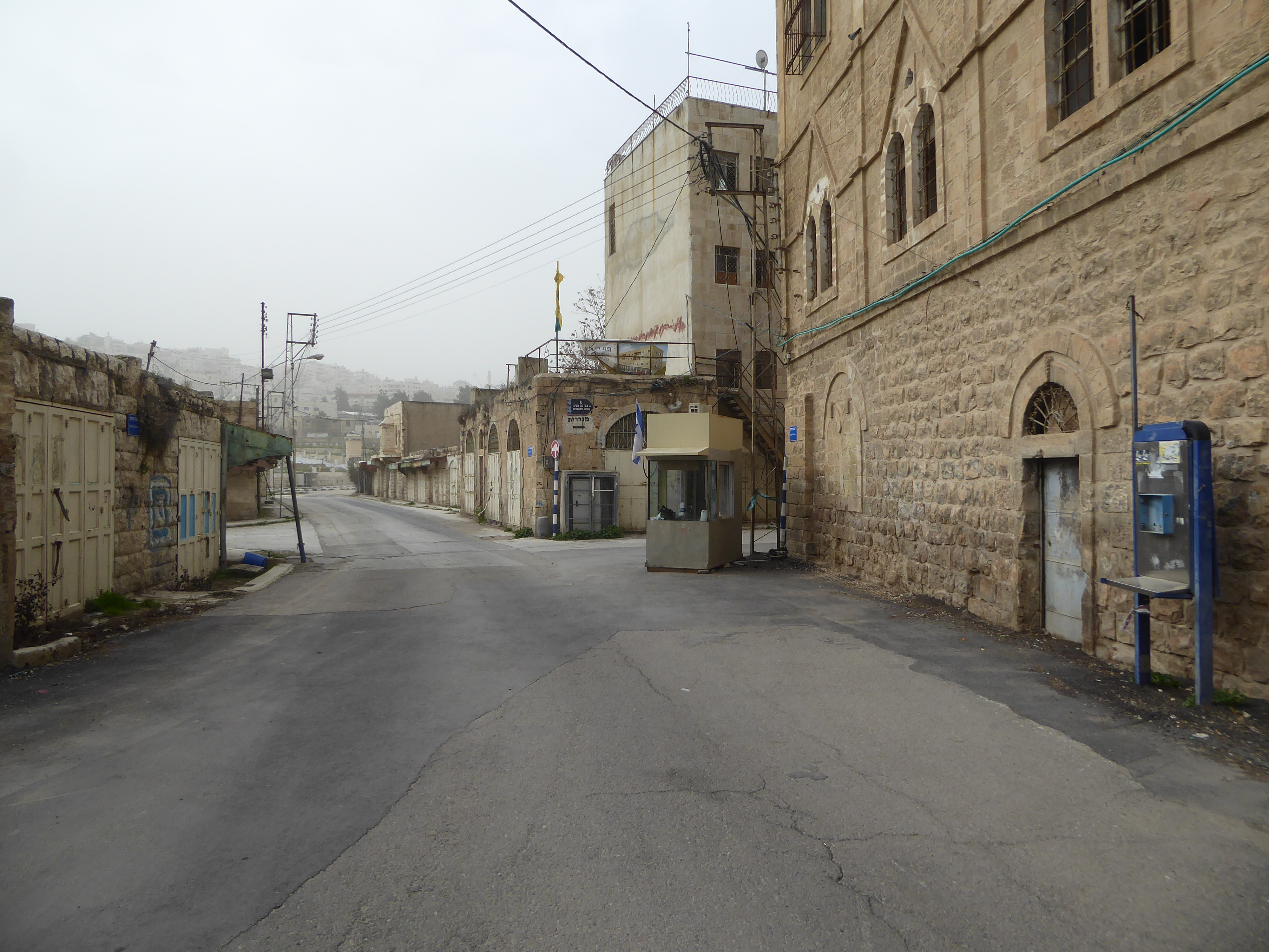
Time to explore the old city of Hebron, transformed since the Second Intifada into a dead zone.
Used to be that despite Israeli foot patrols, you could walk freely around the neighborhood.
Now, David Street (or Martyr's Street, if you're Palestinian) is sealed off from the Old City and dead-ends before reaching the western and still-living part of Hebron.
Walk the whole distance and there's nothing.
Cross through a checkpoint with your passport so you can return, and you come to the the part of Hebron that still has people.
Here's the eastern tip of that city before you enter the casbah, behind the camera. If memory serves, the upper floor of the building was once a hotel.
Looking eastward, this is the entrance to the qanatir or arches, the local name for the Old City. The signs are a reminder that this neighborhood was recently put on the UNESCO world heritage list. It must be one of the very few listings that have not inspired a tourist boom.
Starting in the 1990s, money came in from Arab countries to renovate this district. This meant fixing up the houses with new plumbing and electricity, laying mains, repaving streets—lots of good things. The awnings aren't terrific.
Commercially, the place is a desert. In the 1990s it was crowded as can be.
One section is said to have been fenced to protect passersby from rocks tossed by Jewish settlers in the building above. Myth? Calumny? Perhaps, but stated as a fact beyond dispute.
The old buildings themselves are tremendous.
You can see where the place gets its name, "the arches."
The paths lead to courtyard houses invisible until a door opens. In this case the recent improvements include not only sewer lines but streetlights needed in the tunnel-like darkness.
You can also see that many of the houses, painstakingly restored, have now been abandoned.
Need a bit of fresh air? We've come back down to Jaffa and the sea.