One of the best ways to get your bearings in Venice is to take a boat over to Isola San Giorgio and go up to the top of the church steeple there.
The classic view of Venice, with the 300-foot Campanile—a bell tower but once also a lighthouse—and the Doge's Palace, here partly wrapped by trompe l'oeil scaffolding.
That iconic view comes from the small Isola San Georgio, seen here from the Molo or sea wall at the Doge's Palace. The Isola San Georgio is almost monopolized by a church designed by Andrea Palladio and completed in 1610. It's the Church of San Giorgio Maggiore, and its steeple, clear in this picture, offers panoramic views.
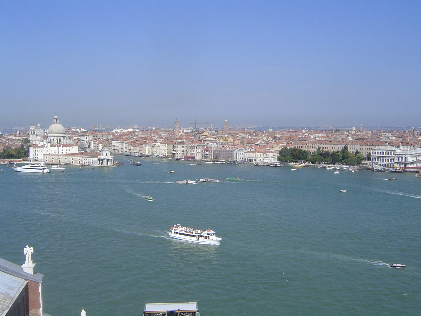
We're back up top now, looking over the church to the Canale della Giudecca, the Giudecca Canal. The prominent dome across the water is that of Santa Maria della Salute, a late church begun in 1631. To its right is the east end of the Grand Canal, which approximately bisects central Venice. The city looks pretty solid, but it occupies over a hundred islands. (Old editions of Baedeker have a compulsive attachment to numbers: the 1906 edition states that Venice occupies 117 small islands, separated by 150 canals and connected by 378 bridges.) Such numbers beg the question: how do you build a city in water? Answer: drive wooden piles through the lagoon's loose sediments until they reach hard clay. Array those piles in circles or spirals with piles at intervals of less than three feet, then tie the piles together with wooden beams. Lay stone blocks in a carpet atop the beams, then start your brickwork on top of the stone. Big job? Santa Maria della Salute was built by the thankful survivors of the plague of 1630, and they began by driving more than a million piles. A bird's-eye-view map by Jacopo De' Barbari in 1500 shows timber rafts lashed to the growing edge of the city, which in his day was mostly on the north side, delimited today by the Fondamenta Nuove, or "new embankment."
In the far distance, across the Venetian lagoon, the mainland can be made out, along with the notoriously polluting smokestacks of Mestre and Porto Marghera. They're both part of Greater Venice, created in 1926. Ships can reach the docks there through two navigation channels—you see part of one here—that are dredged to a depth of at least 10 meters. Pilots must be careful, though: most of the lagoon is barely four feet deep.
Santa Maria is on the left now. The building in front of it, at the point of land, is the Da Mar Customs House, 1677; on its roof is a golden globe supported by two statues of Atlas and sustaining a statue of Fortuna. On the right there is a patch of green—a rarity in Venice. It's the Giardinetti Reali, for which Venetians can thank Napoleon, the man they usually love to hate. It was he who made a garden here as a private retreat for his intended royal residence.
In the distance, to the right of the cruise ships and the tower-crane, the dark bulk of the 14th century Santa Maria Gloriosa dei Frari can be seen.
The gardens are on the left now, with the Sansovino Library fronting the piazzetta.
Stretching east from the Doge's palace is the promenade of the Riva Degli Schiavone—the quai or embankment of the Slavs. These were the Slavic-speaking Dalmatians who once docked here and brought the timber and limestone that Venice consumed voraciously. Today the same waterfront is prime tourist turf. The red-hued Palazzo Dandolo, for example, opened in 1822 as the Danieli Hotel and under that name is still in business for a "if you have to ask, you can't afford it" price.
The Danieli is still barely visible on the left; behind it and slightly to the right is the immense church of Santi Giovanni e Paolo (it's San Zanipolo in the colloquial contraction). On the right side is the steeple of San Lorenzo, attached to a church currently so physically unstable that it's closed.
San Lorenzo is on the left now. On the right, the mouth of the Rio dell Arsenale can be seen; this is one of two entrances into the great ship-building Arsenal, from which so many ships once sailed. Behind it is the square-rimmed border of the Darsena Grande, once bordered with busy shipyards. It's very quiet now but unfortunately remains a closed military area. Cranes can be made out at its edge.
The Museo Navale is on the left, just at the mouth of the Rio dell Arsenale. The greenery to the right belongs to the Giardini Pubblici and the Parca della Rimenbranze.
The Lido is across the lagoon; beyond lies the Adriatic. The piles indicate safe channels. In the foreground, of course, is a bit of the Isola San Giorgio Maggiore. Before construction of the church, gardens and salt-evaporation ponds shared the island with a smaller church that dated back to 790.
Behind the attached monastery, the narrow Canale San Giorgio separates the island from the island of Giudecca—actually eight linked islands. The swimming pool on the left belongs to the Cipriani Hotel. The domes farther back belong to the churches known as La Zitelle (another of Palladio's projects) and Il Redentore.
We've come 360 degrees now, back to the Canale della Giudecca. At the far end of Giudecca, the mass of the old Stucky Mill can be seen. It opened as a flour mill in 1895 despite local protests, and it remained in business until 1955. A fire broke out in 2003, but the building survived and is now a Hilton.
Once again, the classic view.