For most of the 8th century, Nara was Japan's capital, and in 1890 the city's first railroad arrived, from Osaka. Whoa, you say? Bit of a jump there? Sure, but the connection is this: between the 8th and 20th centuries, Nara was a famous place with a thin stream of visitors. Once the railroad came, that stream became a flood. It's no accident that five years after the railroad's arrival Nara's Imperial Museum, now the National Museum, opened for the first time. Now, this town of about 350,000 people has 13 million visitors annually. All but 200,000 are Japanese.
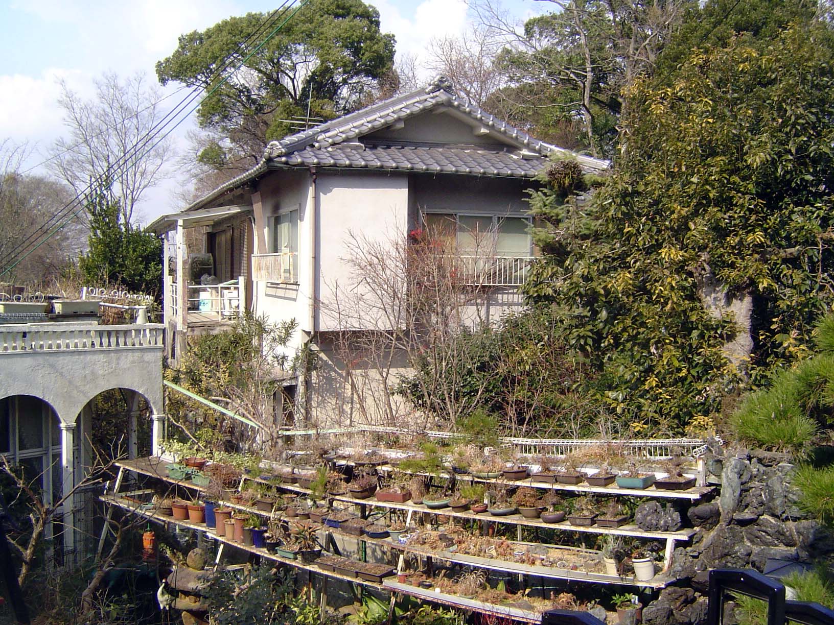
How do people live here? Yes, Virginia, there are single-family homes in Nara. Here's one along the street leading to Kaidan-in Temple. The fencing is a surprise, and a discouraging one, but at least there's no electric wire up top, or spikes or broken glass.
Another, with pots.
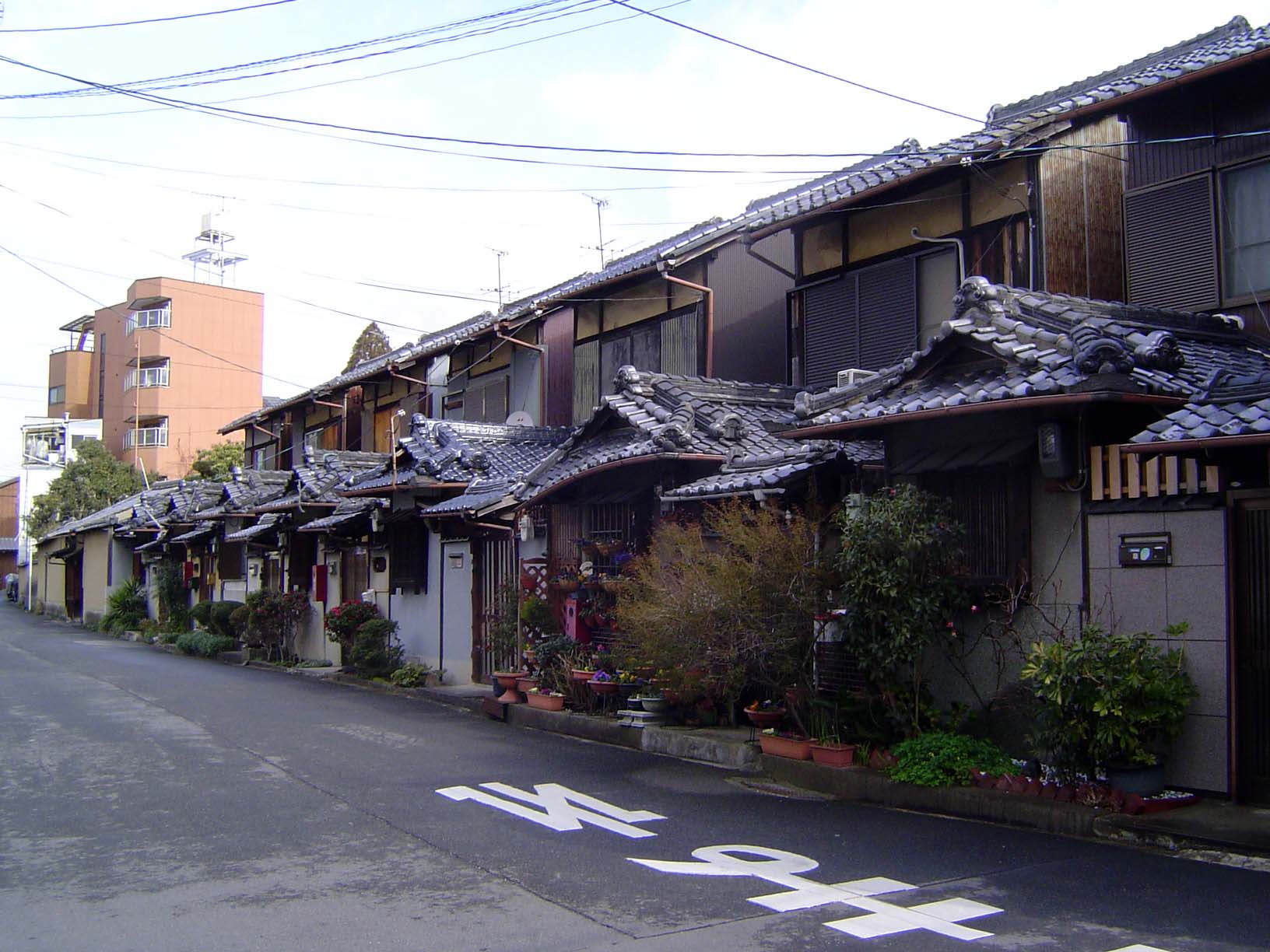
Same street, this time emphasizing the palette of roofing materials and styles drawing on monumental precedents, which themselves originally drew on domestic buildings.
Here's the context for all these houses: the quiet lane with Kaidan-in at the far end. The sign on the left warns drivers to use caution as the street narrows.
Another street, with a house that makes a sharp break from tradition, except for the stone pillar holding the mailbox.
The sign on the left makes a pitch to potential buyers: Good house for sale!
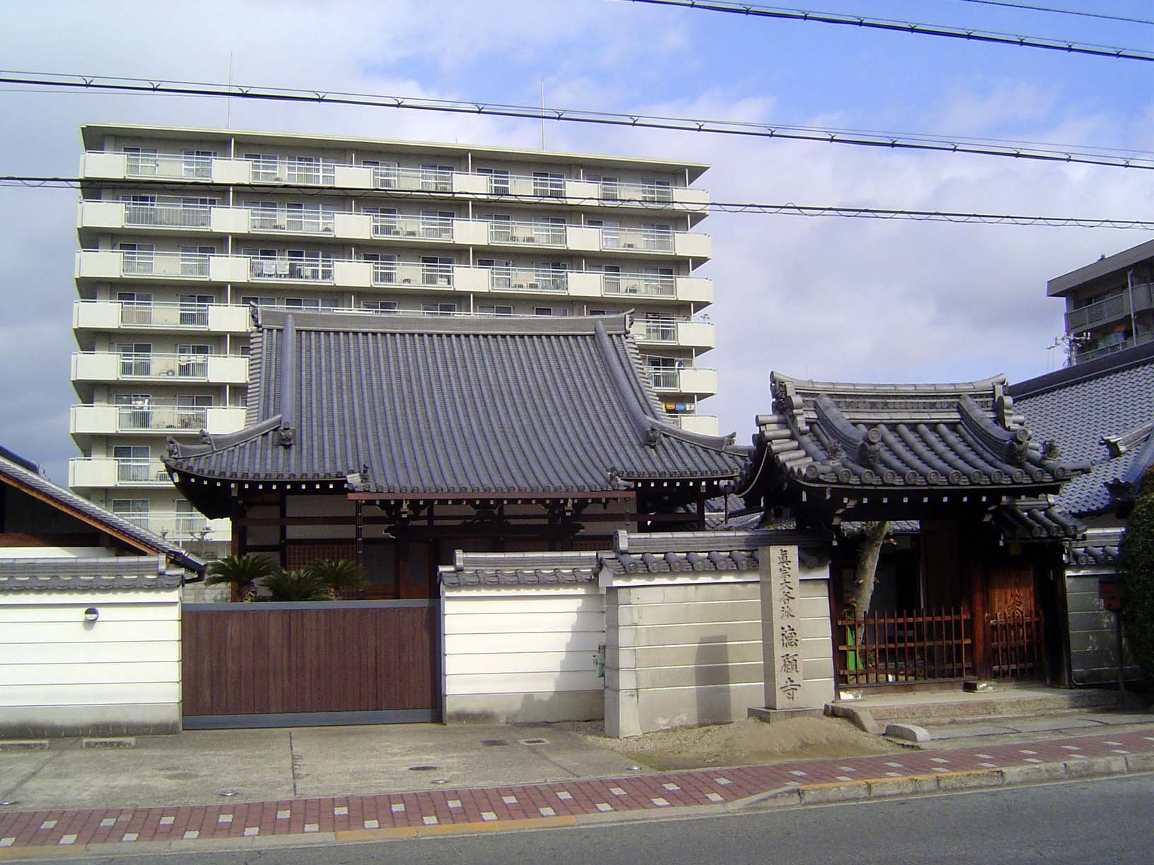
Temples, in this case the Jotoku-Ji Temple, are scattered across the street net. Taller buildings, like the one in the background, stay on the wider main streets.
On the temple grounds. This is a temple of the Nichiren-shu Buddhist Order, and the stones all say the same thing: "adoration of the Scripture of the Lotus of the Perfect Truth." (That's a phrase used in a chant affirming belief in the Lotus Sutra.) The small stone shows a jizo, a bodhisattva guiding Nichiren-shu followers.
Jotoku-ji Temple entrance. The stone, which was moved here after World War II, repeats (in beautiful calligraphy) the same phrase of adoration, which might be transliterated Namu Myoho Rengo Kyo.
A monument reminiscent of a pagoda finial.
A line of newish homes, identical, tightly packed, and almost absurd in their traditional dress.
With the city's growth has come highrise living, here overlooking the Tokuganji Temple. Remember that old movie? Right: "When Worlds Collide."
More apartments. The sign in the foreground is for a bank. The shop with the sign under the green one advertises American clothing.
A little grim?
A dozen miles away, on the walk to Horyuji, an overhead sign asks motorists to drive carefully in Ikaruga, which it calls a romantic and historical town. Rather like a clearcut forest where's there's not a twig left except for the sign cautioning against forest fires.
Nearby, we pass a supermarket and a rice field where last year's straw has been meticulously bundled.
If the West is present in the form of supermarkets, American clothing stores, traffic instructions, and highrises, it's also here at the Nara Hotel, a fusion of East and West.
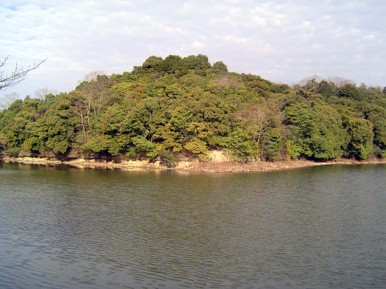
Before we head to Nara's monuments, let's walk an hour or so to the west. We're on the city's western outskirts, but note the hill in the distance.
It's an island, and the lake is a moat. The hill, moreover, is pyramidal. It's the unexcavated tomb of the emperor Konabe.
That tomb is just to the northeast of the area shown on this map, which shows the palace grounds of imperial Nara. The city, called Heijo, was modelled on Chang'an but was only a third the size of that T'ang capital, near modern Xi'an. Studies of the Heijo site began late in the 19th century; the site was designated a historic place in 1922; an archaeological survey began in 1959.
Here's a perhaps clearer model of the palace.
The site of the second imperial audience hall. An earlier hall, adjacent to this one, is to be reconstructed in 2010.
The Suzaku Gate, rebuilt in 1998. The gate itself may be of little interest, but showing it here is useful, because it provides an opportunity to explain Nara's streets, which were laid out with this gate's axis as their guide meridian. Stretching south from here, in other words, was Suzaku Boulevard. Parallel streets to the east and west were numbered and identified as east or west avenues. The perpendicularly intersecting streets were all southern, in reference to the zero-point of the palace, just north of the gate. Want an example? Todaiji occupies the block between First and Second Streets South and Seventh and Eighth Avenues East. These blocks, or jo, were very large—480 meters by 480 meters—and so were all subdivided into 16 machi or cho, 120 meters on a side.