For a podcast episode about this place, find The Places Where We Belong and listen to Supplement 1, Micronesia.
England ruled India for a while, and France ruled Vietnam for a while. Simple! Colonial power in; colonial power out.
Pity Pohnpei: the Spanish were in for a while, but then the Germans took a turn, followed by the Japanese and finally the Americans. Through it all, the Pohnpeians continued to raise pigs and grow breadfruit and taro and bananas and coconuts and—pride of the family—huge yams. Sure: you can now buy strawberry ice cream imported from the USA. Still, as an American anthropologist wrote just after World War II, "castoff dungarees, a smattering of English, and a mission handshake are not to be regarded as evidence of thorough Americanization."
The anthropologist was Douglas L. Oliver, and the quotation is from his Planning Micronesia's Future, p. 6. This oversize, cheaply printed booklet was the only published bit of a major study undertaken by a team of experts commissioned by the U.S. government just after World War II. Operating under the curious name of the U.S. Commercial Company, Oliver was the team leader. He regretted the government's decision not to publish the multi-volume study in its entirety. The Company itself was ephemeral, as from a longer perspective was American rule.
Funny that more tourists don't come (the figure is a mere thousand annually). Perhaps that's because the island is so poorly known. The last time any writer worth an agent paid much attention was in the decade straddling 1960, when at least four authors wrote books with chapters about Pohnpei.
One was Robert Trumbull, a long-time correspondent for The New York Times. Another was E.J. Kahn, Jr., a New Yorker staff writer. The third was Tokyo-based Willard Price, who had previously visited and written about Pohnpei in the 1930s but who had another go 30 years later. The fourth was John Wesley Coulter, an American geography professor who got around. His Pohnpei chapter is more informative than any of the others, but his book was probably the least read of the four. Come to think of it, he probably didn't have an agent, either.
Why the declining interest? Maybe it's because the U.S. Trust Territory of the Pacific Islands was never a hot topic back in Washington, and whatever American pride was kindled by taking over from the Japanese was annihilated when the islands became an independent nation in 1986 (and five years later a member of the United Nations). Pohnpei became one of the four Federated States of Micronesia, proudly independent but also the lucky signatory of a group of Compacts of Free Association that, among other things, still permit Micronesians to move to and work in the United States.
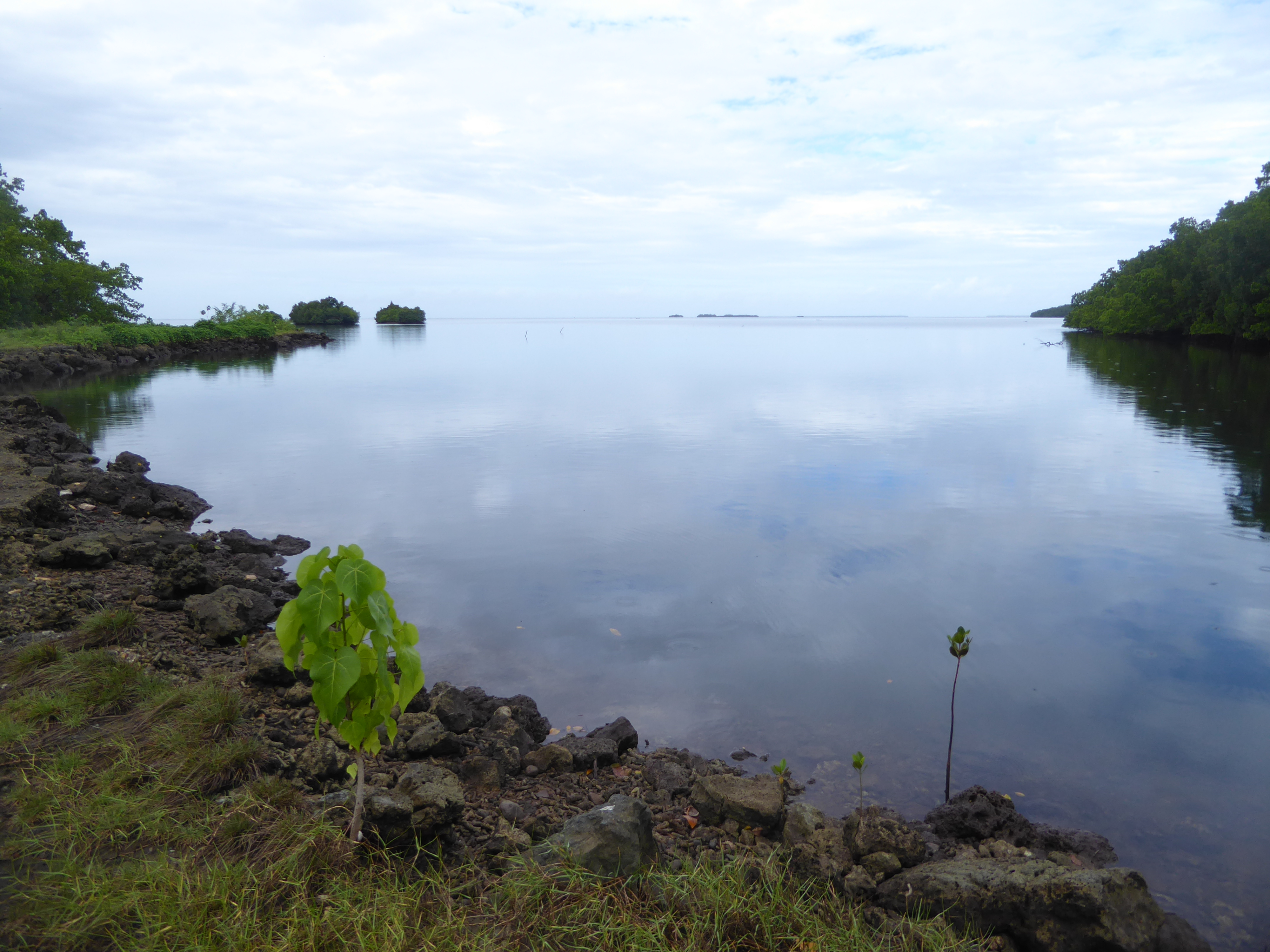
Thirty years later, the island gets three United 737s weekly from Honolulu and three from Guam. That's it, apart from regional airlines offering local flights. It's not just that the Stars and Stripes came down. Blame also Pohnpei's mangrove fringe, which means there are almost no beaches. Also, there's not enough flat land for a decent golf course. (The airport is on fill.) Casinos? Negative. You can see why Lonely Planet's last edition for Micronesia was published in 2000.
Sokehs Island, now joined to Pohnpei by a short bridge, has an impressive cliff at Sokehs Rock, but it's hard to monetize. Back in 1977, an adventurer tried hang gliding but was caught in a draft and seriously hurt. The clouds are standard, too, along with almost 200 inches of rain annually.
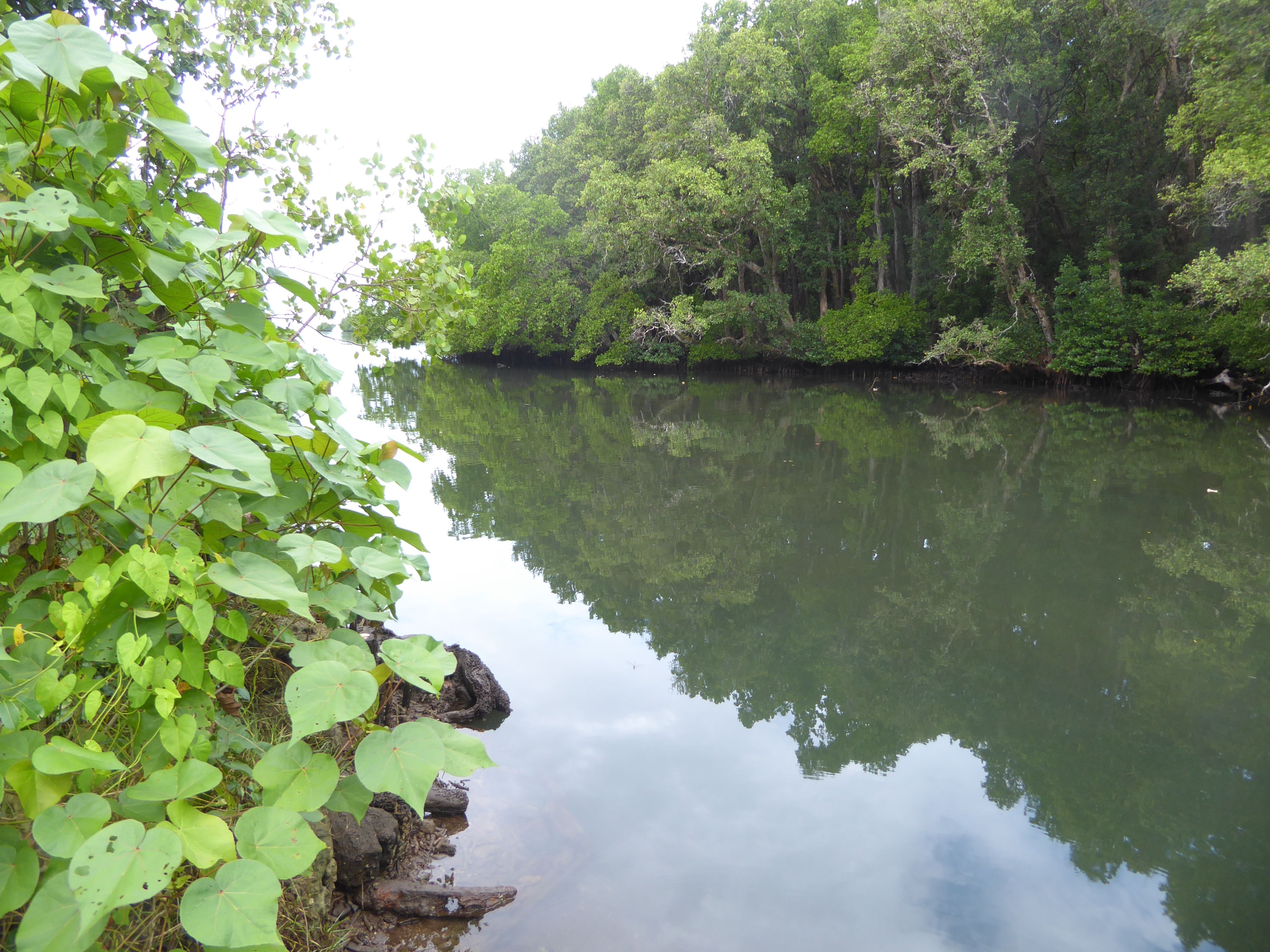
Here's the same rock from the other side. The island's coral-reef necklace is on display, along with two of the several natural breaks in the reef. Those breaks made it possible for American whalers to begin dropping by in the 1830s. The island at that time was ruled by nahnmwharkis, chiefs ruling a segment of the roughly circular island. The Spanish decided to install a governor in 1886 because copra had become an industry, an industry cultivated most assiduously by a German company, the Jaluit Gesellschaft. The Spanish figured that it they didn't take over the islands (which as the Carolines are named after the Spanish king Charles II), the Germans likely would.
We're still up top: here's the view over the island's airport, on Dekehtik Island, now linked to the main island by road. The one town on the island, Kolonia, lies almost hidden in the treed peninsula reaching out to the airport. Roughly 6,000 people live in town. That leaves about 30,000 scattered around the island's perimeter. There's a paved road tracing that near-circle, but there's no bus service—just expensive taxis. There are no cross-island roads, either. Without money for a ride into town, people can be very isolated.
Note for statistics hounds: average household income is about $20,000, and it's been declining about three percent annually for more than a decade. What wealth there is is heavily concentrated in and near Kolonia.
A clearer view of Kolonia. The Spanish called the place Santiago de la Ascension, but informally they also called it La Colonia. The Germans bought the island after the Spanish-American War—their motivation was political expansion, buttressed by copra income—and they renamed the town Die Kolonie. The Japanese acquired the islands as a mandate after World War I, and—this sounds like a Monty Python sketch—renamed the town Koronie. When the Americans took over, the name became Kolonia. (Colonia would have been a possibility, but it was already taken by the capital of Yap, a thousand miles to the west and, along with Chuuk and Kosrae, another member of the Trust Territory and, later, the FSM.) A purpose-built capital would be built in the 1990s for the new country; it's at Palakir, a village a few miles west of Kolonia.
The rock of Sokehs Island (and the rest of Pohnpei) is basalt, which matters a lot more than you might guess.
The same rock is found in lots of places around the island, including here at Kepirohi Falls, caught here during a cloudburst. The rain is warm, which is nice except that your eyes sting from the sweat washing off your forehead.
Here's a quarry at the north end of Sokehs Island. See the columnar jointing, which makes it look as though you could pluck logs from the cliff face?
Somebody had precisely that idea some five centuries ago when they began transporting these "logs" around to the island's east coast. How? "Rafts" is the easy answer, though there's still no proof. Here's a jumble of fragments at the water's edge.
And here we are over at about three o'clock on the island's east side. That's about 20 miles or a 90-minute drive from Kolonia. Piles of basalt columns like these are scattered over a large area of what once was the settlement—shall we call it a city? administrative center? ceremonial center?—of Nan Madol. The name means "the places between," referring to a network of canals separating dozens of artificial islets.
The ruins of Nan Madol (that's all that's left of the place) can be reached by canoe at high tide. The most prominent of the ruins, which holds the tomb of the first king of the dynasty that built the place, can also be reached by a path.
The path blocks tidal flow through some of those canals, which means that they are beginning to silt. A bridge at this spot does keep the water flowing, and there's only one path, so the demise of the canals as a group is not imminent.
Remind you of Angkor? Here's Kahn (A Reporter in Micronesia, p. 151), who came before the path was built: "Nan Madol would probably be a great tourist attraction were it not fairly inaccessible; except at high tide, the ruins, lying along the shores of mangrove-bordered streams, can be approached only in a canoe."
Want something a bit more atmospheric, something in the style of a pulp fiction? Here's Willard Price in 1936 (Pacific Adventure, p. 236): "It is a stormy morning a few thousand years ago. Magnificent canoes, shaped somewhat like gigantic, sea-going gondolas, bravely decorated, move in procession through the water-streets of Nanmatal [sic]. Some are double canoes with a platform between. On these decks maidens dance. Time is kept by the lion-roar of great drums, five feet high, shaped like monstrous dice boxes, and covered with the skin of the sting ray. In one canoe is King Chau-te-leur and his priests. He has proclaimed this festival in honor of the completion of his city. Flowers rain down from the hands of women who line the crests of the battlements high among the tops of the palm trees."
Chau-te-leur is usually spelled saudeleur today. The name means "Lord of Deleur," which itself is an older name of Pohnpei.
Background: the first saudeleur established Nan Madol about 1200. He also established both the first unified rule of the island and a dynasty of succeeding saudeleurs who ruled the island for about 400 years. A revolt or an invasion—choose your poison—brought the dynasty to an end, but Nan Madol continued as the base of a weaker successor dynasty, which for unknown reasons eventually left Nan Madol and moved to the main island and subdivided it into domains ruled by Nahnmwarkis. They remain much respected today, though holding no official role.
Now, in 2018, a few Japanese visitors wade across the canal encircling Nan Douwas, the islet containing the tomb of the first saudeleur. The water is shallow and warm. No fancy hiking shoes, please.
Here's the wall of the enclosure those tourists had been exploring. The construction method is standard across Nan Madol: headers and stretchers, or logs layered this way and that. The weak point of the raft theory is evident here: the base stones seem too heavy to have been rafted except by giants, who, of course, have been proposed from time to time—along with flying dragons.
We can cross and peek. Don't get your hopes up: the tombs have been thoroughly raided and excavated.
The original paving? Your guess is as good as mine.
The central tomb is straight ahead.
Perhaps the first person to write about the site was James F. O'Connell, shipwrecked on the island in the 1830s. In The Life and Adventures of James F. O'Connell, 1841, he describes what he was perhaps the first to call (p. 208-9) the "Venice of the Pacific."
The islanders considered the place haunted and would not accompany him. "You will die! You wish to look too much! You will die!" O'Connell, however, found the place engrossing and productive of "deep yet vague speculation. The immense size of a portion of the stones in the walls, rendered it impossible that they could have been placed there without some mechanical contrivance superior to any thing I met among the natives; and no contemptible degree of architectural skill was manifested in their construction, though their dilapidated state afforded no clue to the purpose for which they were piled."
Robert Trumbull, the Times correspondent, writes (Pacific Paradise,p. 83) that "this enclosure was the only part of Nan Madol that the government keeps cleared of the constantly encroaching jungle." That's still true.
By "government," Trumbull meant the anthropologists attached to the Trust Territory government. They included John Deyoung, fresh from working at the Minidoka Relocation Camp for interned Japanese, and Alfred F. Whiting, a specialist in Indians of the American Southwest. Neither seems to have written about the island before, during, or after their stints. (One exception: Whiting prepared a mimeographed tourist guide to Nan Madol. It's still around, though scarce.)
Oliver's Commercial Company research team included an anthropologist who undertook an authoritative study that anyone other than an anthropologist would consider exhaustingly exhaustive: he was William Bascom, an African folklorist who 20 years later published his minutely detailed Pohnpei, a Pacific Economy in Transition. It emphasizes land tenure and the island's economy, however, and ignores Nan Madol.
Since Independence, archaeologists have taken apart the first saudeleur's tomb, in the center of the enclosure, with the proverbial comb. A photograph taken in the 1890s by Frederick William Christian, however, shows that the general appearance of the tomb hasn't changed much. The headers on the right side of the tomb here are in Christian's photo hidden by a stretcher, perhaps the one that seems to have tumbled down.
See Christian's The Caroline Islands: Travel in the Sea of the Little Lands, p. 90f. The same photograph appears in Christian's paper read at the Royal Geographical Society that year; see its Journal, 13:2, p. 119.
As building material the columns are as handy as can be, provided you can pick them up. The rock weighs about 190 pounds per cubic foot, however, so it's not as though a half dozen stalwarts are going to hoist one of these babies.
Here's the floor of the tomb. Need another dose of atmosphere? Here's Price in 1936 (p. 239): "Descending a moldy stone stairway beneath one of the stones we entered a half-dark crypt, frightening the bats. Large bones, skulls and jewels have been taken by former excavators, notably Kubary and Christian. But our efforts were rewarded by the discovery of fragments of shell axes, necklaces, bracelet, shell needles and fragments of bone."
Today you're not likely to find any souvenirs, assuming that's your grave-robbing inclination. The space is no longer as dark as it used to be, either.
Behind the tomb but still within the enclosure there are heaps of logs left over from vanished structures, probably parts of the tombs of later saudeleurs.
Getting around is a little tricky.
Here's the view from the top of the enclosure's rear wall. There are two outer walls protecting Nan Douwas. There's no visible reef because all these structures sit on the reef.
There's a side door to the tomb enclosure: it's just at the right height to make passage awkward. Whiting asserts that this and other openings like it were the only entrances permitted to commoners.
We've scooted through it and are on our way around the outside of the enclosure. I'm looking at those base rocks and still wondering how they got here.
Here's Willard Price again (p. 238): "The mighty building blocks which compose these barbaric structures make the English castles or those of the Rhine seem delicate and ladylike in comparison. The ferocious appearance is heightened by the fact that there has been no effort to join the stones. I have tried unsuccessfully to insert a knife-blade between the perfectly matched stones of Inca structures in Peru. Here one might insert a hand or a head with ease. The difference is that the Inca stones were tooled to fit. But no tool has touched these stones. The material would have defied Inca implements."
Here's the same path seen from mid-canal to reveal the massive base stones. They do crack with time.
The path makes its way around the southeast corner of the enclosure. We're stepped into the water to get a good look at the wall. The corner's base block is cracking, not a good sign for the wall's future.
We're come around to the northeast corner, with the open sea in the distance.
A clearer view of the two outer walls.
Here's the view from the inner outer wall, looking back to the northeast corner.
Here's the view back as we wade across to Kerien, an islet to the southeast that supports another tomb enclosure. The tide's out today, revealing mangrove aerial roots stiff as wooden spears and about as dangerous.
There's Kerian, which used to be linked to Nan Douwas by a wall, now mostly gone. See the wall on the islet?
Sea cucumbers (?) on the coral floor.
Too bad this isn't video, so you could see the waving motion of what I guess are anemones.
Here's the enclosure wall on Kerien; the base boulders are honest-to-God megaliths, but the coral jumble is a real hazard, unstable and wicked-sharp.
We're made our way around to the far side of the same enclosure; a nearly buried shipwreck offers a bit more protection to the stones. You can see what happens if the government doesn't keep the forest at bay.
We're not going in: it's too unstable.
Making our way back to the tame part: the view south leads to still other islands. Maybe in another life we can come back at high tide and get a boat.
John Kubary, who used the first saudeleur's tomb as a darkroom, mined the Nan Madol ruins sufficiently to extract a hundred crates of artifacts. He intended to send them to a German museum, but almost everything was lost in a shipwreck.
Perhaps Kubary was a grave-robber, but he was also a productive scholar in many fields, including linguistics and ornithology. His career was not an easy one and in 1896, age 50, still on Pohnpei, he hanged himself, apparently after discovering that his wife had been unfaithful. He was buried in Kolonia, where a large contingent of German scholars and scientists paid for a monument in the Nan Madol style. It's been rebuilt since then, and its plaque has been lost.
The Japanese for some reason decided to move all the German graves on the island. In 1938 they also excavated Kubary's but found no body. Gene Ashby, in *Pohnpei: An Island Argosy *, 1987, writes (p. 74) that "the brass plaque with his bust on it had been sent from Germany to Pohnpei in 1901. It was attached to a large stone set up on a pyramid of basalt logs. A couple of years after the grave was exhumed, the Japanese renovated the memorial and reinstalled the plaque. Today, the pedestal remains in the Spanish Wall Park, but the plaque is unaccounted for." A photo with the plaque is included in David Hanlon's From Mesenieng to Kolonia, 1981, p. 179. The pyramid itself appears to have been rebuilt and possibly moved from its original location.
Digging at Nan Madol proved unlucky for Victor Berg. He was the German Berzirksamtmann or District Officer at Pohnpei (the stone reads something like "Imperial Councilor") but became suddenly and fatally ill after a bit of amateur digging. Was it a coincidence? Islanders thought not.
Here's the so-called Spanish Wall, close to Kubary's tomb. In comparison to Nan Madol, it's unimpressive. It's not Spanish, either: it was actually built in 1975 as a reconstruction of a wall that the Germans built after naively tearing down the real Spanish wall.
Run it chronologically. The Spanish in 1886 made Pohnpei the headquarters for their Eastern Caroline Islands colony. The initial Spanish establishment consisted of a governor, his secretary, a doctor, six clerics, and 50 Filipino soldiers.
After an uprising, the Spanish built a hexagonal fort. The Germans, after buying the island from Spain, tore down the Spanish fort, but another rebellion persuaded them that the prudent course would be to rebuild it. This they did, but the Japanese once again tore it down as unnecessary. The wall was then rebuilt during the American period. So is the wall Spanish? Semantics, I suppose. The real Spanish legacy on Pohnpei is Catholicism.
The site of the Spanish fort is now a baseball field, properly lit.
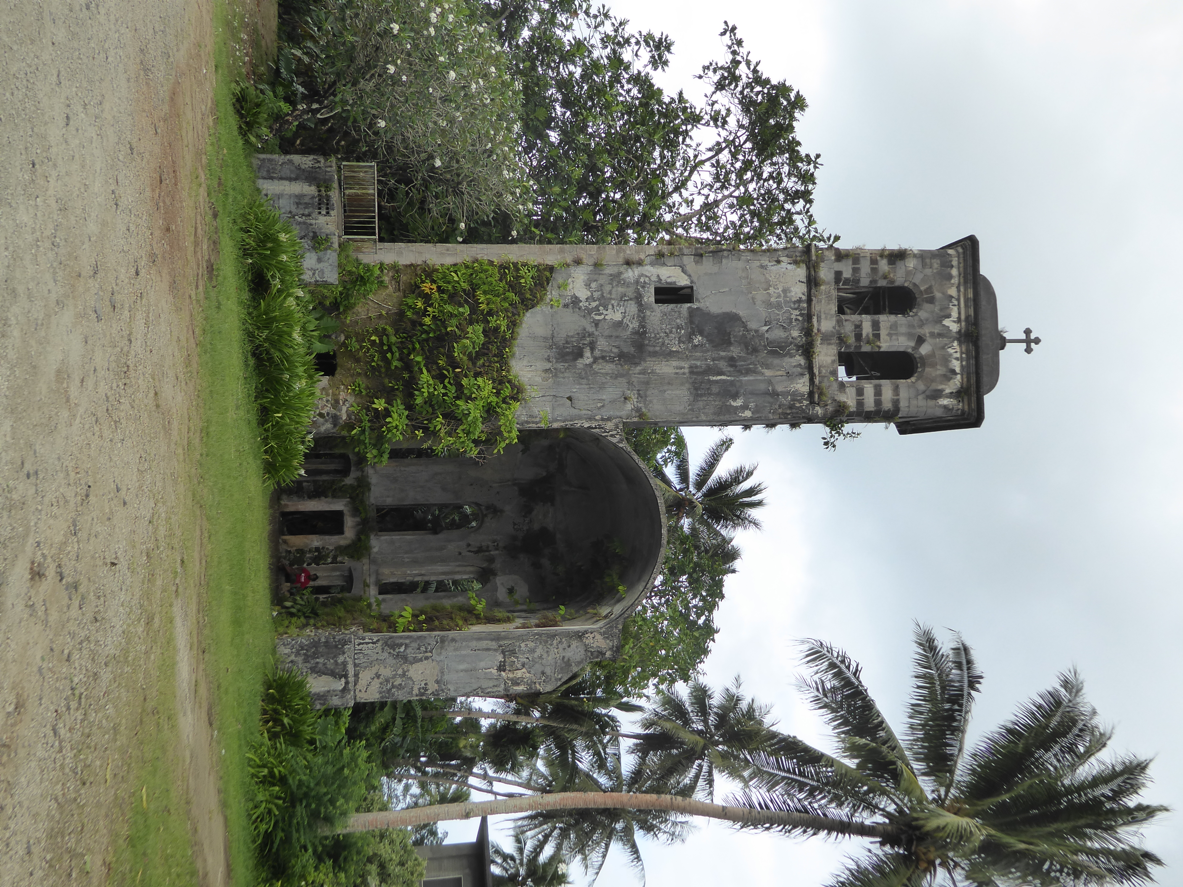
Hugging one end of the wall is this, the Pro-Cathedral of Our Lady of Mercy, built by the German government after the adjacent Spanish church burned down. American bombers blew this one up in 1944 after learning that the Japanese were using it as an arms cache.
Trumbell writes (p. 69): "the Rev. George P. McGowan of Jersey City, New Jersey, Superior of the Ponape Roman Catholic Mission, told me he hoped the condemned ruin could be reinforced and saved as a monument." McGowan was in Pohnpei because the American authorities after World War II insisted on replacing the German Jesuits who had replaced Spanish Capuchins and been tolerated by the Japanese.
Note: the spelling "Ponape" occurs in English-language literature until well after World War II.
For a photo of the ruin in 1945, see http://www.vmb613.com/september\_19452.htm
Here's the German cemetery, thoughtfully relocated by the Japanese to a spot where the Japanese wouldn't have to look at it.
Berg's successors were smart enough not to go digging at Nan Madol, but one of them still managed to get himself killed when he tried to calm a group of islanders angry at being told to work harder on the compulsory and unpaid road crews.
The whole episode was linked to a major land reform. Here's the beginning of the story as related in the Handbook of the Trust Territory of the Pacific Islands, a suitably hefty volume prepared for the U.S. Navy in 1948: "The Ponape trouble began in 1907 when Governor Hahl visited the island from New Guinea and announced to the assembled chiefs that the old feudal-like system based on class distinctions and local customs of land tenure was abolished... Tribute was to cease and those formerly having only limited use-hold rights in land were to become fee owners" (p. 78).
Sound good? Maybe, but along with the program came the compulsory road-building program in lieu of taxes.
It took the Germans several months to bring in a military force able to capture the rebellious workers. Here's the Navy's Handbook again: "Seventeen leaders were executed, and the entire remaining population of the district, 426 in all, was removed to exile in the Palaus."
Here's the spot where the 17 apparently lie buried. No fancy inscription, just a painted wooden sign.
The walls are a post-independence addition by Boy Scouts. It's odd that there's no stone or brass inscription, but most islanders, locked in historic clan rivalries, supported the Germans punishing the rebels, who were already on poor terms with the other islanders. Divide and rule is often an effective strategy, and in this case the Germans didn't even have to do the dividing.
There's not much else left from the German era, unless you count this ruinous bridge over Dewen Neu, the creek at the inland border of Kolonia. The water main on the left is more recent.
There's one more tangible bit of the German era: it's the alignment of this road, extending south from the Spanish fort-turned-baseball diamond, seen in the distance. It's one of the two main roads in town, the other one, roughly parallel to it, running along the waterfront perhaps 300 yards to the east.
Did the Germans have a name for this road? I don't know. The Japanese called it Namiki Dori ("tree-lined street"), and now it's called Kaselehlie, literally "hello," as in welcoming visitors.
Here's the view looking the other way, toward the government building in the distance.
Yvette Etscheit Adams, who lived her life on the island, wrote: "The Germans built the first roads in Kolonia. They were narrow, with one track for pedestrians and another for cyclists, each about six feet wide. One was located down on the water and the other started at the Spanish Wall and went up the hill to where the State legislative compound is. Mango trees were planted all the way along on both sides of the upper road. It was like being in a shaded tunnel when you walked there. It was nice because it was so hot. The Japanese cut down all the trees to widen the road." The irony is that they cut down the trees on a road they called the "tree-lined street." (Island Traders, p. 68)
Here's Trumbull's impression of the street a few years after the Americans incinerated it in 1944. "John deYoung and I went sightseeing in Kolonia our first night on the island. This didn't take long. Before the war, under the Japanese, Kolonia had been a neat little town by the seaside. The streets had been laid out in a more or less rectangular pattern, and there had been a main avenue—sort of a Ponape Ginza—with movie theater, shops and a night club and geisha house called the "Sun and Moon." All this was gone" (p. 60).
The Japanese military met no resistance when it took over Pohnpei on October 7th, 1914. After World War I, Japanese tenure was formalized in a League of Nations Mandate, and in 1922, the Japanese put control under the civilian Japanese South Seas Government (Nanyo-Cho).
In the years that followed, the main road on the water was called Kaigan Dori, or—surprise!—Waterfront Street. It's still often called Waterfront Street, though there's also a Pohnpeian name, Kapwar E Sou, which may refer to the food offered to traditional leaders at dawn. (See Tom Panholzer, Place and Building Names of Kolonia Town: A Brief History, p. 136.)
Here, on Kaigan Dori, the Nanyo Boeki Kaisha or South Seas Trading Company ran the Nambo Department Store. It was one of the very few buildings to survive the American bombing. Yvette Adams recalls (p. 65) that "on the flat roof of this building they had playpens and swings for children. The Japanese would leave their children up there to play while they shopped. There was also a big cage of monkeys that they brought from the Philippines." Like many American military families stationed overseas today, the Japanese had very little to do with the Pohnpeians. A Japanese anthropologist, Umesao Tadao, visited in the late 1930s and wrote: "The Japanese [on Pohnpei] live a life completely isolated from the island and its people. .. Though they live in the South Seas, they know absolutely nothing about it." (Quoted in Mark R. Peattie, in Nan'yo; The Rise and Fall of the Japanese in Micronesia, 1885-1945, p. 203.)
Another view of the same building and its neighbors. For a photo of the building in the 1950s, when it was a public-works office, see
https://www.goodreads.com/author\_blog\_posts/7116690-the-nambo
On an intermediate street, the Japanese built a school. Here's the entrance, with the school behind. The building is used today as the Kolonia town hall.
The gate seems very formal for a school.
The school-turned-town hall.
The Japanese tolerated not only Catholic churches but Protestant ones, including this one, which replaced a destroyed church and which was built in the early 1930s by the Nanyo Dendo Dan, or South Seas Mission. Protestant missionaries had arrived in the 1850s, well before the Catholic mission and of course well before Spanish rule. Today the island is split evenly between Protestants and Catholics, though other groups are present too, prominently including Mormons.
Nothing fancy, but it's a small miracle that it survived the American bombing of the town.
This Japanese tolerance of Christianity may seem odd, but Japanese rule until the war was generally benign. The takeover itself had been very peaceful. Mark R. Peattie (p. 63) quotes the Catholic bishop of Micronesia, Salvator Walleser, as follows: "A few days after the seizure, the chief of the occupying forces appeared and explained with polite excuses that Japan had conquered the island and would administer it from now on. For the present, everything was to remain as it was... By and large, the conquerors—officers and troops—acted with decorum during and after the takeover of the island. Although the troops had gone through everything and had ample opportunity to steal whatever they wanted, not the least little thing was missing after they left."
The Japanese officer in charge of the search, Matsuoka Shizuo (1867-1936), later became a cultural anthropologist specializing in Micronesia.
There's no Shinto shrine or Buddhist temple in Pohnpei today, but Gene Ashby, in <i)Pohnpei: An Island Argosy</i>, writes (p. 260) that the Japanese did save one section of the old wall, against which they built a prayer platform.
The Japanese for a time hoped to make a real colony of Pohnpei, a place where Japanese could settle and flourish. To that end, they began breeding and planting rice and many other crops. Here's the headquarters of the research station. Things went swimmingly until World War II. Yvette Adams recalled (p. 69) a "Mr. Ono, the Japanese man who was in charge of the station.... After the war Mr. Ono returned to Pohnpei to visit. When he saw what had happened to the experimental station and all of his work, he stood at the entrance and cried."
The Americans re-established the station under Leo Migvar, an agricultural extensionist from Spokane. A coconut expert, Dick Pieris of Ceylon, worked here, too. Trumbull recalled the result as of the 1950s (p. 70): "The lovely orchards contained orange, mango, avocado, mangosteen, papaya, cacao, breadfruit, mahogany, sandalwood, and other trees, from which the most suitable varieties would be propagated elsewhere on the islands."
Late in 1958, Typhoon Ophelia hit. (The name was retired two years later, after another, even worse, Ophelia crossed another part of the Pacific.) Pohnpei was hit so badly that the station reoriented its work away from tropical fruits and toward vegetables; the aim was to reduce the traditional reliance on starchy breadfruit and yams. The Trust Territory government also set up a 2,700-acre Farm Institute for coconuts, cacao, mahogany, and rice.
Price reports (p. 86) that by 1966 Hoshino, a local farmer who worked at the station, "succeeded in acclimatizing the cucumber, eggplant, tomato, radish, okra, lettuce, carrot, onion, squash, pumpkin, melon, watermelon, ginger-cabbage, kohlrabi, pea, bean, spinach, mitsuba, potato, sweet potato, sugar potato, and eight-headed potato." Price thought it a small miracle: "We were prepared to find nothing but ruins and weeds... But the farm had been rejuvenated."
He spoke too soon. Perhaps Coulter correctly diagnosed the problem in 1957, when he wrote (p. 280) that "the government agriculturalist has little influence because he can't show the natives how to raise bigger yams!" The implication is that the islanders were interested only in the prestige granted the grower of the biggest yam.
By 2000, Diane Ragone and colleagues at the National Tropical Botanical Garden in Hawaii reported in Economic Botany (2001, pp. 300-01) that ""most of the plantings at the station have been neglected and in some cases, abandoned. In 1999, the staff was reduced and most Agriculture Department operations were moved from Kolonia to a site in Madolenihmw District.... The situation for the station plantings, sadly, is dire. On a recent visit in September 1999, only the grounds around the entrance road where the breadfruit collection, palms, and spice trees are located are being maintained. The rest of the site is choked with thigh-high grasses and weeds.... The plantings of palms, fruit, timber, and other economic and ornamental trees and plants on the grounds of the former Pohnpei Agriculture Station are a state and national treasure. They represent what once was the finest collection of useful and economic plants in all Micronesia and possibly the entire Pacific."
The Japanese got involved with infrastructure, too. What would an engineer see, looking at this river? It's the Lehn, which flows north and enters the sea on the eastern edge of Kolonia.
You and I might see a nice place to get wet, but Japanese engineers saw energy going to waste.
And so the Japanese built a weir across the Lehnmesi, a tributary of the Lehn, and installed a power plant.
How exactly the water dropped into the turbine isn't clear to me.
Here's the Lehnmesi just above the waterfall and below the weir where water was diverted toward the powerplant.
Contrary to League of Nations rules, the Japanese began building military airfields, too. One, for seaplanes, was on Lenger Island, just offshore Kolonia. (The concrete landing ramp is still plainly visible on Google Maps.) The other, at Nan Pohn Mal, just inland from Kolonia, was totally destroyed by American bombing. The Trust Territory's handbook states simply (p. 28) that "no attempt has been made to put back into use the damaged Japanese airfield." Gradually the site has been taken over by suburban expansion in the Pohnpeian mode, which means simple houses and heavily planted farmsteads with the customary breadfruit, bananas, taro, and yams.
Finding the remains of this inland airfield can be a challenge, but perhaps this is a bit of runway or taxiway. Here's Mark Peattie's comment (p. 312): "Almost no one ever comes to kick through the weeds and rusting framework of what used to be Japan's main fighter base on Ponape. Driving along the paved road three kilometers west of Kolonia one can see at some distance from the road across the taro patches, the ribs of an aircraft hangar. A rough and prickly trek through the weeds is rewarded by a view of the foundations of barracks, sections of Japanese fighter aircraft strewn about, two small construction locomotives, trenches, bunkers, and other detritus."
He's describing the ruins as they was at least 30 years ago; less is left now—or is exceedingly well hidden.
Aha! A lined ditch leading to the water purification plant that served both the airfield and the town.
There are Japanese guns here and there, too. This one is atop Sokehs Island.
What have we here? We're at the edge of Kolonia and near the Japanese military base. When the Japanese left, the Americans moved in. Here's what I assume to be the boundary of the U.S. Navy base. Am I 100 percent sure of this? Nope.
We do know that Pohnpei was off the strategic island-hopping track from Tarawa in the Gilberts to Kwajalein in the Marshalls and Saipan in the Marianas. We also know that the Japanese garrison surrendered peacefully in September, 1945, and was evacuated by December. We know finally that there wasn't much left by then to surrender. Despite the town's off-the-track location, Coulter writes (p. 278) that Kolonia had been "burned to ashes by American incendiary bombs."
We've seen the few buildings that survived the bombing: the Nambo department store, the Protestant church, and the cathedral tower.
Another boundary marker. The Trust Territory government was created in 1947, and the Navy handed administration over to the Department of the Interior in 1951. America's Man in Pohnpei was the Distad, short for District Administrator. He was Hank Hedges, formerly the owner of a Chicago construction company.
Trumbull writes (p. 58): "Hank was the type of man who gave the impression that he would love wherever he was, and whatever he was doing.... Clad in his usual working costume of wide-brimmed native straw hat with a band of shell beads, flowered Hawaiian shirt, khaki Bermuda shorts, and Japanese sandals, Hank looked like 'Mr. South Seas' in person."
Not exactly the model of a British (or French or Dutch) colonial administrator. Was it a successful formula? According to Coulter (p. 279), Pohnpeians said that "under the Americans we do not have so much money [as we did under the Japanese], but we are more free."
Bluntly, the Americans never cared much about Micronesia. Even in the early days of American administration, Oliver wrote (p. 87) that "the natives are restless and are becoming increasingly anxious about their future. They have been assured many times that a major program would be forthcoming.... Some native groups wonder if the government really intends to help them restore their prewar levels of living...."
The Americans, like the Spanish, the Germans, and the Japanese, invested in infrastructure. Coulter writes (p. 261): "a settlement on Jokaj Island comes into view. The pontoons emerge from their nests as the plane circles for a lower approach to make a water landing. There is a great splash and forward motion and then the waves surge above the windows. When the wheels are lowered into the water, the plane wades ashore like a giant bird and, on reaching the beach, turns around to disembark the passengers. A boat takes them to Colonia...."
Here we are on the west side of Sokeh and near the Roie Church. Could this have been part of the seaplane dock?
We're back where we started, overlooking Dekehtik Island, now the site of Pohnpei's container port as well as its airport.
Until 1962, only sea planes or amphibious planes came to Pohnpei. Then an airstrip was built on Deketik Island, and the Trust Territory's own DC-4 began service; a second plane was acquired in 1966. The airstrip was at that time unpaved, and there were no mechanics within hundreds of miles. "Each flight has to carry its own mechanic," Kahn wrote (p. 140).
In 1968 Air Micronesia, or "Air Mike," began service. This was the beginning of the "island hopper" running today between Guam and Honolulu. United's service, in other words, was inherited from Continental, which had always had a stake in Air Mike and which eventually took control of it. The plane today still carries a mechanic with a tool kit.
The island's port, seen here in the foreground, had originally been closer to Kolonia but was moved here in 1970 as Port Southerland, named for the engineer of the Micronesia Inter-Island Line (MILI).
The Trust Territory government had nine ships inherited from various sources: one had formerly been used on the Seattle to Alaska run of the Bureau of Indian Affairs. There were private docks, too. Here's one of them, built by Carlos Etscheit, a trader who built a long career here. His daughter Yvette would eventually document the family history in Island Traders, and of this dock she writes (p. 187): "It took a lot of hard work and sweat to build a dock ten feet wide and 150 feet long from the shore by our old store to the channel." The Etscheit family also owned the land expropriated for the airport.
Here's the Tunguru, which Carlos Etscheit had operated since 1966 or earlier as the pride of the Pohnpei Shipping Company, operating between Pohnpei and Rabaul, in Papua New Guinea. Yvette writes that in 1970 "the Tungaru was tied up to the Carlos Etscheit dock by the company store and the Pohnpei Shipping Company closed its doors. The Tungaru has never moved away from that dock." Nor has it since.
She writes (p. 185) that the ship had originally belonged to the British government and had served officials of the Gilbert Islands. "Meals were served on white linen tablecloths with proper silver and glassware. Unfortunately, with the change in crew came a change in style. Slowly all the linen and other things disappeared and everything became 'Micronesian Style.'"
Lots of ships are tied up more or less permanently in the waters of Pohnpei. Here's the Micro Glory, built in 1978. Jeannine Talley, in Lure of the Trade Winds, writes that the ship serves the surrounding islands, but she was describing the early 1990s. Government owned, the ship had been tied up (here in 2018) since some time before 2014.
Rougher shape still.
The Japanese South Seas Development Company, or Nanyo Kohatsu Kabushiki Kaisha, pioneered the tuna industry on Pohnpei. (Part of the electricity generated by the hydroelectric plant went to make ice for the fishing boats.) The ship here is the Trinidad II, formerly the Lou Jean II, a purse seiner originally operating out of San Diego. The ship appears to have been sold to the Caroline Fisheries Company in 2006.
Close-up of the ship's nets.
Here's a Singapore-based container ship.
Amazing, what container ships bring to distant corners of the globe.
Infrastructure aside, nothing gives a better picture of the lackluster interest of the United States in this part of the world than this building, now a pharmacy but until a few years ago the United States Embassy to the Federated States of Micronesia.
In the days of the Trust Territory, this was the Pohnpei State Hospital; now it houses the government's heritage protection unit. Did the Americans build it? No way: it was built as an elementary school for Japanese children.
Coulter writes (p. 279) that the Trust Territory government operated out of "a collection of very scattered quonset huts, put up by the Navy, some of which are in a state of dilapidation and decay. They are used as offices for the administration of the Trust Territory, storehouses, and homes for members of the staff...." Here's a survivor: the Public Utility Company, next to (on the left) the FSM telecom building.
The Pohnpei Electronics Outlet houses one of the early postwar stores, the Joe Boaz store, which opened in 1957. The site had formerly been occupied by the Suzuki Shoten Department Store.
In the early years of American rule, the U.S. government, through its Island Trading Company, was the only buyer of copra. The reason was simply that nobody else had ships to handle the stuff. Meanwhile the ITC contracted with the Etscheit family to operate a commissary. In 1948 it additionally contracted with three companies to handle all the island's wholesale and retail business. One was the Pohnpei Federation Cooperative Association. The second was the Nanpei Company (of which we will soon hear more), and the third was the ubiquitous Carlos Etscheit Soap Company, which made soap with coconut oil. The Etscheit retail store was destroyed by a flood in 1988, after which a new store was built near the site of the old U.S. military base. Here it is, still going strong in 2018.
Another Etscheit store, the A-One, operating near the Spanish Wall.
The store owners know their customers' needs. And, yes, the island runs on the U.S. dollar.
Here's another store. It opened in 1992. That ice cream you saw a while back was in a freezer here.
The store opened in 1992. Although all the Japanese had been deported in 1945, some had married local women. They asked to be allowed to return to Pohnpei and were eventually allowed to do so.
Trumbull writes (p. 61) that "Hank Hedges said the town would be gradually rebuilt in conjunction with a government homesteading program. American surveyors have laid out home sites, retaining the old Japanese street lines, but house lots will be made bigger in order to permit home subsistence gardening." Here is such a homestead, close to the old Japanese school now serving as the town hall. Along with the forest of taro, bananas, and coconuts, there's a shed. See who's inside?
Every grocery sells hog feed. Pigs were introduced to the island by the Spanish; before then, red meat came from dogs. To a limited extent, it still does.
Shall we look at some typical houses? Trumbull writes (p. 59) that "the living quarters for the twenty-five American personnel and their families were also in ancient Navy quonsets. Some of these, I understood, had been condemned long ago by Navy surveyors as unfit for habitation." Here's a house of that vintage.
Another house in central Kolonia.
Roadside houses on Sokehs Island.
Affluence.
Expat paradise: houses probably leased to American embassy employees. Best evidence: no bananas, taro, or coconuts.
The Pohnpei Legislature meets here. Who do you think built the place? For the answer, walk over to the group of flagpoles.
Look right at the middle of the concrete slab. There's something there. It's not a bird.
Bingo: the emblem of the U.S. Naval Construction Battalions, the C.B.'s.
The Seabees have competition now. Here's the new administration building of the Pohnpei State government. Who built it?
Here's your answer.
A few miles outside town we can explore the curiously deserted complex built to house the national government of the Federated States of Micronesia.
It's spooky quiet.
A corridor linking two buildings is lined with fake-basalt columns supposedly evoking the grandeur of the past. Who was the architect? I wish I knew. Couldn't real basalt logs have been used?
Here's the Presidential Office and the Justice Department. No, it's not a holiday.
The Supreme Court. This building replaced one in Pohnpei. That building was described by a judge there as follows: "Construction was of the corrugated-metal siding and roof type which I had by now come to associate with Navy production and Trust Territory architectural patterns. When fairly new, their battleship gray color stood out sharply from the surrounding foliage. After ten years without re-painting the building was dilapidated, the metal rotting. Such structures, originally designed for about three years' use, had long since passed their projected span of life."
See Philip R. and Pauline M. Toomin, Black Robe and Grass Skirt (p. 79). Toomin, appointed to the High Court of the Trust Territories on the nomination of Everett Dirksen, had been a practicing lawyer in Chicago. He and his wife lived on Truk (now Chuuk) for the two years of his judgeship but traveled around the various islands. Toomin's memoir closes with a lament that the public buildings of the trust territory revealed "the United States in the role of a miser, too penurious to pay adequately for his assumed obligations...." Islanders, he wrote, "remember the beautiful public buildings, shrines and torii gates erected by our predecessors the Japanese, and destroyed during the bombardment" (pp. 285-06).
The reserved spaces hardly seem needed.
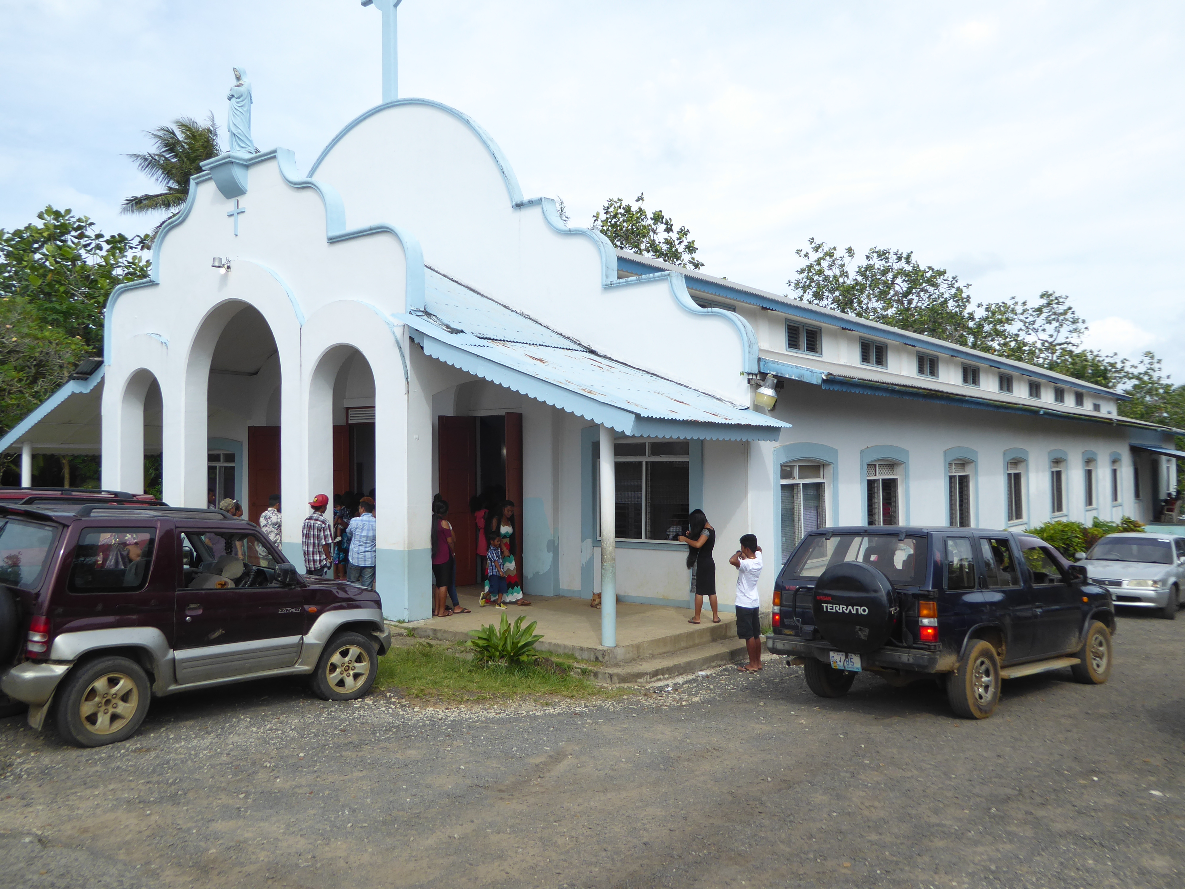
The Catholic church in Pohnpei, on the hand, was crowded on a Sunday morning. The building was completed in 1953, long after American Jesuits had been imported from New York to replace the German Jesuits. The designer in this case was probably Brother Bill Condon, "who had supervised the construction of half the post-war church buildings on Pohnpei during his twenty years of service in the mission [but who] had returned to the US in 1972 due to failing health."
The quotation comes from "A Life at the Edge of the World," by Brother Francis X. Hezel, S.J., who over his career in Micronesia became the most prolific historian of the islands.
The officiating priest in 2018 was no longer a New Yorker.
Another Jesuit from New York had built the Pohnpei Agriculture and Trade School, known as PATS. He was Hugh Costigan, one of the group of Jesuits imported in 1947. Kahn reports (p. 268f) that Costigan was "a singular priest, being among other things a skilled construction man, a Sunday-school teacher in a Protestant church, and the parent, by adoption, of a Ponapean boy."
Born in 1914, Costigan had been a bricklayer and plumber before studying for the priesthood. His father had been a New York City fire department battalion chief, and Costigan took in thousands of dollars annually from NYPD police department raffles for the benefit of PATS. Kahn writes: "On his occasional Stateside visits, Costigan also makes a point of looking up his old friends in construction unions; a couple of years ago, the nearly fifteen hundred members of one Brooklyn plumbers' local assessed themselves a hand tool apiece for the mission. Costigan's otherwise austere bedroom at Tamori was furnished, when I last looked in on him, with a whole case of brand-new sixteen-ounce hammers."
The school, on the site of an old German coconut plantation, is now on the road to Nan Madol,but when it opened in 1965 could be reached only by sea or on foot.
Costigan retired in 1982 and died of cancer five years later. An obituary in the Pacific Daily News for May 30, 1987 said that the school's goal was to instill in students a sense of social justice, "concern for community, love of our neighbors, a spirit of service and a sense of self-reliance and confidence." In 1977, it continued, Costigan had said that he set out "simply to teach students how to produce for themselves and their families."
Closed in 2005, the school was deserted in 2018.
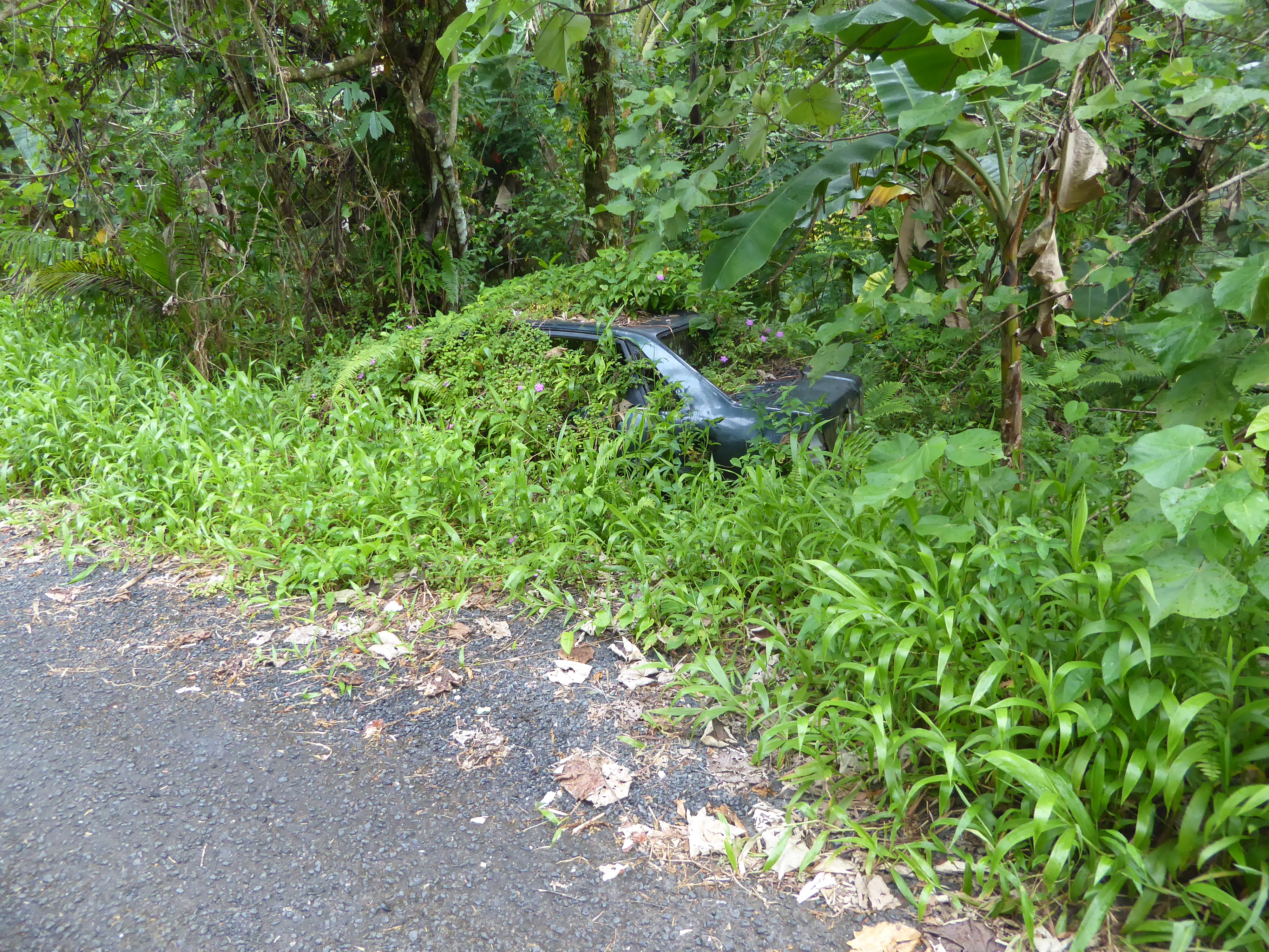
When cars break down on Pohnpei, they are often abandoned rather than fixed. Carcasses litter the main road around the island.
You could make a gallery of these things.
In time, the cars disappear.
Blue's a popular color.
Trucks, too.
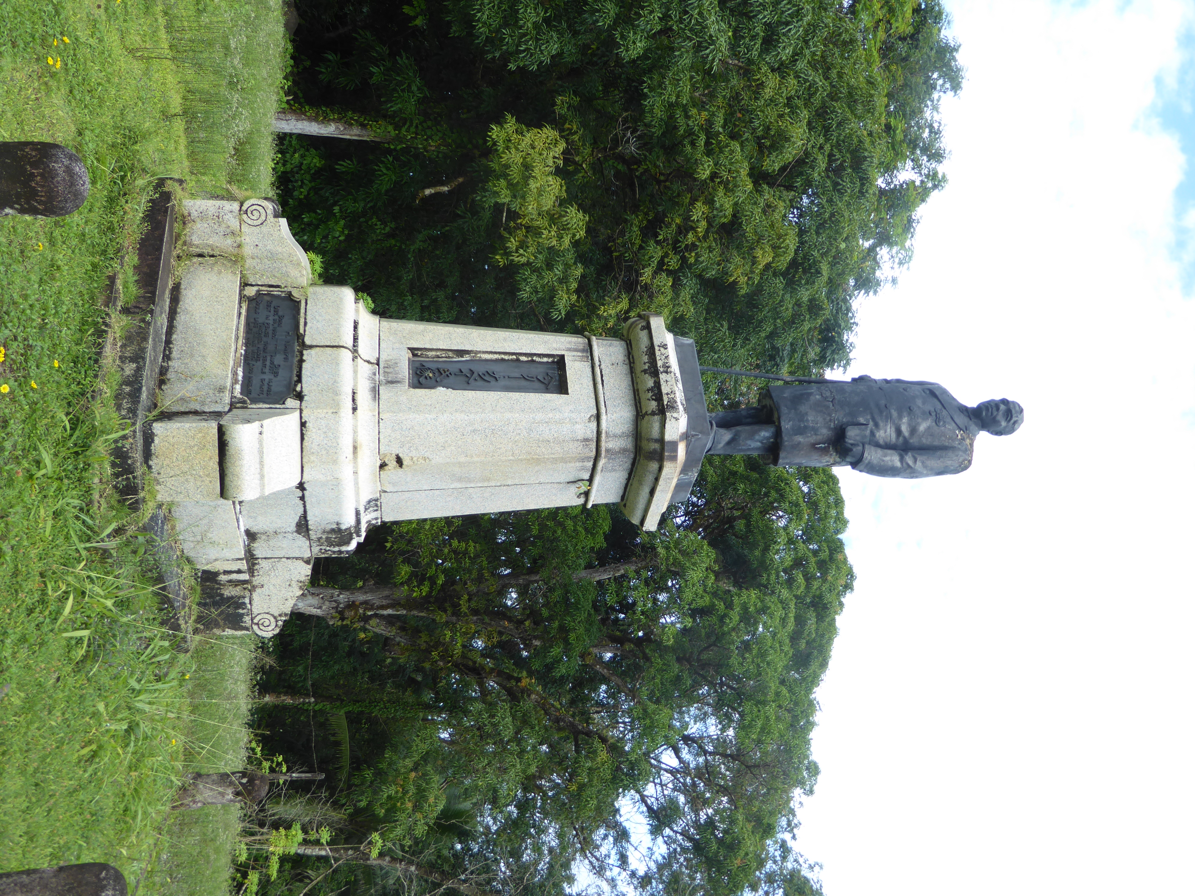
We've come over to Kitti, on the west side of the island, more or less opposite Nan Madol. Here, on a branch road leading to the important 19th century port of Rohnkitti, there's a surprising statue of the wealthiest Pohnpeian of the late 19th and early 20th century, Henry Nanpei. He surveys what once was his coconut plantation.
Nanpei was "the most gifted and successful" product of the American missionaries on Pohnpei. Their outlook was put in classically Yankee terms by Albert Sturges who labored on the island from 1852 to 1885: "This is the business secret of every successful enterprise, every acquisition is added to the stock, and kept in the market, and made to work. Our acquisitions are converts, these accumulate and constitute the church, the church repeats itself, and we have a cluster of churches. The cluster of churches organize and we have the board."
Quoted in John Garrett, Footsteps in the Sea, p. 295.
Born in 1860, the boy was baptised as Henry and as a prosperous adult took the honorific title Nanpei as his last name. He owed his fortune, at least at first, to his paternal grandfather, the Englishman James Headley, who insisted that his son, who was in effect the prime minister of the Kitti chiefdom, deed to Henry all of the chiefdom's collectively owned property. This, writes David Hanlon, was "an unprecedented, revolutionary departure from the traditional Pohnpeian practice of returning to the nahnmwarki all land held in trust by the deceased. The inheritance of major tracts of land in Kiti, officially certified by the Spanish governor in 1896 and honored by subsequent colonial administrations, provided Nanpei with an economic base that he developed into a source of immense wealth."
See Hanlon's important Upon a Stone Altar: A History of the Island of Pohnpei to 1890, p. 176.
The crack near the base of the statue shows where it was repaired after being broken by a falling tree.
While still a student, Nanpei opened a store at the port of Rohnkiti, a mile or so from where the statue stands. The patterned flooring is all that's left.
Rohnkitti harbor was very active in the 19th century, however. The reef keeps the coastal waters quiet.
You can barely discern some offshore islands on the reef.
The only ship in sight is abandoned.
Between the harbor and Nanpei's statue is this church, built on the site of Pohnpei's first protestant church, established in 1852. A grocery order sent home in those early years included one barrel each of beef, pork, flour, sugar, molasses, fish, hard bread, and lamp-oil. (See Ella Theodora Crosby Bliss, Micronesia: Fifty Years in the Island World, 1906, p. 28).
For the first five years, the missionaries were entirely isolated. One complained that "Not a native boy or girl, man or woman, can we get to do anything for us." Finally, in 1856 the missionaries had a bit of luck: "On taking up a stray paper brought by a trading vessel, we noticed that we are to have a mission vessel. On reading this, our hearts bounded with joy. We blessed God that our prayers were being answered...." The ship in question was the Morning Star, launched in Boston and setting sail to Micronesia. (Bliss, p. 42)
Near Rohnkitti, a road penetrates deep into the heart of the island, then dead-ends. Here's a house along the way.
Another.
A third.
Somebody's decided to build a shop.
He or she's got competition.
Along with canned fish, spam, and toothpaste, the storekeeper has two computers.
Meanwhile, the island's forest cover has been reduced from 43 percent in 1975 to 12 percent in 2002. Those numbers at first glance seem impossible: the whole island is green, after all. But most of the green is planted by islanders venturing into the forest to plant Piper methysticum, the source of sakau, or kava, the mildly narcotic beverage of choice on Pohnpei.
There's a series of maps showing the progressive loss of the island's forest cover in Balick and colleagues, Ethnobotany of Pohnpei, p. 15.