For a podcast episode about this place, find The Places Where We Belong and listen to Supplement 2, Peru.
What does the mosque at Delhi's Qutb Minar have in common with Cordoba's mesquita and Cairo's Barquq complex? Answer: besides all three being mosques, all three were built of masonry from older buildings ruined or dismantled for the occasion, whether Hindu, Roman, or Egyptian. The Spanish in Peru went one better, not only dismantling and reusing the superstructure of Inca buildings but putting up Baroque confections atop the intact Inca foundations.
Perhaps it's this dismal history that predisposes me to dislike Cusco's churches. It doesn't help that the Spanish churches are not only gloomy but suffused with the aura of the Inquisition. Besides, Spanish buildings here are transplants, maybe fine at home but tiresome in the New World. (As Ronald Reagan almost said, see one Spanish Baroque cathedral and you've seen 'em all.)
In the pictures ahead, I'll try to let you judge for yourself.
The National Geographic caption would read something like: "The snow-capped peak of Ausangate rises 60 miles beyond thriving Cusco." Here's the less chirpy version: "Cusco, population half a million, fills a valley draining southward, away from the camera." Drive toward that pass in the distance and your nose will tell you that the runoff flows that way. It's the logical place for Cusco's sewage-treatment plant, of course. Fortunately for the tourist industry, the historic center is up here, at the head of the valley.
P.S. If Ausangate doesn't look like it's 20,000 feet above us, that's because Cusco is already halfway there.
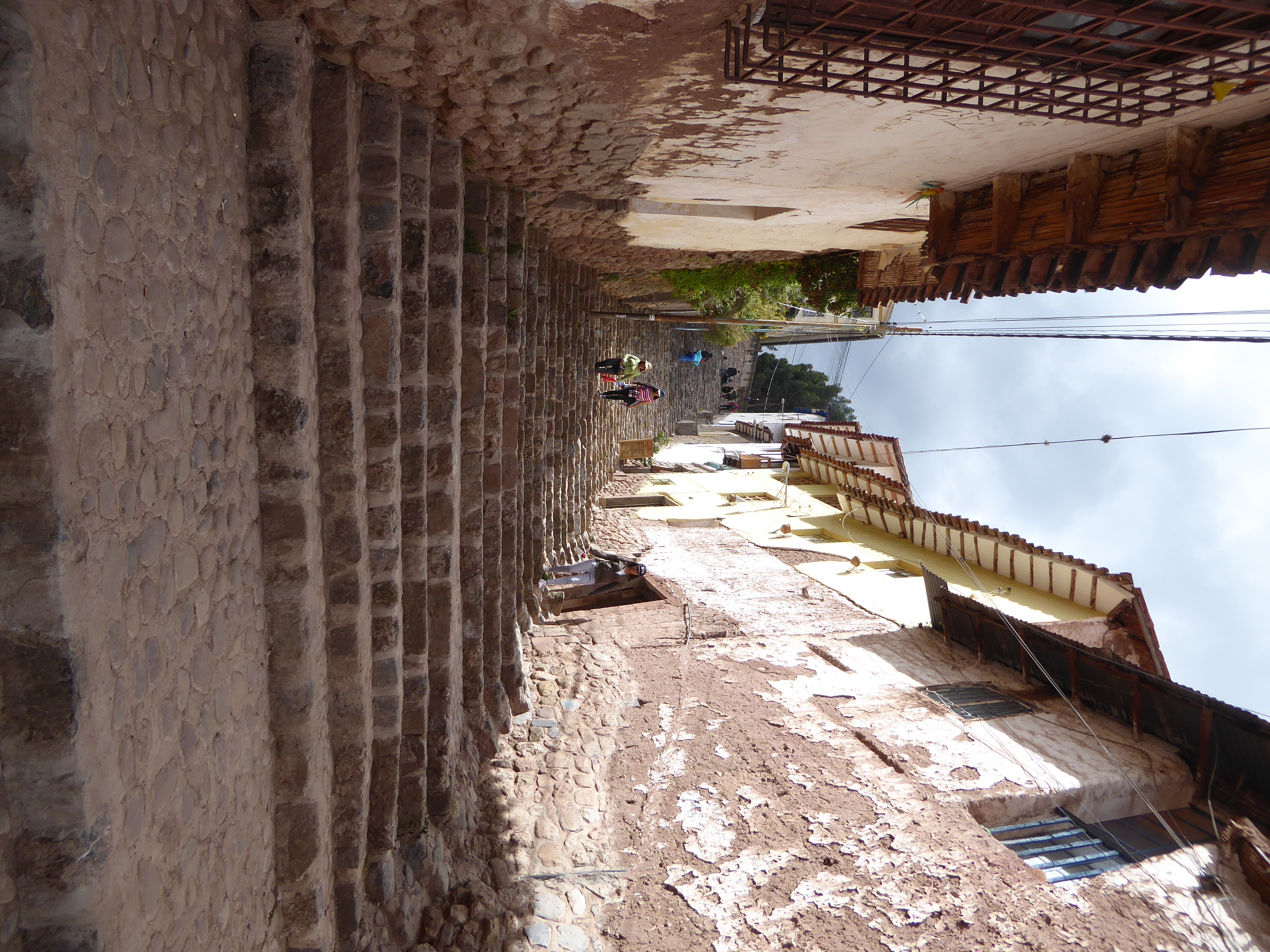
If we were really going to describe Cusco today, we would spend a lot of time—maybe most of our time—looking at buildings like this. Where did the grandparents of the residents here today live? How do the people here today get by? My own preference would be to ask who made money on this stuff. The pre-development land owner? The developer? A city official? Guidebooks never talk about this stuff: it's the old Baedeker's disease.
Ferreting out that stuff takes time and a bit of cheek, if not nerve. In these pictures, we're Baedeker slaves. Translation: we're going to stay at the valley's north end.
In front of us, that's the Plaza Mayor or Plaza de las Armas, perhaps best translated loosely as "parade ground." Two churches stand kitty-corner from each other—the edge of the cathedral is on the left and to its left the Iglesia de la Compañia de Jesus, the Jesuit church. Two blocks to the west there's the Convento de la Merced, and at the upper right there's the Iglesia San Pedro, all of which goes some way toward reminding us just how much the world has changed in a few centuries. If you're wondering what I have in mind, check out the Starbucks wedged between the two churches. (You can't see it here, but it's in that tile-roofed, arcaded white building peeking out at you.)
Here's a better view. The cathedral, on the left, was built on the handy footing of an Inca hall big enough to serve as a barracks for the conquistadors. The Jesuit church is said to stand on the foundations of another Inca building. The Inca buildings, though of the highest importance, were both one-story affairs, like almost all Inca buildings: the roofs were thatched on poles, which meant that fires during the Conquest did the Spanish a favor, leaving them a kind of blank slate on which to build according to their own needs and tastes.
The northwest corner of the Plaza Mayor is at the lower left; the plaza at the center is the Plaza San Francisco, bordered by the church of that name and the blindingly white Colegio Nacional Sciencias. The two plazas were conjoined in Inca time, but the immense space was too much for the Spanish, who broke it up and built on the space between.
The preceding pictures were taken from a couple of different spots on the hill seen here from the Plaza Mayor. That's the Iglesia San Cristobal framed by trees; out of sight behind it is the renowned Sacsayhuaman, of which more later. You're probably not thinking about the slope up to the church. Right?
You will when you climb it. The Inca didn't need cardio workouts, and for visitors today past 70 the steps are not a lot of fun. Railings? You've got to be kidding.
More fun this way? Go for it; there's lots more.
It doesn't help that we're oxygen-deprived.
Notice the wall on the left, a low-key introduction to the spectacular Inca stonework that survived the Spanish.
Room for a short-axle cart?
A taxonomist might have fun sorting out the masonry types on display. I count five.
We're up in the choir of the Jesuit church, with the cathedral out of sight on the right. Before you start gushing about delightful Spanish plazas, let me point out that the local prefect in 1911 "completely metamorphosed" the square, which for a few of the preceding centuries had been a crowded marketplace—and, earlier still, in Inca time, had been the Aucay Pata, a terrace used for ritual feasting. Now, according to Hiram Bingham, fresh from Yale and en route to Machu Picchu, "concrete walks and beds of bright flowers have replaced the market and the old cobblestone paving and made the plaza a favorite promenade of the citizens on pleasant evenings." That was then: in the 1990s another author, Peter Frost, wrote that Cusco's mayor had just uprooted the plaza's native Andean trees and replaced them with "sparse, pitiful flowerbeds." Fast forward 20 years and trees are sprouting.
See Bingham's Inca Land, p. 98, and Frost's Guidebook to Cusco, p. 65.
Bingham went on to say that the town's market had moved to the Plaza of San Francisco, but in the years since Bingham it's moved yet again. One more detail: the plaza had once been an Inca ceremonial center so important that the Spanish chose it as the site for the execution of both Tupac Amaru and Tupac Amuru II.
For an old photo of the plaza, with with groups of llama grazing on the grass, see https://www.youtube.com/watch?v=cQS9BARSxco
The cathedral is flanked by two smaller churches. On the right here, cut off, is the Triunfo or "Triumph," the first church in town and opened in 1538 to mark the Conquest. The main building is the cathedral itself, completed in 1654, and on its right, invisible here, is a third and later church, Jesus Maria, from 1738. Internally they're interconnected, and visitors, entering in Jesus Maria, pass from a space painted white with faux marble to a large space of gray stone and then to one of tan.
Years later, from his home in Spain, Garcilaso de la Vega recalled the site: "Then there is the Cathedral, which opens onto the plaza. That building, in Inca times, was a beautiful great hall which served them as a plaza for their festivals on rainy days. They were houses of the Inca Viracocha, eighth King; the only one of them still standing in my time was the great hall; when the Spaniards entered that city they all quartered in it that they might be all together whatever might happen. I knew it thatched and saw it roofed with tiles." (Garcilaso, Royal Commentaries of the Inca, Book 7, Chapter 9, quoted in Gasparini, Inca Architecture, p. 198.)
Lots of guards wander the premises, ready to pounce on anyone with a camera. ("Security" is their explanation.) The main door of the cathedral is briefly opened early in the day but gives a view only of a gilt screen. The nave beyond would be dark indeed if not lit by electric lights.
Brilliantly lit. The silver altar may be a thing of wonder, but the thing of beauty is the altar just three feet behind it. Almost completely hidden by the splashy silver, this second altar is of plain but elaborately carved alder (Alnus acuminata or lambran) and almost impossible to photograph even if the guards have gone for coffee.
Here's the view from the cathedral door toward the Jesuit church. Age of the pavement? Given the Inca avoidance of mortar in prestige projects, it's Spanish or later.
The minute you see mortar, think Spanish. The Inca used it only on casual stuff.
Do the police make you feel safer?
Where the cathedral has a silver altar, the Jesuit church has one of gold. How's that for one-upmanship?
Ephraim Squier, an indefatigable American, explored Peru in the 1860s and later wrote a very thick book about it. This church he judged "a marvel of architectural beauty—a little too florid, perhaps, but with the finest facade of any church I have seen in Southern America."
See Squier's Peru: Incidents and Explorations in the Land of the Incas, p. 454.
Perhaps he was thinking in particular of the adjoining Chapel of San Ignacio de Loyola.
A little too florid? Safe bet. Today it's an exhibition hall for the University of San Antonio Abad del Cusco.
A bronze statue of the essential founder of the Inca Empire, the Inca Pachacuti, was placed in the center of the plaza only a decade back. Think it was welcomed by all Peruvians? Think all Peruvians want to celebrate the Inca? Think again: the statue's placement was a political act in a long-running political contest.
There's no more famous symbol of that contest than this, the church and convent of San Domingo, built a few blocks away atop the most important Inca temple, the Coricancha or "golden enclosure."
The design of the cloister is entirely Spanish, though the stone font, of porphyry, may (or may not) be Inca. In an environment as prone to earthquakes as Cusco, the arcade seems singularly risky—and in fact was rebuilt after quakes in 1650 and again in 1950. Stroll under the arches and see if you don't remember Damocles.
The most spectacular vestige of the underlying Inca temple is this gray andesite wall. The wall below it is ancient but rebuilt in modern times. Old photographs by Max T. Vargas show no lower walls and show different buildings on the right.
The same wall from another angle: the curvature is unexplained, unless you think it's enough to say that the sun temple once lay on the other side. Reminds me of a submarine hull, but that does seem an unlikely association.
Meticulously shaped and fitted, the blocks are not quite perfectly rectangular. This departure from assembly-line uniformity can be seen as a shortcoming or as a playful departure from tiresome consistency. See Utah?
Had the builders chosen to design a wall of perfectly rectangular blocks laid on a perfectly rectilinear base, is there any doubt that they could have done so? The batter, by the way, is customary and in a land of earthquakes perhaps wise.
A few Inca alcoves survive around the cloister, and their stones are as perfect as an engineer might wish. The recesses served an unknown purpose but are characteristically trapezoidal, a form used in doorways, too, again to provide greater stability during earthquakes. The block on display in the center is recent and was placed by someone who thought that the space should not be left empty. The little hole behind the stone is perplexing.
It's one of three that penetrate the wall, which is a single block thick. Here, on the outside of the building, is the other end of those holes. Speculation on their purpose is rife. Why some courses are flat and others rusticated also remains unknown.
Here's the same external wall, about 15 feet high. The lower third is a retaining wall; the upper two-thirds are the wall of the cloister chambers. As has been observed countless times in countless places, the stones are unmortared.
Compare that with the thickly mortared tower, made of basalt and good enough for government work. It was rebuilt after the earthquake of 1950.
The interior of the tower. Want to set up a cot and wait for the next big one? Not I.
Here's the facade of the church of San Francisco, restored after a quake in 1650. Compared to the Inca walls at the Coricancha, the masonry is clodhopping.
Ditto the Iglesia Santa Clara from 1622 and built stoutly enough to have survived the quake of 1650. The tower's a later addition.
Given blocks and mortar, I might with a bit of practice build a wall like this. Inca walls? Not a prayer.
More of the Convento Merced.
Sometimes the Spanish tried harder, which is to say that the Indians they hired as builders were told or allowed to do better. Here's an example built as the home of Admiral Francisco Aldrete Maldonado, who died in 1643. There are lots of interesting details here, but isn't the most eye-catching feature the foundation wall?
The courtyard is weak in comparison.
An anthropomorphic lion on the main staircase.
Call them pseudo-gargoyles?
Here's the salon with the corner window above the main entrance.
View from the window in that room and over the main entrance. That's one of the cathedral towers. If you get the feeling you're being watched, check the pseudo-caryatid.
The carpentry befits the home of an admiral accustomed to the work of shipwrights.
In the mid-19th century, Bolivia and Peru were briefly unified as a confederation. The leader of that unified state was Bolivia's Marshal Andres de Santa Cruz, who bequeathed this triumphal arch to mark the event. The confederation broke apart after three years, though the arch survived and was raised a generation later. Anyway, the point is that the Marshal had occupied the Admiral's house in the confederation years. Call the Admiral's house the town's premier address.
Here's another example of Spanish workmanship at its best, the Casa del Marques Valle Umbroso, which for a time was the home of the Esquivels, the city's richest family. The trapezoidal entrance is what we of refined taste would call an Inca homage.
The home was restored in 1976 for the Regional School of Fine Arts Diego Quispe Tito.
Here, also on Calle Marques, is another old house, the Casa de Alonso de Toro, unrestored but with another trapezoidal door set in masonry that's probably going to outlast us all.
Trust the walkway on the upper level?
Any safer on this side?
Here's the pick of the bunch, the so-called Archbishop's House that now is a museum of religious art. See why it's the pick?
Since the 19th century it's been described as the site of the Inca Roca's palace. He, however, is a legendary figure, not a historical one, and the site during Inca time is identified by Adam Herring as a sacred agricultural terrace, which may have supported a temple to the Thunder God, Illapa, and been the site of ceremonial corn planting each year. With the fall of the Inca, a house was built atop the terrace. The house became the property of the Church only in 1948 and served as the archbishop's palace only from 1957 to 1967, when it became a museum. The building on the other side of the fountain is a chapel.
See Adam Herring, "Shimmering Foundation: The Twelve-Angled Stone of Inca Cusco," in Critical Inquiry, 2010.
Was it here before 1950? Good question.
Balcony doorway.
View over the Plaza Jesus Lambarri, created only recently when a building was demolished so vehicles could make the turn more easily.
We're back to the main entrance of the museum, as shown in a photograph taken by the pioneering Peruvian photographer Martín Chambi.
Here it is in 2018, repaved and with most of the overhead wiring relocated. The street is called Hatun Rumiyoc, Quechua for "great rock."
Hundreds of people pose daily with that great rock. We're looking, in Adam Herring's reading, at the northwest face of the wall around the sacred agricultural terrace.
The characteristic that draws so much attention is that this stone has 12 angles. Remarkable? Maybe, but maybe also this is a case of missing the forest by focusing on one tree.
Different light on the tree. The stone is diorite porphyry.
Come down to the rounded corner.
And look down the street, pretty much ignored.
Think the masons couldn't have built a precisely coursed wall?
Ever see a playful mason? Behold liberty exercised in a severely disciplined society.
A great many theories have been proposed to explain how the Incas maneuvered and shaped their rocks. Nor is there general agreement about the nubbins or nipples on many but by no means most of the stones. Functional? Freudian? Choose your poison.
Around the next corner, the wall has broken down at several spots and been rebuilt with astonishing crudity.
Anywhere else, the repairs might seem acceptable, but here they're like a violinist who puts on thick mittens before playing Mozart.
Here, maybe two blocks away, is the longest surviving Inca wall, not as imaginative as Hatun Rumiyoc but impressively neat and of course without mortar. The building is the Acllawasi, which in Inca times housed the so-called "chosen women" in a kind of harem. The Spanish made the place a convent, the Convent of Santa Catalina.
The street itself is called Loreto or Intik'ijllu. Squier is very respectful: "One face of the walls, on the square called Pampa Maroni, is nearly perfect, except where it is pierced with modern doorways leading to the edifices that have been built over the ruins. This is perhaps the finest piece of ancient wall remaining in Cuzco...380 feet long and about 18 feet high. The courses of stones are symmetrical and accurate." (Squier, p.446)
The street itself is an Inca survival, straight and narrow as most were. Pizarro's secretary, Pedro Sancho, wrote that the streets were "crossing at right angles, very straight, all paved with stone and in the middle of each one runs a water channel lined with stone. Their defect is in being narrow, since only a single horseman can go on one side of the channel and another on the other side." (Quoted in Graziano Gasparini and Luise Margolies, Inca Architecture, p. 61; see Sancho's Account of the Conquest of Peru, 1534, chapter 17.)
Here are two of those doors. One has been partly filled again; the other leads (catch your breath) to Starbucks and one of the city's almost 1,200 places for tourists to sleep.
The jointing of the wall is not only tight but visually emphasized by cutting down the edge of each stone. Why did the Inca do this? Is it anything more than an esthetic preference?
John Howland Rowe suggests another possibility. He speculates that "an observant traveler in the Cuzco Valley cannot help noticing that many boundary walls and even houses are not built of either stone or adobe, but of square-cut blocks of sod. The turfs are 10 to 15 centimeters in thickness and are laid up in rows with the topside down. They weather to a grey color, something like that of the local stones, and the walls have a surface texture entirely different from either stone or adobe construction. Each turf acquired a rounded face, curving back on the edge to leave the chinks countersunk, much in the fashion of rusticated masonry.
"Now, Inca masonry of the ashlar, or regular course type, generally has a surface appearance that is too similar to that of a sod wall to be accidental. The stones are cut with a rounded surface and countersunk joints, details which serve no structural purpose, are not natural to the medium of rectangular blocks, and hence are purely a decorative convention. Sod construction is the most likely source for such a convention."
See John Howland Rowe, An Introduction to the Archaeology of Cuzco, 1944, p. 25.
Want a unique hotel room?
Try this one. No windows, but a genuine Inca wall.
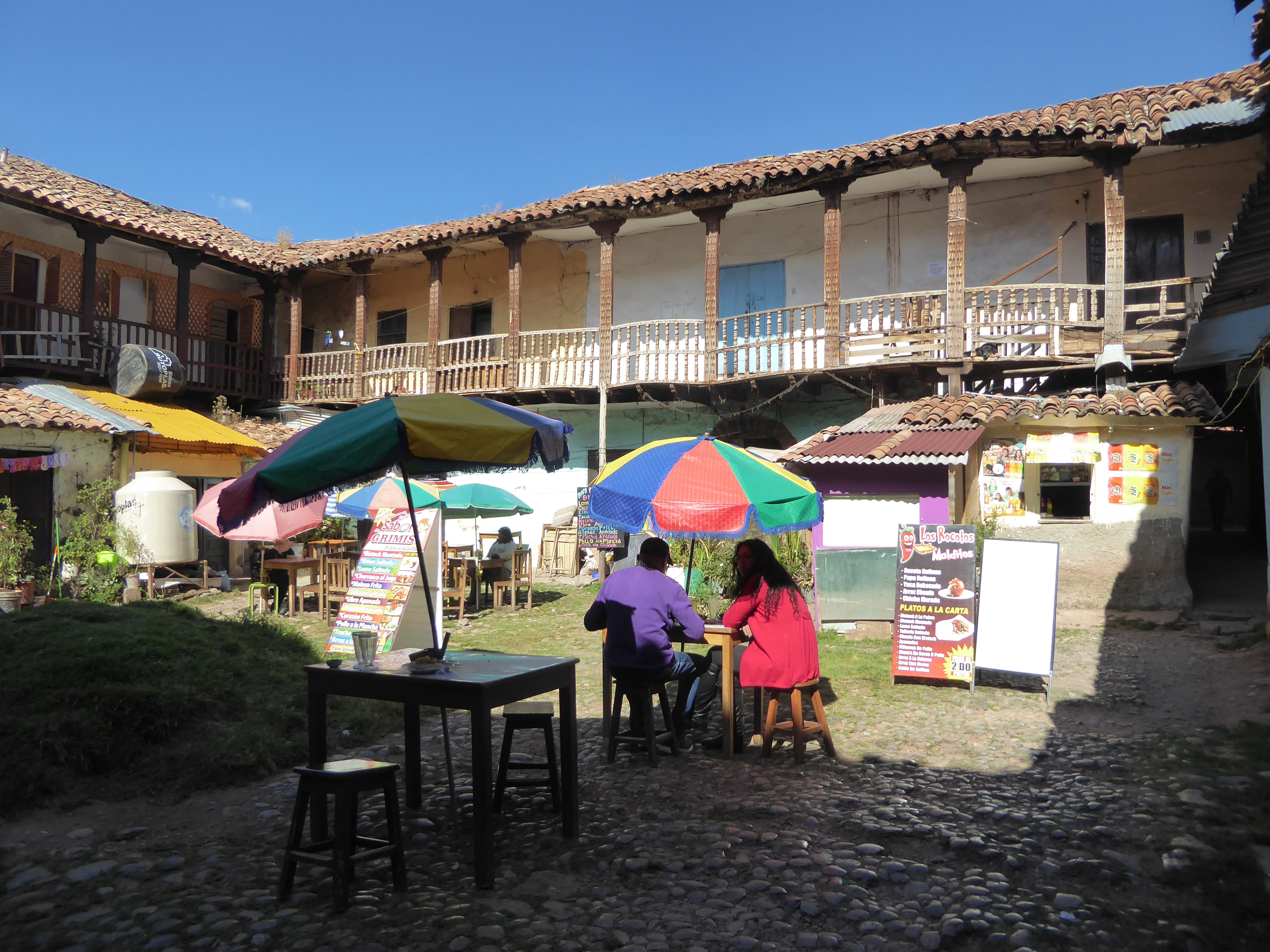
Which brings us to the role of tourism in the city's economy. A taxi driver sighs and says that there's nothing else but tourism. This particular day was a bad one for him. A minibus that dared venture onto the streets had firecrackers tossed its way by strikers.
Even on a day of labor protests, tourists sustain craft markets.
They bolster the municipal market, too.
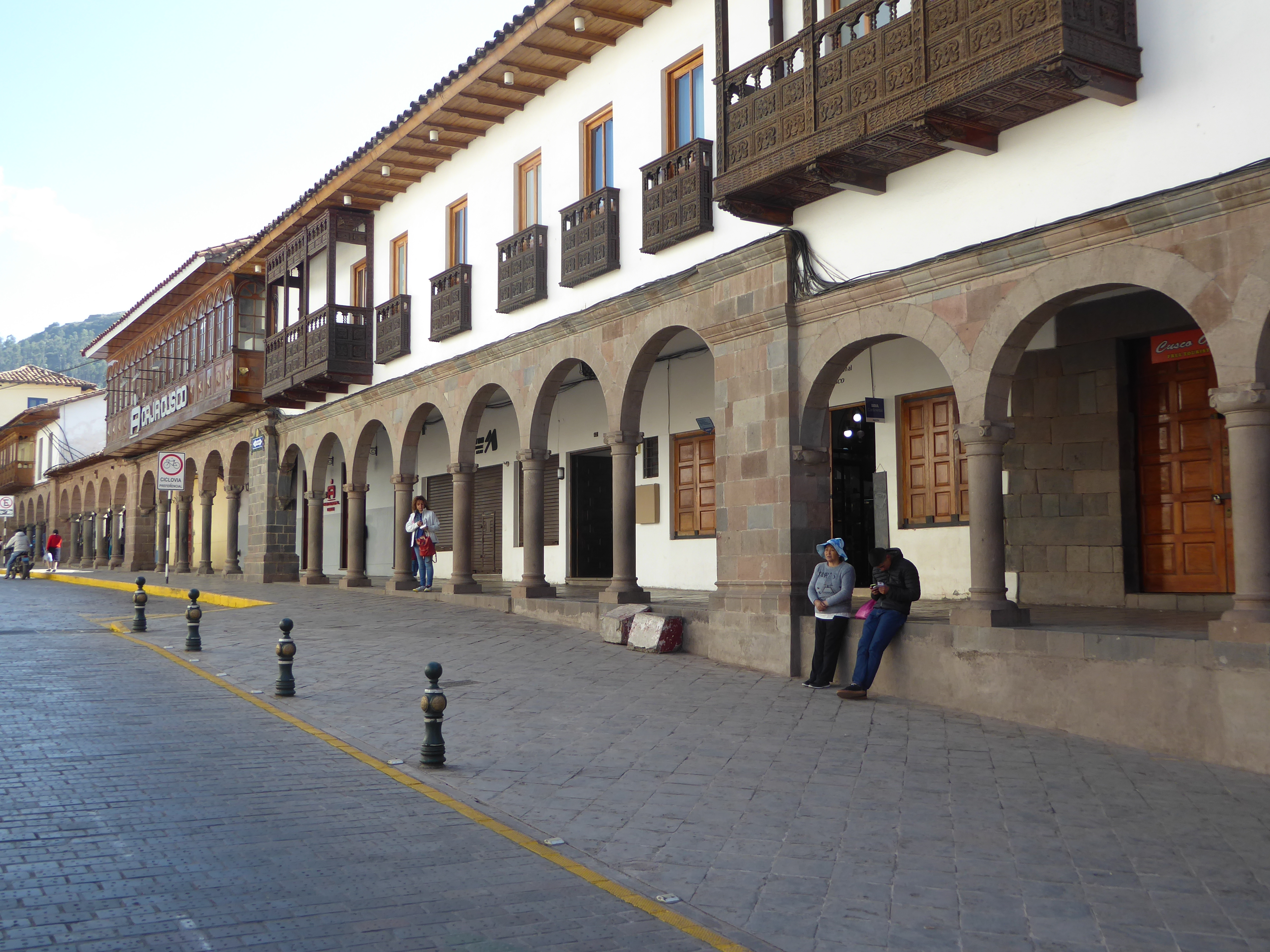
Tourist money has paid for many of the balconies facing the Plaza Mayor. Old photographs show the buildings here with only a few.
The Portal Espinar, one block west of the Plaza Mayor and just north of the Convento Merced, looks tiddlier today than it has for centuries.
The tourists themselves are certainly less tiddly than they once were.
You recognize the location. The photographer is the same Martín Chambi who photographed Hatun Rumiyoc Street. Several collections of historic photographs with his work have been published.
See, for example, Andrés Garay Albújar, Cusco Revelado: Fotografías de Max T. Vargas, Max Uhley, Martín Chambi,, 2017, or May Castleberry, ed., The New World's Old World: Photographic Views of Ancient America, 2003.)
Not all the tourists are blonde foreigners.
Wonder what the crowd is?
Some kind of show?
Not quite: the blue banner attacks the "assassins of micro-entrepreneurs." The complaint is that the police keep telling street sellers to move on.
It's a multi-purpose event, with air horns to attract attention.
On this occasion the protests remained peaceful, though shopkeepers rushed to lock their doors for a few minutes.
We've climbed back up the hill north of the plaza. Clements Markham (1830-1916), for decades an eminence in the Royal Geographical Society, spent some time here as a very young man. He wrote: "The city lies spread out like a map, with its handsome churches rising above the other buildings and the market in the great plaza crowded with Indian women sitting before their little merchandise or passing to and fro like a busy hive of bees."
See Markham in Peru, ed. by Peter Blanchard, p. 91.
Try an about face and you're up against one of the city's handsomest walls. It's adjacent to the San Cristobal church and is the most visible surviving bit of the Colcompata. This was the palace of Pachicuti, founder of the glorious or at least most expansive phase of the Inca state. For a century or more, a private house, more or less hidden by greenery, has sat atop the wall.
The masonry style, neither cyclopean nor coursed, is aptly called cellular.
Here again there are wall niches, their original purpose unknown. Did they hold something? Squier thought not: "Where there are long lines of these walls—as, for instance, those supporting the terraces of the Colcompata—the monotony of the front is generally broken up by the introduction of countersunk niches, something like the 'blind windows' which our architects introduce to relieve the blank walls of houses" (pp. 432-3). An architect writes, "As far as Ecuador to the north and Bolivia to the south, the shape identifying the Inca presence—the trapezoid—was imposed as the seal of the conquering culture" (Graziano Gasparini and Luise Margoles, Inca Architecture, p. 5).
Behind the wall there's this coursed relic of the palace of Paullu Inca, a puppet Inca installed by the Spanish. The building once contained a huaca or revered object, in this case apparently an idol. Could it have had anything to do with the figure on the stone behind?
(See Squier, p. 451, and Brian S. Bauer, The Sacred Landscape of the Inca, pp. 56-7.)
Still farther up the hill is Sacsayhuaman. We're standing atop it and looking across an Inca parade ground to a second hill, called the Rodadero. Markham in the 1830s wrote, "Many deep excavations have been made on it [the parade ground] in the fruitless search for treasure, and it is now sown with barley" (Markham in Peru, p. 91).
The barley's been replaced by tourists, but they haven't arrived yet this morning.
The Rodadero has lots of enigmas like this apparently incomplete limestone carving.
It's also been a playground for a long time. Here's Markham again: "...rains have, in the course of ages, formed them into grooves, now smooth and polished from the many generations of boys and girls who have been in the habit of tobogganing down them. It is still the principal amusement of the youth of Cuzco of both sexes" (Markham in Peru, p. 92).
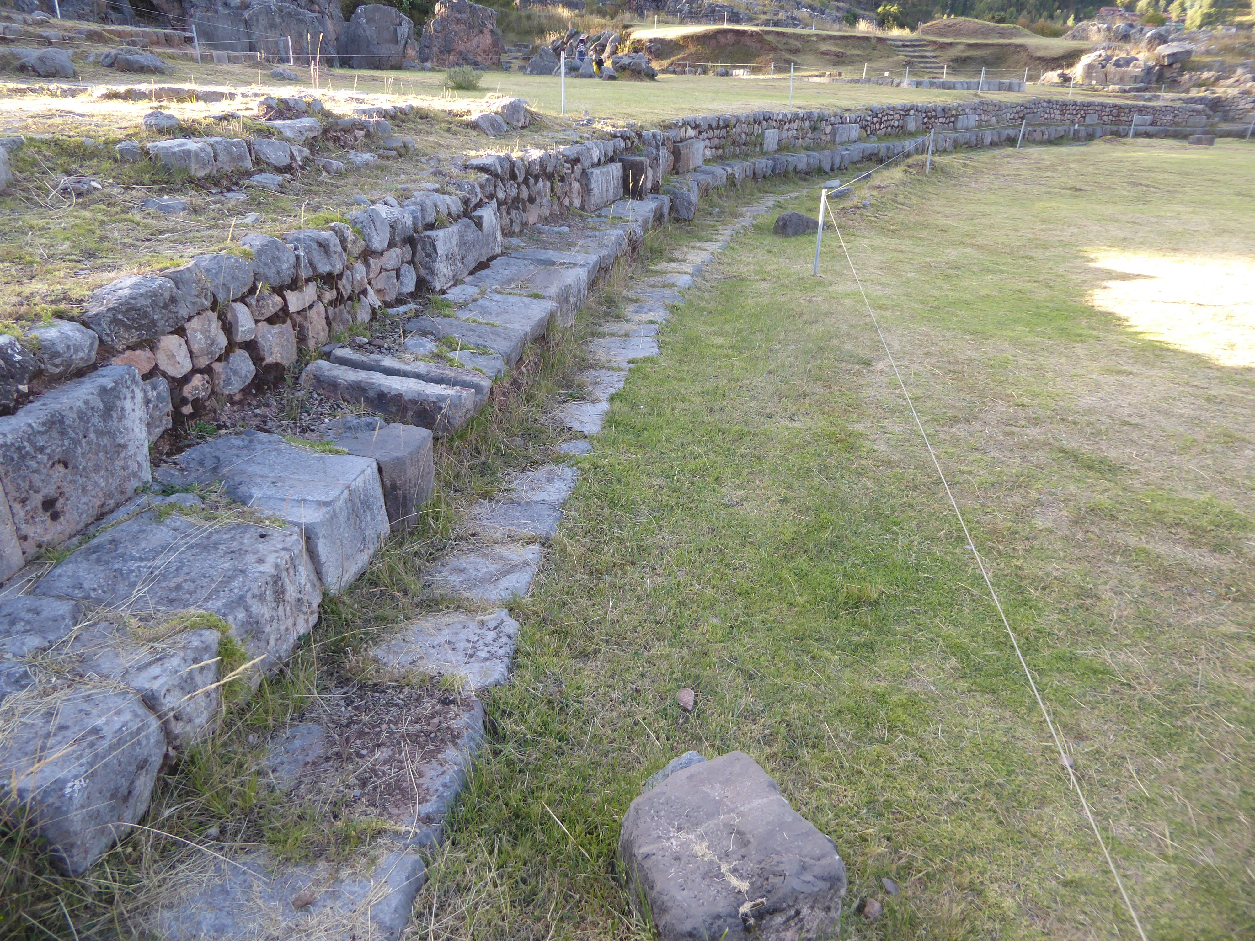
This Inca reservoir on the east side of the Rodadero was discovered only in 1968 and has subsequently been unearthed.
It's a reservoir equipped with channels for filling and draining, but the seating suggests a ceremonial function as well. Ritual bathing certainly occurred nearby. One author writes: "...then on the twenty-first day of this month, all those who had been knighted would go to bathe in a spring called Calispuquoi, located behind the fortress of Cusco, nearly a quarter of a league away. There, they would remove the clothes in which they had been knighted, and put on others called unuaclla, which are black and yellow with a red cross in the center. From there, they would return to the plaza..." (Brian S. Bauer, The Sacred Landscape of the Inca, p. 55, quoting Cristobal de Molina.)
Here's the view looking back from the Rodadero to Sacsayhwaman proper, a fantastic blend of fortress and symbol—in this case the serrated teeth of a puma—the Inca equivalent of the bald eagle for Americans.
Juan Pizarro, Francisco's brother, fought and died here in 1556. He didn't have much time to think about symbols. Instead, he wrote of "a very strong fort surrounded with masonry walls of stone... and in the lower part of this wall there were stones so large and thick that it seemed impossible that human hands could have set them in place." (Quoted in Brian S. Bauer, Ancient Cuzco, p. 102.)
The symbolic importance of the place has been clear to others, however, for a long time. Here's Hiram Bingham, writing in 1911: "It seems to me possible that Sacsahuaman was built in accordance with their desires to please their gods.... This seems to me a more likely object for the gigantic labor involved in the construction of Sacsahuaman than its possible usefulness as a fortress. Equally strong defenses against an enemy attempting to attack the hilltop back of Cuzco might have been constructed of smaller stones in an infinitely shorter time, with far less labor and pains" (p. 106).
And here's John Hemming, a leading historian today: Sacsayhuaman "was far more than a fortress. It was primarily a shrine... to rival Coricancha" (Monuments of the Inca, p. xxx).
Even some of the early Spaniards probably understood that this was more than a fortress. Garcilaso de la Vega, born in 1539 to a Conquistador father and an Inca noblewoman, wrote that this place "was built more to be admired than for any other reason" (Gasparini, p. 285).
One way or another, the stones were hauled for miles—and without the benefit of wheels. Cieza de León explained that workers were recruited on a rotational basis. "Four thousand of them quarried and cut stones; six thousand hauled them with great cables of leather and hemp..." (Quoted in Bauer, p. 103).
Early in the morning, you can have the place just about to yourself.
We're back to cyclopean or megalithic masonry.
How did the Inca do it without wheels or rollers, without the means to cut stone, and with no more than hammers of a harder rock to break it? The architect Gasparini calls this a foolish question. "With the backing of an all-powerful organization that has no manpower problems and that can gather in a moment one or ten thousand workers, the potential for erecting impressive works is almost limitless." Of course this raises the question of how the Inca were able to create such a formidable command-and-control hierarchy—and do it without any system of writing. Gasparini sidesteps that one (Inca Architecture, p. 324).
Wires might make sense in an art museum, but here? The authorities are afraid of the oil in visitor's fingertips?
An artfully rounded corner. Why bother? So many questions, so few answers.
Markham observed that the three entrances were "so narrow as only to admit of two persons to pass at a time." Squier added that the gates were closed by lowering a block of stone, though it's unclear exactly how this was done. His explanation seems to be based on a comment from Garcilaso to the effect that a door was suspended from the lintle, but again there is no evidence of this (Markham, p. 92, Squier, p. 473; for Garcilaso, see Hemming p. xxx).
Ropes keep visitors from approaching the foundation of the so-called circular tower or Muyumarca, uncovered only in 1933 and in Inca times filled with water brought by conduit from an unknown source.
There's not much to see up here now, but recall the words of Garcilaso de la Vega: the Spanish "demolished all of the polished masonry that was built within the fortification walls, so that there is no house in the city that was not built with that stone." This included the cathedral. What survives on this hill is mostly what was too heavy to move. Cieza de Leon, who like Garcilaso was here in the 1540s, regretted the loss and hoped that what remained would be saved: "It would be appropriate," he wrote, "to order it preserved in memory of the greatness of the land...." (Gasparini, p. 288). Stone continued to be removed from the site until the 1930s.