The French government decided in 1857 to establish a town at Dakar. Slow going: twenty-odd years later the place had a population of about 2,000 people. By the mid-1890s, the population had risen to about 8,000. Dakar was then designated the capital of French West Africa (customarily abbreviated AOF). Green light: the city grew to 25,000 by 1905 and 92,000 by 1936.
All these numbers seem picayune, of course, alongside Dakar's two or three million people today. For anyone interested in the colonial city, however, the small early numbers mean that you can see it pretty much on foot, skipping 90 percent of the city as it stands today. The French part of the colonial city is even smaller, because only about five percent of its population was French: in 1940, in other words, Dakar had 5,000 French and 95,000 African residents.
Here's a hazy Cap Manuel, the tip of the hook of the Cape Verde Peninsula. You might like to sit at the point (it's one of those geographical fetishes like the confluence of the Mississippi and the Ohio), but you can't: this has been a military zone for as long as anyone can remember. You can't even get within 200 meters of it.
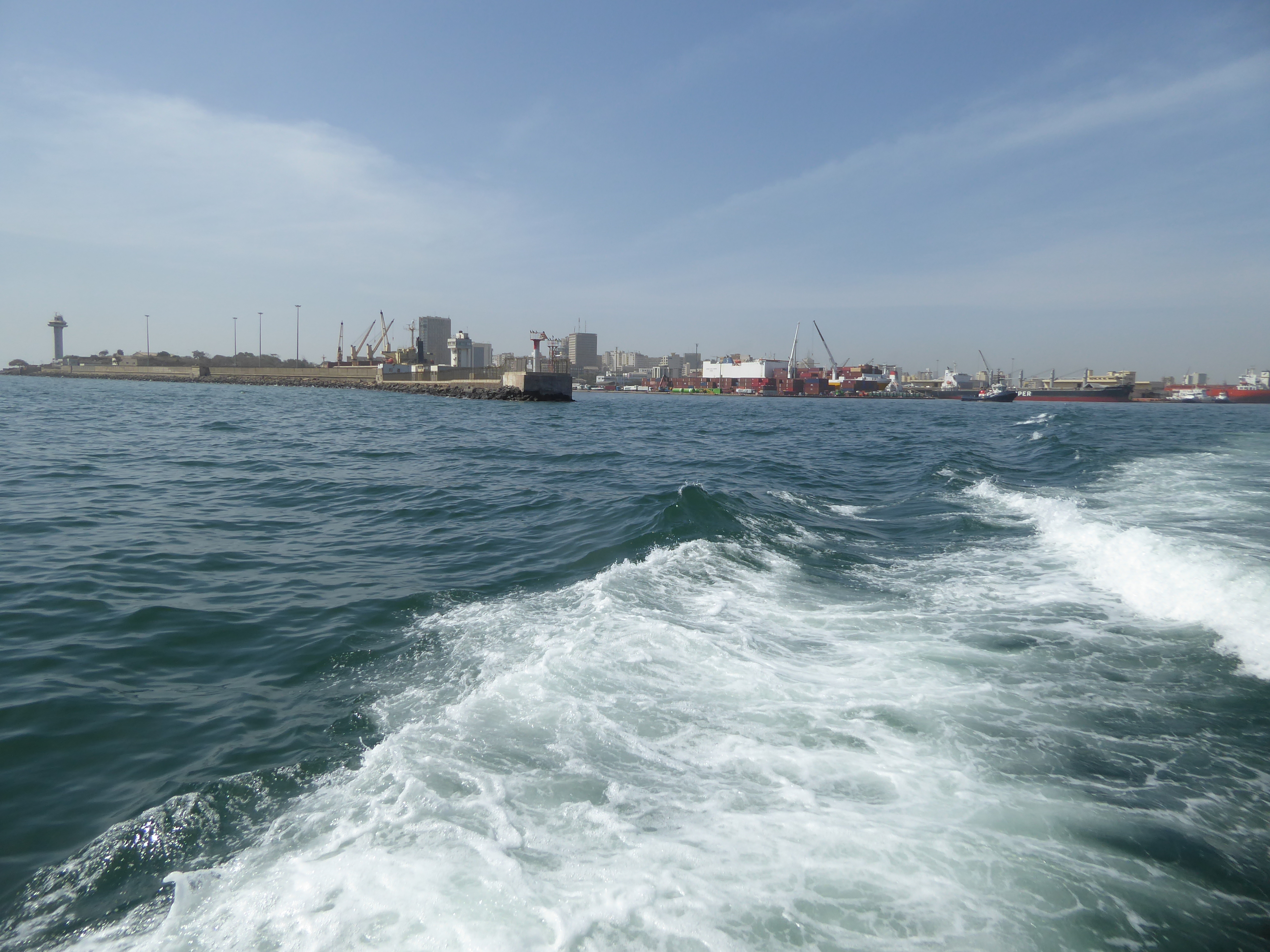
So we've backed up toward Dakar Harbor, protected by this breakwater from about 1940. It forms the Point of Dakar. That would be Gorée Island at the left. Can we get down to the breakwater? Not unless you want to jump the fence.
We'll get around it the easy way. The harbor has several protective works. This is the South Jetty, farther inside the bay than the breakwater. The harbor here grew steadily until, by 1940, it was the third port of the French Empire, after Le Havre and Marseilles.
Who's here today? First off, an Aframax tanker whose registered owner, Razorblade, must have a sense of humor.
Here's a Danish-owned Handysize bulk carrier, maybe carrying phosphate or cement or—this being Senegal—sacks of peanuts.
Here's an Italian-owned geared container ship, so-called because it has its own cranes with which to pick up and drop off containers at small ports—and even larger ones like this. Odd that the cranes here are in use, because Dakar has 10 docks with 18 cranes, some of which are capable of serving the biggest container ships.
Here's a Norwegian roll-on/roll-off car carrier; it makes two trips monthly from Asia.
This is a real port, in other words, second in West Africa only to Abidjan and Lagos. The docks are largely on fill overlooked by a natural bluff. The colonial-era buildings face Avenue de la Libération, a name that's a reminder of Dakar's strategic importance in World War II. Before then, the road was simply the Boulevard Maritime.
The road and rail network carries freight from here not only across Senegal but inland to landlocked Mali, Niger, and Burkina Faso. Odd, considering that Ouagadougou and Niamey are closer to ports in Ghana and Nigeria; maybe it's a legacy of the AOF. A path gets established, and people just keep using it.
We'll walk inland through a street grid laid out in 1862 and covering about one square mile. Welcome to Dakar Proper or Dakarville, which is still the commercial and administrative center of Dakar—and Senegal. Like a June bug cracking out of its shell, new buildings keep emerging in this urban core. Here, within a five-minute walk of the harbor is everything from old single-story houses to (in the right background) a Hyatt Hotel whose completion seems perpetually postponed.
About as simple as you can get, but perhaps comfortable.
Hark back to the 1880s, when a lonely Colonel Henri Canard, Dakar's governor, lamented that "Dakar is always very quiet, it is also sad, few houses, few inhabitants, little commerce and no industry.... [There is] nothing but silence, a complete tranquility, always too few European and mulatoo residents, themselves not eager to engage in industry; there is not a cobbler here, nor a tailor, nor a toupée-maker."
Quoted in Liora Bigon, History of Urban Planning in Two West African Colonial Capitals..., 2009, p. 110.
The texture varies a lot over a little space, and so there's lots to look at, in this case pink plastic and pink Bougainvillea.
Clear plastic.
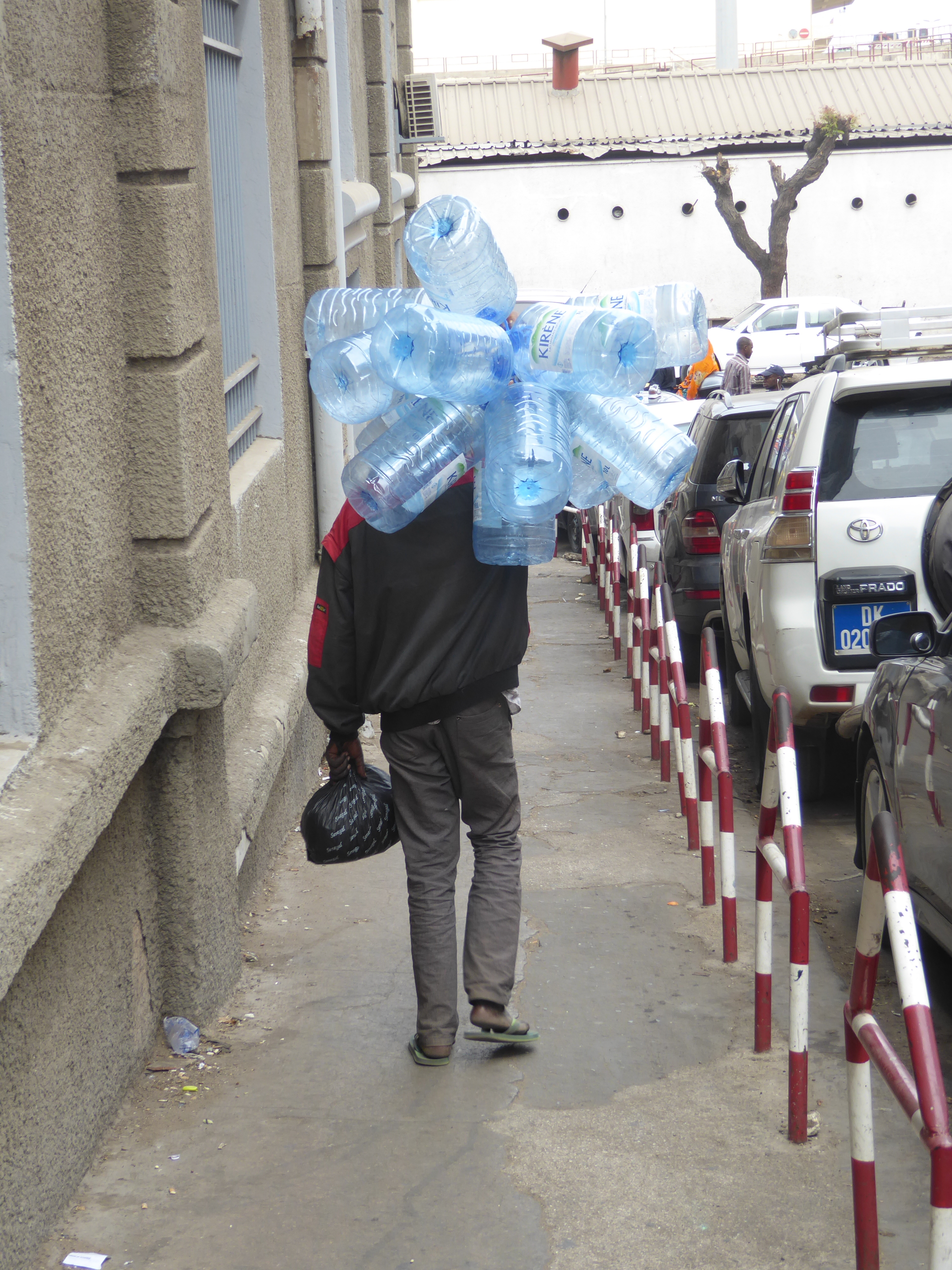
Hmmm. Do you see tourists?
The mask-covered wall is part of the Kermel Market, the original European public market. This is a copy, built in 1997 after the original burned.
It's a legit market, selling squid now as it did a century ago.
And bizarre, coral-eating parrot fish.
There are fishermen less than a mile away.
Across a street from the market, this is an early home of the Bank of West Africa, established in Dakar in 1901 as a private bank authorized to print currency and, in effect, serve as the central bank of French West Africa. The CBAO dominates banking in Senegal today, though it is as foreign now as a century ago: Morocco's Attijariwafa Bank bought a controlling interest in 2007.
A Parisian architect then (Auguste Labussiere); a Senegalese architect a century later (Jean-Paul Castanet).
Banking's evil twin. Or at least its inescapable sib.
Hardly a ten-minute walk from the harbor, we've made it to the monumental center of Dakar Proper and the focal point of the master plan of 1862. The plaza, like the plan, was the work of an engineer-turned-governor, Émile Pinet-Laprade. Its name has changed over the years. In the colonial period, it was called the Place Protet, for Admiral Léopold Protet, who had seized the Cape Verde Peninsula and in 1855 been appointed Senegal's first governor. A son of empire, he died in 1862 in the defense of Shanghai during the Taiping Rebellion. His name survived here until the 1960s, when the plaza was renamed the Place de l'Independance. Was it then so bare? Probably not. Was the plaza ever more attractive? I'm betting it was.
For a long time, the buildings around it were low, like this one.
The sign on the left looks original; there seems no need for the second.
Here's the courthouse from 1906, now the Ministry of Foreign Affairs. Think the color's original? One guess.
Still on the periphery of the plaza, this is the office of elected local officials, including mayors and presidents of rural and regional councils.
Dakar's Chamber of Commerce started out on Gorée Island, but by the early 20th century the balance of economic activity had shifted so completely to Dakar that the Chamber moved onto a site facing the plaza.
Just off the plaza, here's an old hotel that's kept its old name.
It faces the town hall of 1914.
Any ideas?
Iron frame, brick fill, faience trim. Still no ideas?
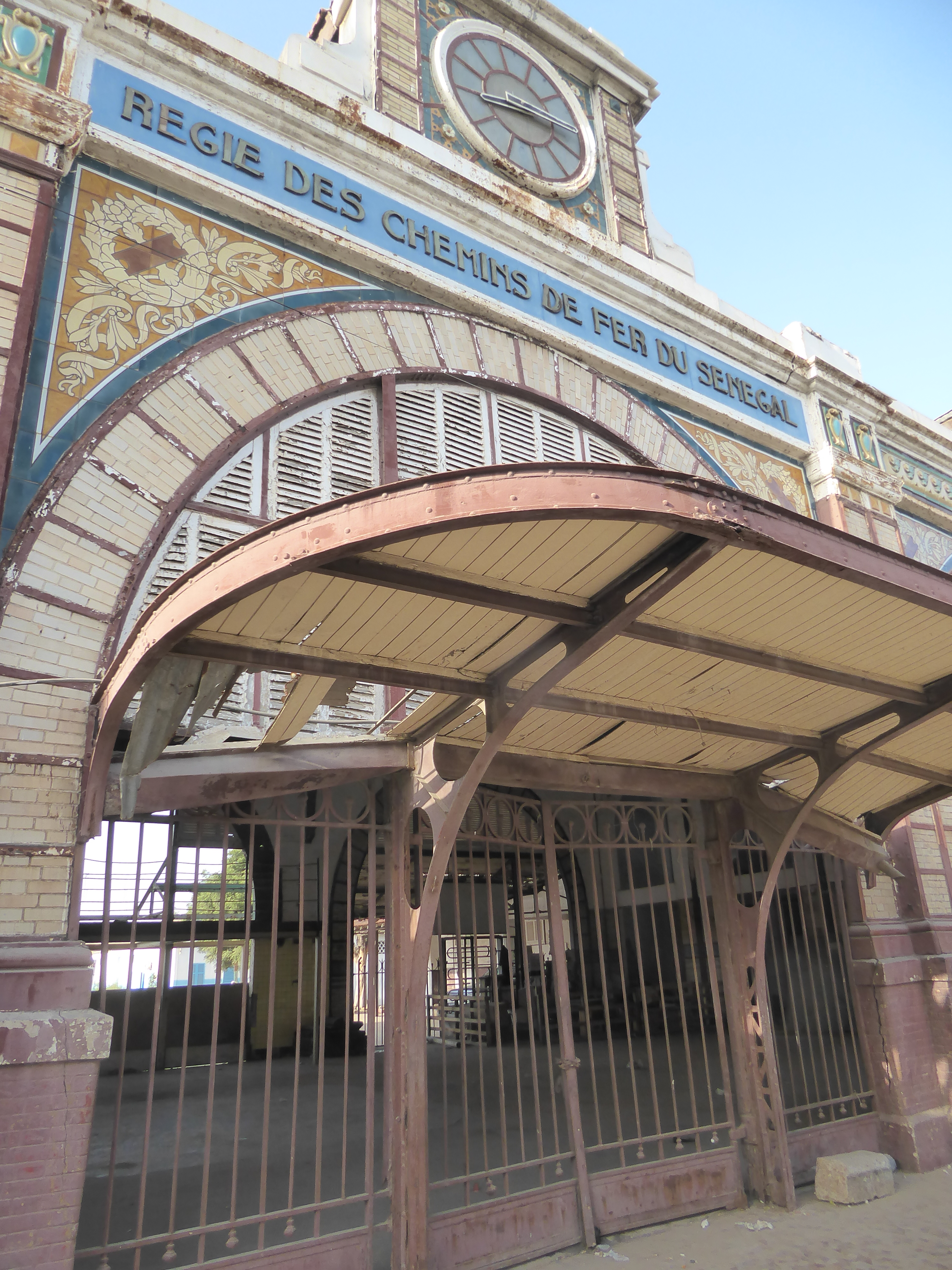
Rail service to Saint-Louis began in 1884; this station opened quite a bit later, in 1912. By 1940 trains ran to Saint-Louis daily. Track by then had been extended to Bamako, a distance of 1,291 kilometers, and two trains ran there weekly. Service ended in the 1990s, and the station was about ready for demolition when a change of government in 2012 saved it. Five years later, the building was just sitting, wedged between the town hall and the harbor.
Ironwork reminiscent of the Paris Metro?
The quiet interior.
A famous World War I monument, popularly called Demba and Dupont, now stands in front of the station. It's been moved repeatedly, most recently from the Bel Air Cemetery.
The figures, sculpted by Paul Ducuing, were unveiled in 1923 and originally stood on a base honoring Governors Faidherbe, Ballay, van Vollenhove, Clozel, and Ponty. Their names are gone from the monument, but the new base still honors representatives of France.
Another Senegalese rifleman or tirailleur sits outside the Primature or prime minister's office and faces the presidential palace. Photography is discouraged, not to say forbidden, but the palace has been rebuilt from the French era in a semi-modern style and no longer makes any effort to impress.
Pinet-Laprade, designer of the Dakar Proper street layout, reserved a block of land to the west "in order to build there later, in the event that the settlement of Dakar gains further importance." Nothing happened for 50 years, but just before World War I the reserved area was subdivided into a neighborhood called Plateau. Its elevation was little if any higher than that at Place Protet, so the name may have referred primarily to social status. The streets were designed like a mini-Paris, with traffic circles and radiating streets. Here's one of them, Rond Point Washington.
(Quotation from Bigon, p. 106.)
Streets were shaded.
The houses built here are hard to see. Many have been demolished, and the survivors are buried in Bougainvillea.
You can hardly blame the owners.
A few larger homes are more exposed.
Another has been repurposed as a jewelry store called Florence de Lapeschardiere Creation.
By the 1930s, stylish apartment buildings began popping up in the old core.
A department store, too.
The L'Elysée Apartments were added on Rue de la République, Plateau's busiest street.
Schools were built.
In this case, the building is now the Institut Français.
The Cathédrale du Souvenir African was designed in 1913 but not opened until 1936. The words at the top replace the original inscription, which read: "For those who died in Africa, a grateful France." The white paint is a later addition, too; early photographs show masonry in its natural tone. A visitor during its construction was surprised to see that no machinery was being used.
See Maurice Ricord, France Noire, 1939.
The interior, upgraded with blue plastic.
Logo on the main hospital gate: a baobab in the desert.
The Musée Théodore Monod d'Art Africain is part of IFAN, the Institut Fondamental d'Afrique Noire.
Rear of the museum. Date: 1938.
Demba and Dupont stood here before they were moved to the Bel Air Cemetery. The circle was then called Rond-Point de l'Étoile; now it's Place Soweto. That's the Senegalese national assembly.
Why is it that the gates to these places are always closed?
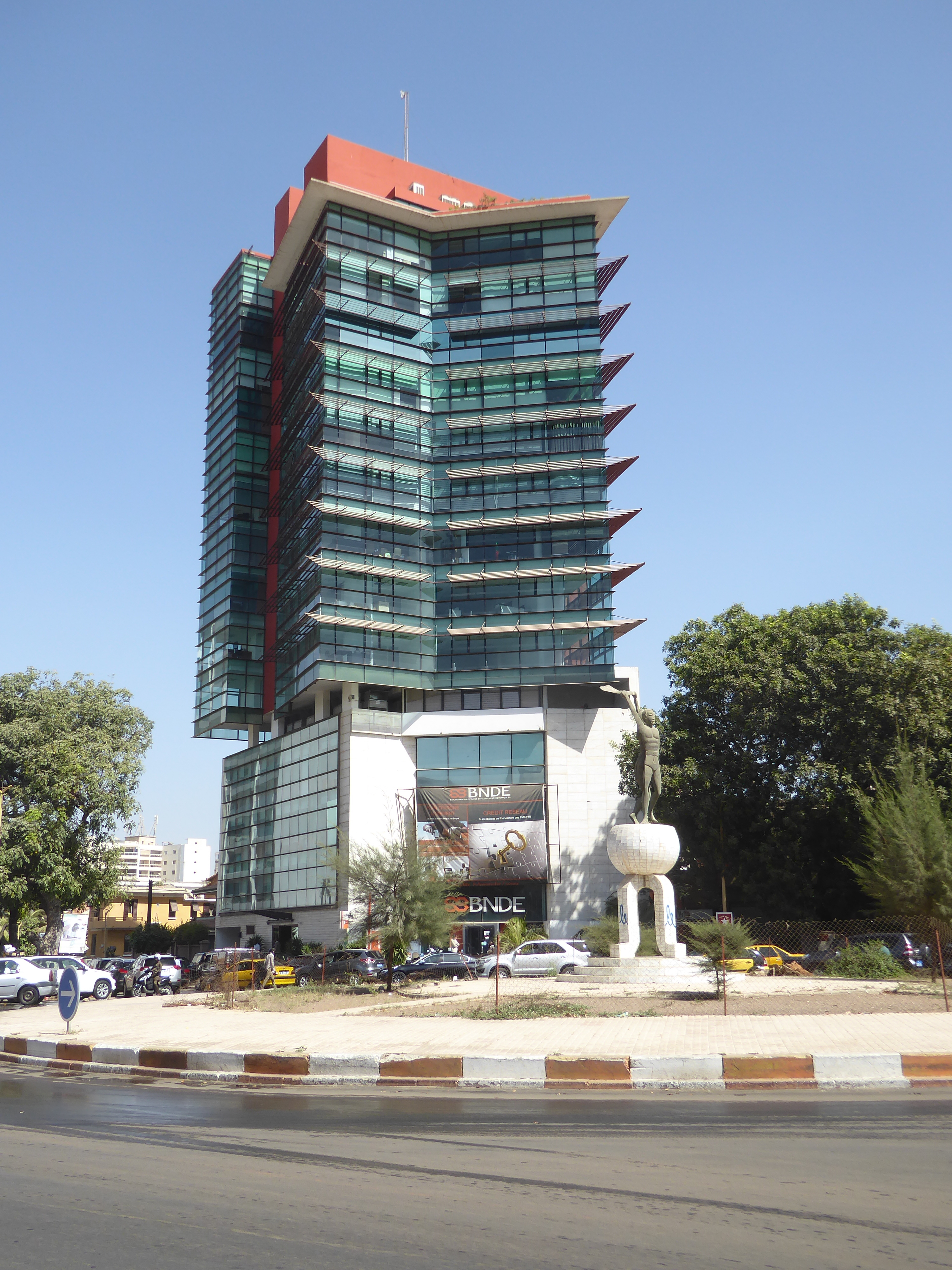
What else should occupy such central real estate? Answer: the National Bank for Economic Development
Not far away, a new Administration Building rises.
Where should we live if we move to Dakar? How about a highrise on the water?
If the traffic drives us nuts, we can watch the fishermen.