The western tip of Africa has a convenient hook, the Cape Verde Peninsula. It projects about 25 miles into the Atlantic and the downward-facing hook creates a bay providing good shelter most of the year. Gorée Island sits here, sheltered but offering nothing else to mariners: no water except from summer rains, no fuel, no food—nothing except a refuge. Refuges can be handy, however, and among Europeans the Portuguese, as usual, found this one first. They held the island from 1444 to 1677—uninterrupted for the first 173 years and then spoiled by some intervals of Dutch rule. From 1677 the place was French, with some bits of British rule, until 1959. Through these centuries the island's economic value was as a safe place to hold slaves pending their shipment west. With the abolition of slavery in the early 19th century, Gorée Island lost this value. The French gradually moved two miles west to the town of Dakar on the hook of the Peninsula. Gorée slept all the more soundly when the colonial government in 1944 declared it a historical monument and forbade new construction.
The name Gorée is a corruption of the Dutch Goedereede, "good bay," which may refer to the sheltered waters here but more directly hints at Dutch homesickness and another Goedereede, this one just south of Rotterdam. Senegal's Goedereede in any case is tiny, 350 meters by 800. The northern part is a low terrace; the southern, a basalt mountain. The slab on the left here is a French fort. The tower atop the mountain is a memorial to slavery. The unusual palm tree at the base of the mountain is, of course, a disguised cell-phone tower. Wonders never cease.
Here's the fort, Fort d'Estrées, named for Vice-Admiral Jean d'Estrées, who seized the island in 1677 and began the era of French rule.
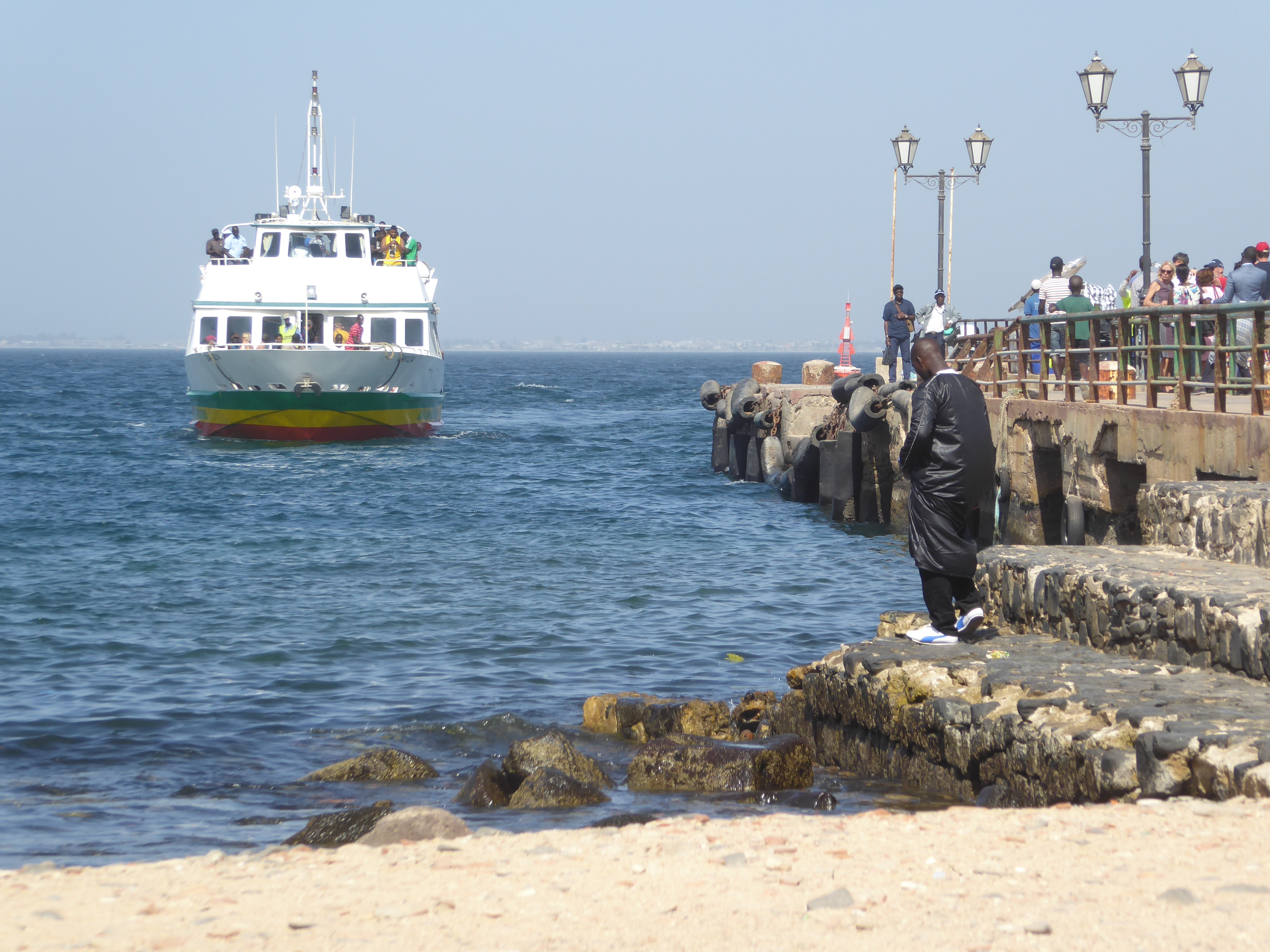
There's a small harbor with a breakwater, pier, and sandy beach. The breakwater is handy, but summer storms often come from the northeast, spoiling the anchorage here and, in the past at least, forcing ships to anchor off the west side.
Judging from the lamp posts, people have been coming and going for a while—now almost entirely on day trips.
We can wander over to the fort. Here's an 18th century house built of basalt, plastered and painted with an ahistorical but now common vermillion. The wood bits are pine. The only trees growing around here naturally are palms and baobabs, so the pines are imported. You might expect that they came from France, but no, they're pitch pine from North America.
Water supply was always an acute problem, with cisterns catching rain and supplemented by water brought in boats.
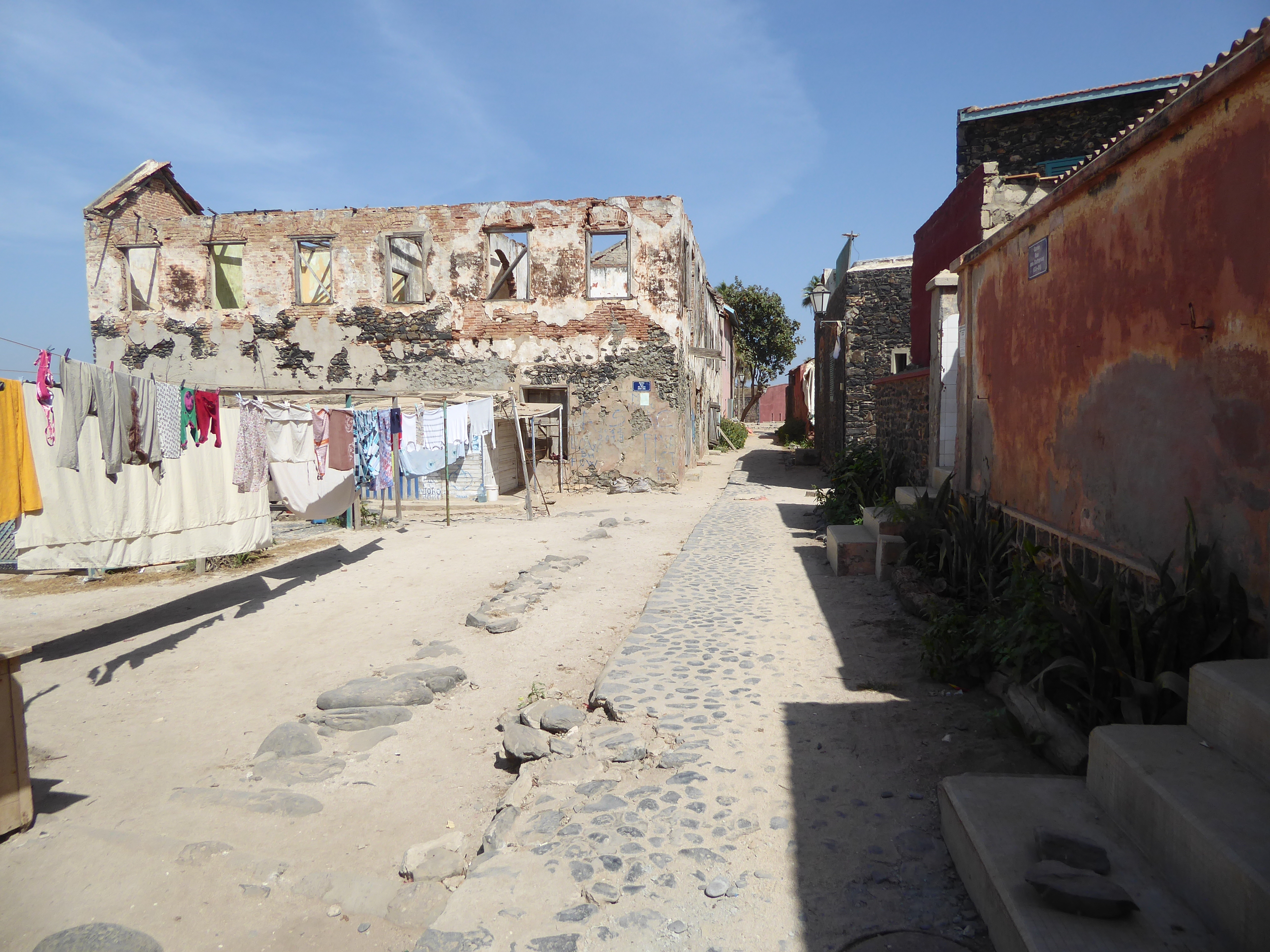
There are plenty of buildings in ruin, but many have been tidied up to a fare-thee-well.
Here's one showing off its basalt bones.
Solid as the buildings may be, waves are attacking many foundations.
Still on the way to the fort: a building not long for this world.
Here we are.
Cells off a courtyard.
The cells house a museum, including this tombstone from the period when the island was held by the British.
View of the harbor from the roof of the fort.
View from the fort toward Dakar. Cape Manuel, the southern tip of the Cape Verde Peninsula hook, is at the end of the land mass there. Head west from there and if you're lucky you'll bump into one of the Cape Verde Islands in about 400 miles. Otherwise, it's about 2,000 miles to Recife.
A different path back toward the center. When did manholes arrive? Good question. No answer here.
There's a sandy central plaza, decorated with Parisian lamp standards and baobabs.
A monument to the pharmacists and doctors who died during an epidemic of 1878. The colony at that time had a total of 26, of whom 22 died, including Michel Mathis. He was the father of Constant, for many years head of the Pasteur Institute in Dakar.
A podium or bandstand, with inoperable fountains.
Spare cannon.
The Palace of the Governor, later but no longer the Relais l'Espadon, or Swordfish Hotel.
Another angle.
The back of the building looks toward Dakar.
So does an old military hospital, designed with lots of ventilation. Speaking of illness, there's no cemetery on the island; the deceased were sent west to Bel Air, where a large cemetery grew at a remote location now in central Dakar.
Just because a building is unrenovated doesn't mean that it's uninhabited.
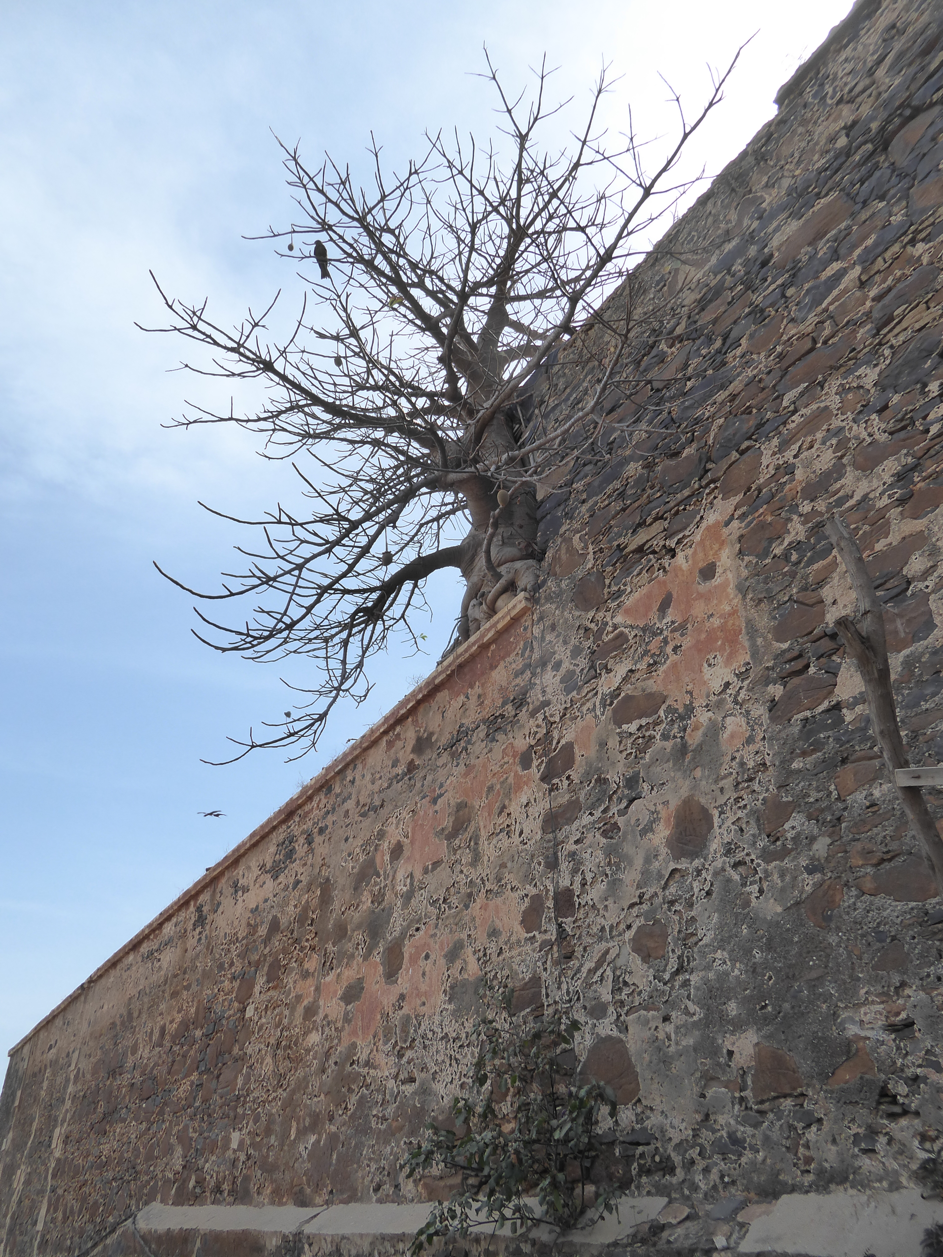
Parts of the mountain are walled, but other parts need no protection.
Path up, with squatter huts.
A walled section.
View back over the terrace.
The summit is paved, a relic of World War II fortifications. The slave-trade monument, suggestive of Dubai's Burj al Arab Hotel, was completed the same year as that hotel, 1999.
There are older bits up top, too.
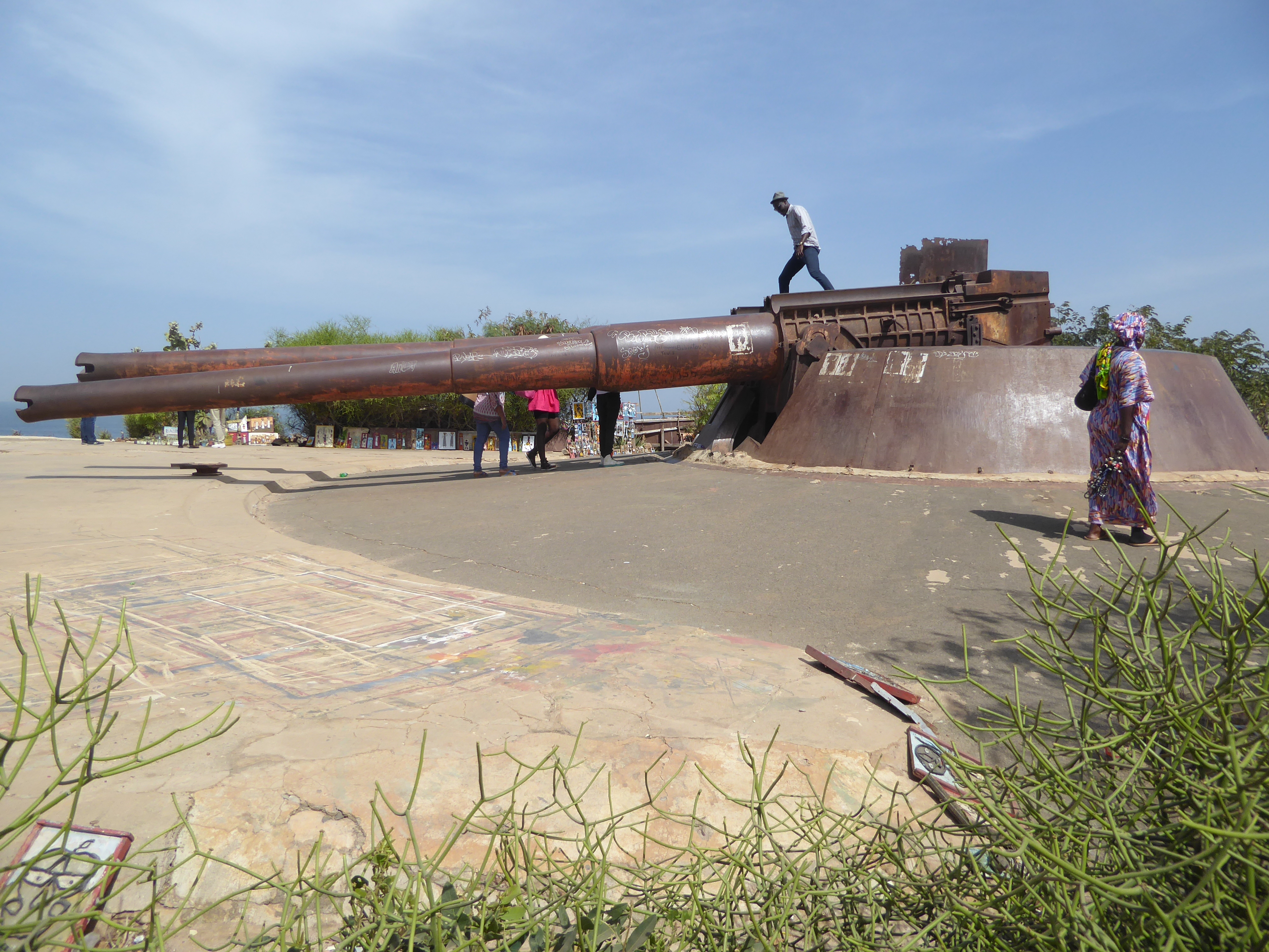
Here's a crowd-pleaser, a 240mm twin-mount gun installed on a French battleship in 1902 but moved here (somehow!) in 1934.
We've come back down and stopped at the St. Charles Church, destroyed by an arsonist in 1799 and rebuilt in 1829. Sorry: it's locked.
Quiet time of day.
Here's a little town park with a surprise. Can't see it?
It's linked to this tree.
The baobab got its scientific nama (Adansonia digitata) from Michel Adanson, who laid out this garden during the four years he was on Gorée as a botanist.
On the other side of the park there's a school.
Here's the entrance to that school, the École Elementaire Leopold Armand Angrand (1859-1906). It's named for the mulatto son of a French shipowner and a signare or French-African woman. Sent to Bordeaux and Paris, the son became a shipowner himself and later a local politician. Among the school's former students: Félix Houphouët-Boigny president of the Ivory Coast from 1960 to 1993.
Facade of the school.
The Gorée Institute was founded in 1992 as an institution devoted to African peace and development.
A line begins to form for the ferry.
Like clockwork.