It's about 30 miles from Cape Town to the Cape of Good Hope. The last half of that distance is over a narrow peninsula, roughly four miles wide and mostly unsettled. Here we go down the east side of the peninsula to the point of the cape, then come back up the west side to the city.
A railroad spur line comes about halfway down the east side of the peninsula. It opened in 1882 and brought vacationers to the beaches at Muizenberg, a holiday destination drawing vacationers not only from Cape Town but from the Rand and Kimberley. The Cape Town Guide of 1897 states that "in climate Muizenberg approaches the nearest of any South African seaside resort to the Riviera of the Mediterranean, and in the near future promises to almost rival it by the influx of a wealthy population, not only from the great money-making centres of our own continent, but from Europe" (p. 43). Now you know why the station, opened in 1913, got special attention and one why student has called it "the jolliest railway station in the Cape, although it looks more like a town hall."
Trackside.
Nearby, a Carnegie Library opened in 1910. It closed when a new library opened; a police station moved in. The police moved out, and a police museum arrived. It did not last. The cupola is a replacement from the period of the museum.
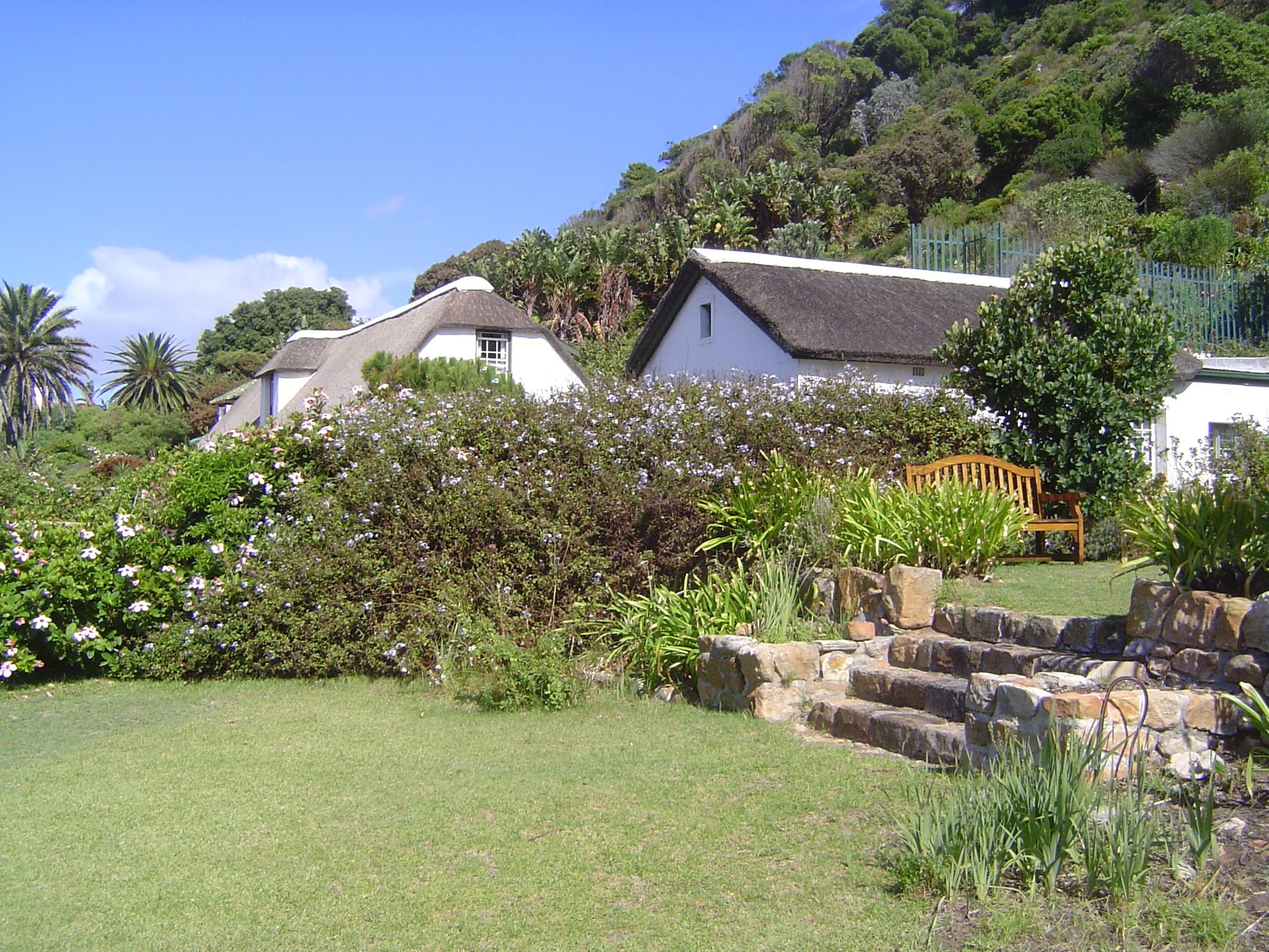
Muizenberg attracted more than daytrippers. The house with the tile roof is Graceland (originally Watergate) and was built about 1915 by John Garlick, owner of a chain of department stores. The thatched-roof building was probably built by an American whaler in the early 1800s. It was known for a long time as Barkly Cottage, from the Cape Colony governor of the 1870s, Henry Barkly. In recent decades it has been known simply as Long Cottage.
Here's Long Cottage again, but this time seen from the garden of the neighborhood's best-known, though short-term, resident.
That would be Cecil Rhodes, who bought this house in 1899. He moved in during 1900, hoping to recover from illness brought on during the Kimberley siege. Instead, Rhodes died here in 1902. The cottage was donated to the government of Northern Rhodesia in 1932; the government politely turned the place over to the City Council of Cape Town in 1937. The house became a museum in 1953. In the background is a huge place, Rust en Vrede, "peace and quiet," designed by Herbert Baker. Originally intended for Rhodes, it was bought by a friend, Abe Bailey.
The museum has a cast of the "Big Hole," the best-known of Kimberley's diamond mines. No, it's not broken: the pit looks like that.
A few miles down the coast we're looking south at False Bay, a shallow indentation that, despite its limitations, was especially important before Cape Town had built a safe anchorage capable of protecting ships from winter winds from the Atlantic. Those winds made Cape Town so dangerous even into the 19th century that the East India Company or VOC ordered all its ships to come around the Cape Peninsula and anchor at False Bay each year from May 15th to August 15th. The town that grew on the spot is variously spelled Simon's Town or Simonstown for Governor Simon van der Stel, who visited here in 1687. The British based a squadron here from 1814, about the time of their takeover of the colony.
The main street is such an assemblage of Victoriana that one imagines it's all for the benefit of tourists.
The main street winds along the water's edge, with much of the water's edge occupied by the naval base.
Dig a bit and you'll bump into the usual story of businesses coming and going with none of the stability of old buildings.
The logo stands for Simon's Town Municipality. The building from 1815 to 1893 was a school; from 1913 to 1945 it was the town office, then briefly a parish center. Between 1953 and 1983 it was a pharmacy; now it's a convenience store.
Whyte's Building held a bakery below, apartments above. Later there was a grocery, then a hardware, now a furniture store with branches all over the country.
The building goes back to the 1860s but didn't become a hotel until 1894, when it was converted by Ohlsson's Cape Breweries. The gable appeared in 1902. The hotel stayed in business until the 1960s, when it failed to meet the minimum statutory star rating. It managed a comeback and is now a guesthouse.
The ABC up top stands for Atwell's Bakery Company, a chain owned by South Africa Milling. The building had earlier been a boarding house, then a club for the navy. The bakery moved in in 1897 and began baking largely for the navy. The building was remodelled, and the Standard Bank rented part of the street frontage; upstairs remained residential. The bakery operated until 1929, but South Africa Milling didn't sell the building until 1942.
The British Hotel, from 1890, is still in business. Perhaps a coincidence, the hotel opened the same year that the railway arrived from Muizenberg. Simon's Town remained the end of the line.
A sobering reminder.
This building began life as a boarding house built by Jeremias Auret in 1785. His widow remarried, and her new husband lost the property, which was sold at bankruptcy in 1809. The new owner held it for 40 years, selling to a shipping agent who stored supplies inside. From 1860 to 1887 the building housed the town's post office. In 1898, William Runciman, the five-time mayor of Simon's Town, bought the building and gave it the facade seen here. Since then it's been a grocery and pharmacy. Part of it is now a patisserie.
After Simon's Town the peninsula is uninhabited and protected in the Cape of Good Hope Nature Reserve, part of the Table Mountain National Park.
Can't get lost.
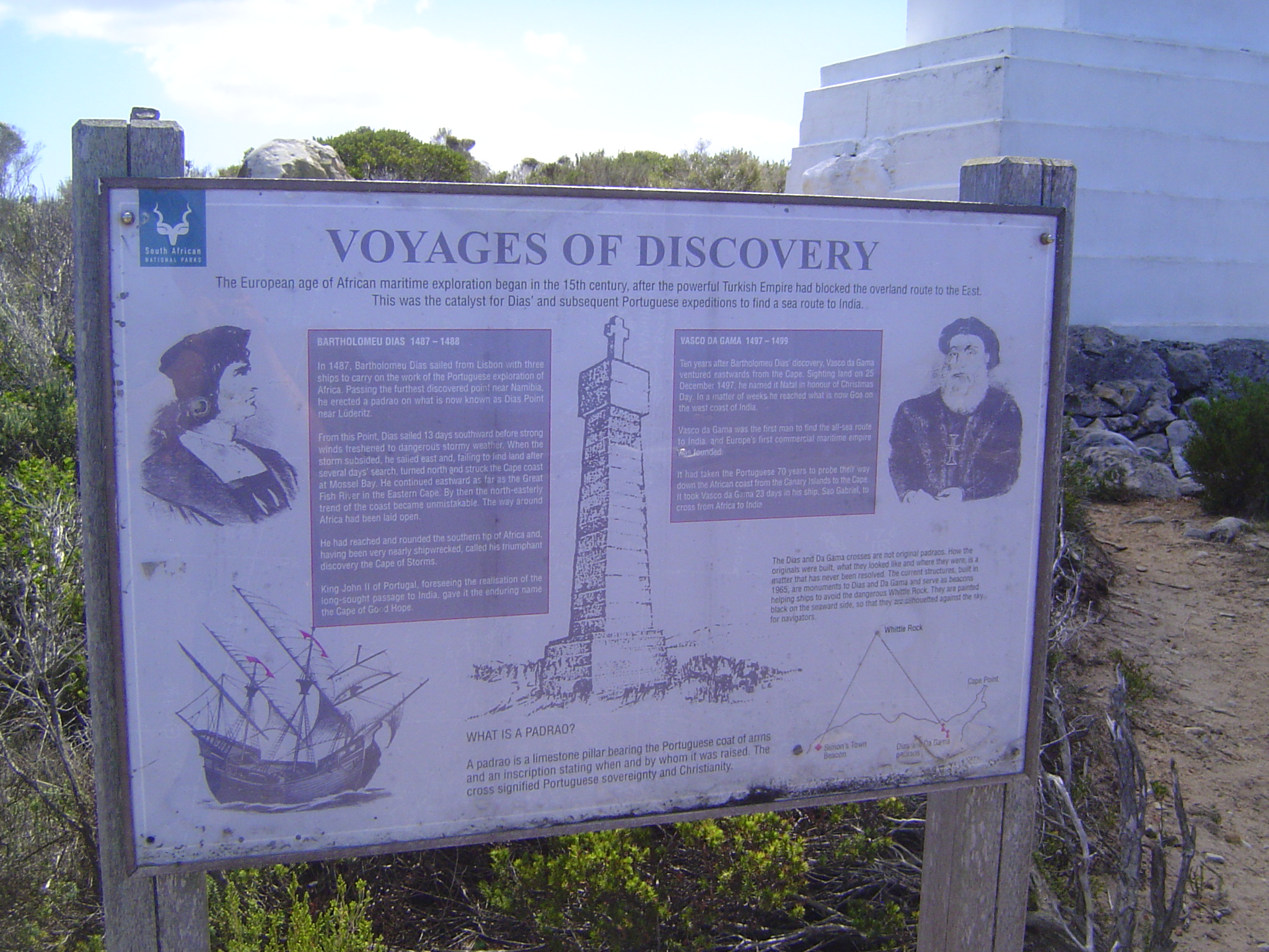
Reminders: Bartolomeu Dias rounded the cape in 1488 but was forced by his crew to turn back near what is now Port Elizabeth, 400 miles farther east. Nine years later, in 1497, Vasco da Gama kept going to India.
Dias and Vasco built monuments to aid navigation; both were obliterated over time but were rebuilt in the 20th century.
One for each.
The Cape of Good Hope. Dias named it the Cape of Storms but King João II was more interested in the promise of trade with India than in the hazards of getting there.
Cape or Dias Point is about a mile to the east; there's a light house down there; a bit of its white roof is visible.
There's also an older lighthouse higher up.
It proved to be so foggy up here that the lower light was added.
Sign on the cast-iron tower.
There must be a name for these things. One goes up whenever tourists are drawn to a distant place.
Not that they're alone here.
Parking-lot spillover.
We're winding up the west side of the peninsula. This is Chapman's Peak Drive, a spectacular road.
Camp's Bay, with Table Mountain in the background and a bit of security in the fore.
The city is only a few minutes' away now via Kloof Road, and it has grand views of mountains and sea. Think you're in Southern California?
Window washers must do all right here.
Stack 'em up.
Nice electric fencing.
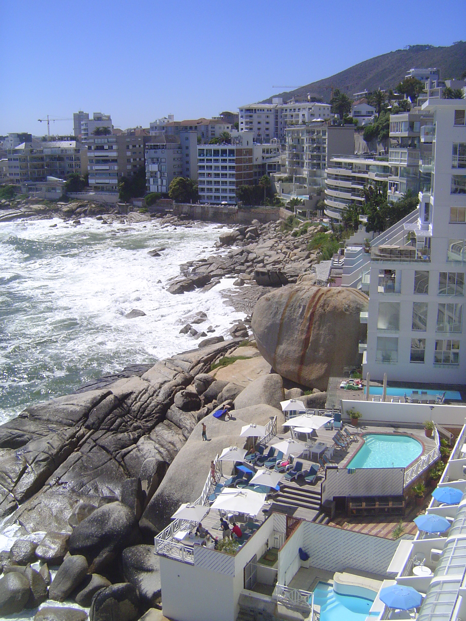
Instead of taking Kloof Road into the city, we're sticking to the coast. So do the developers, who don't take "no" for an answer.
A bit of flat land appears at Sea Point.
A mile more and we're at the Green Point light, from 1824, though the lantern dates from 1865 and electricity came only in 1929.
Climb nearby Signal Hill and there's a good view of Table Mountain.
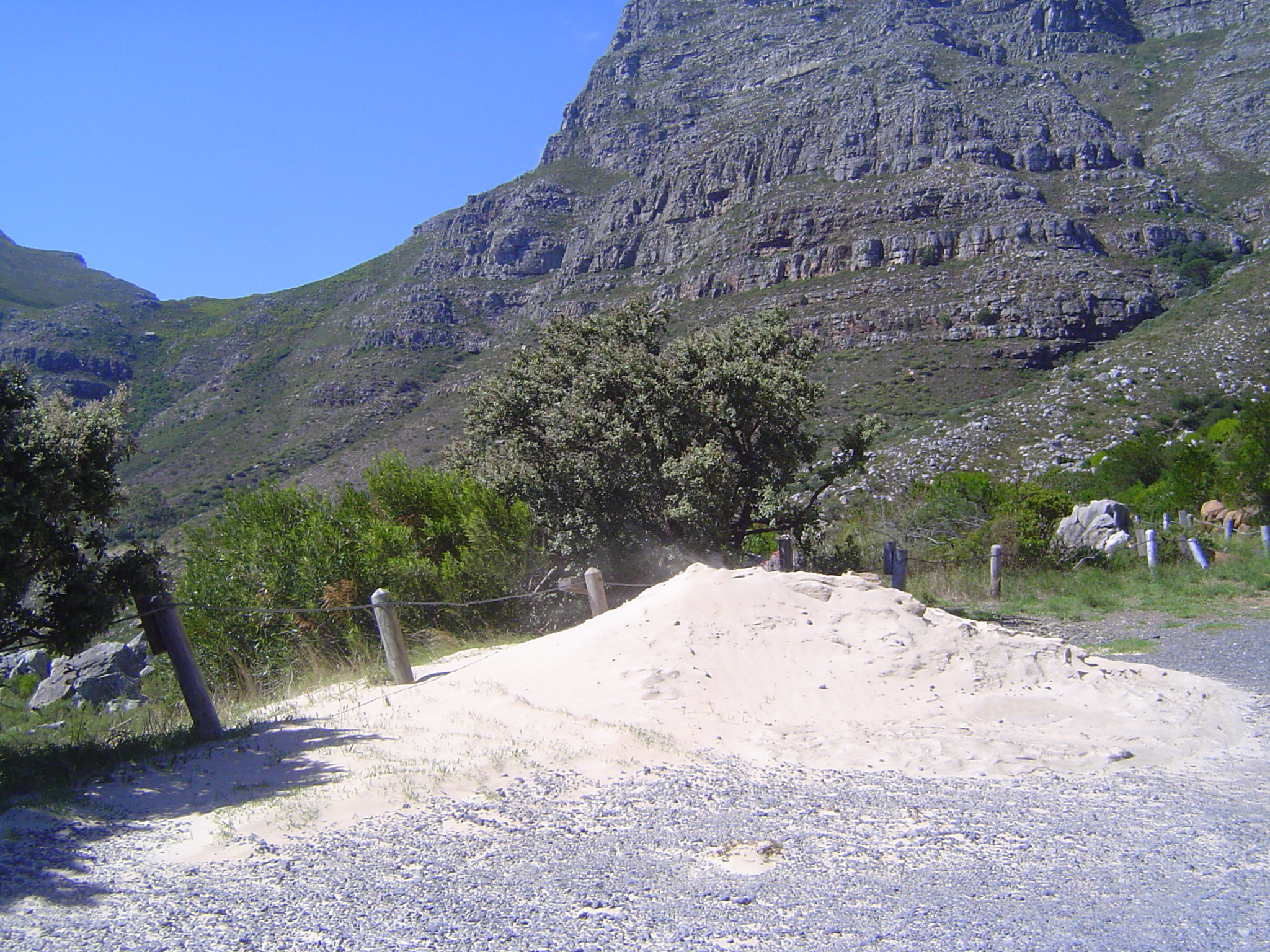
Think it's a nice day? Look at the top of the sand pile. The wind was blowing hard enough not only to set the sand moving but to stop the cable car that runs to the summit.