Home UpThree Districts in Central Seoul
Best put our feet on the ground. This city of 10 million is divided into 25 districts or gu. We look here at three of these districts. They're all central: Jongno-gu, Jung-gu, and Yongsan-gu.
Americans of a certain age or experience will tingle for a second at that last name. Where have they heard it before? Answer: the Yongsan Garrison, headquarters of the United States Forces Korea since 1945. The site had previously and conveniently been the Japanese Imperial Army's Korean headquarters, a handy reminder that Japan ruled Korea from 1910 to 1945. Americans may have forgotten about that, but Koreans haven't.
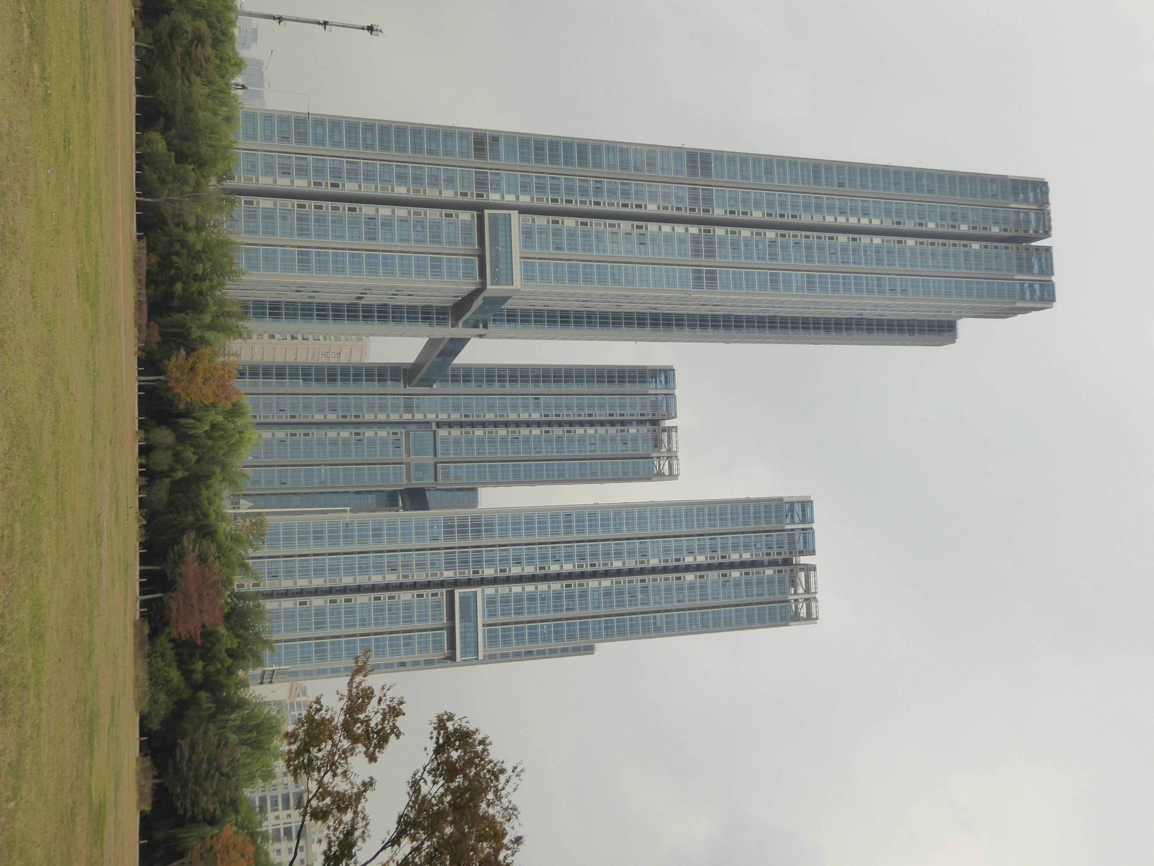
We're looking up at three towers. They have a name, of course: Raemian Caelitus, so you think of that centurion on television last year. No go; the name's a mystery.
Maybe this will help.
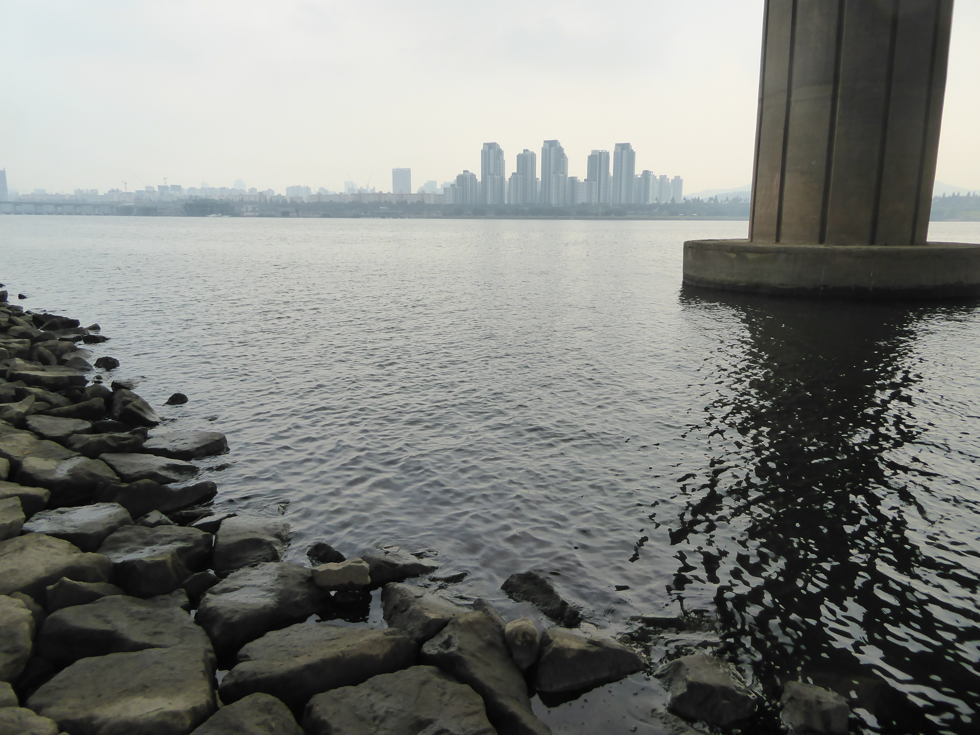
Need context, you say? Great: here's context. The towers rise next to City Route 70, alias the Gangbyeong or Northern Riverside Expressway. It parallels the Hangang River, which flows northwesterly on a 300-mile course. We're about 40 miles from the river's mouth, which lies in the distance. We'll try to get to the river, but it isn't easy. We only got this far after two policemen saw us looking as though we were going to attempt a dash across the highway. They thoughtfully pointed to a safer alternative.
This tunnel is ready-made for an action movie. Something bad is going to happen.
Made it! Feeling nature's healing power? A train thunders overhead.
Maps from the 1950s show no buildings within several hundred yards of the river.
Five miles to the north and close to the city's traditional core, Samsung paid for this, the Jongno or Samsung Millennium Tower. Rafael Vinoly conceived it one morning after dreaming of starshipsn. Inha Jung writes (in Architecture and Urbanism in Modern Korea,, 2013, p. 102) that the building "overpowers its neighbors, attempting to impose a new order on the city." Mission failure.
How can it be that the millennium already seems so far away?
A decade later, BCHO Architects, a Korean firm, gave Seoul another prominent highrise, the Twin Tree towers, supposedly designed to resemble a tree trunk.
Here's something less twisted (OK, less futuristic) but more startling: a Muslim neighborhood in Itaewon, a Yongson neighborhood.
A global city is a potpourri by definition, so we shouldn't be surprised by the nearby Central Masjid, built in 1970 on land donated by the government.
You don't have to ask where the construction money came from. Really, you don't. Hint: it came from a close U.S. ally that shows up on lists of the world's least democratic countries.
Muslims have built beautiful mosques for centuries. Some have been opulent, others so austere that they make Mies's buildings look gaudy. Where on earth have the skill and taste gone?
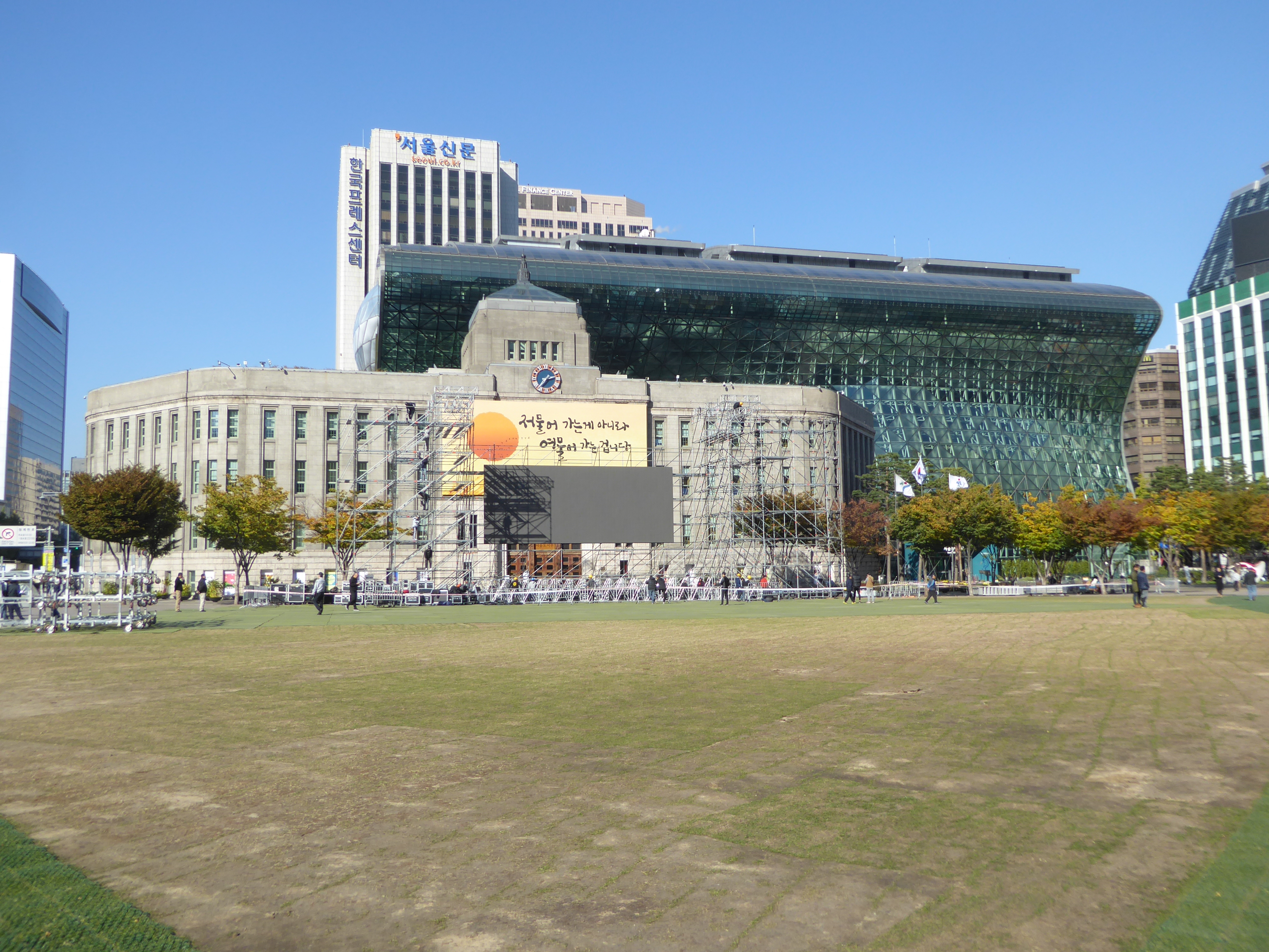
Here's another import. It's the City Hall (now the public library) begun in 1926 and designed by Keichi Sasa, an engineer employed by the Japanese government. So is it an import from the East or from the West? Answer: the West, via the East. The swooping thing behind it is the new city hall, designed by Yoo Kerl and completed in 2008, when the byword was Soft Seoul.
At least the leaves are soft.
More than half Seoul's buildings were destroyed in the Korean War, but here's another survivor of the Japanese era. Now a bank, this was the home of the Chosun Ilbo, a newspaper founded in 1919 and in nearly perpetual trouble with the Japanese government. It's still publishing, with an online English edition to boot.
A simpler building from that era.
A juxtaposition of the industrial city in its low- and high-rise forms. That's the Gran Seoul office building, from 2013. Like it? Of course not; nobody does except the real-estate agent.
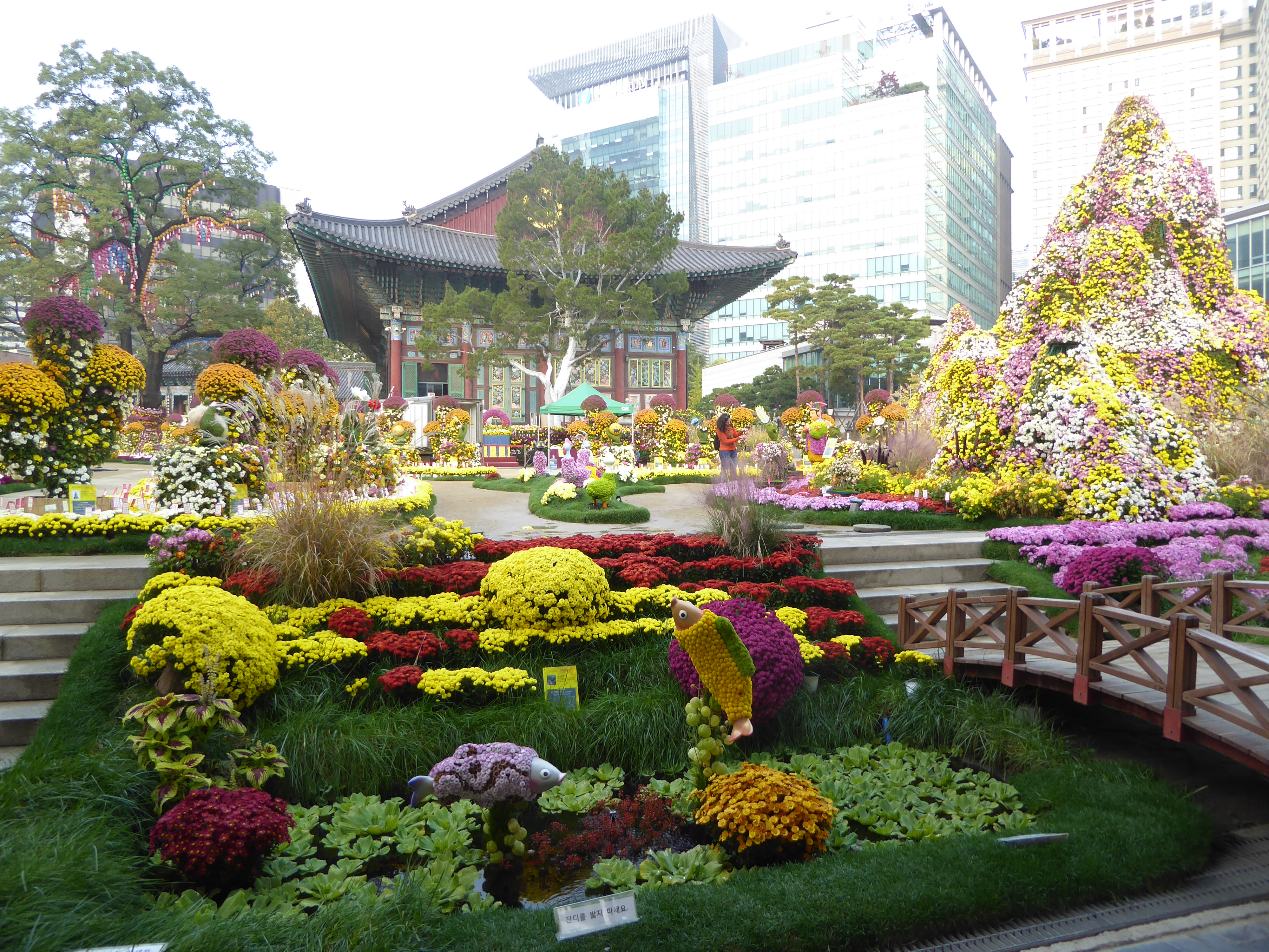
Here's Insadong, since 1992 an official "culture street." What's a culture street? According to the Korean Culture and Arts Foundation (quoted by Jieheerah Yun in Globalizing Seoul: The City's Cultural and Urban Change, 2017, p. 72) it's a "street territory which can utilize independent cultural resources and develop into a place with a distinct cultural identity, with its value perceived and shared by many people."
No, I don't really understand that, either, but the facts are pretty simple: historically, Insadong was a neighborhood with calligraphers and painters dependent on the nearby government center. After the Korean War, Insadong became a tourist attraction that took off with the 1988 Olympics. Wonder where everybody is? We just happen to be here early in the morning.
Is it traditional or commercial? Yun quotes a shopkeeper who says, "To be honest, attempts to find tradition are ridiculous. We are doing this since it is our job. We can only make a living if we search for tradition. So we follow that path. There isn't any one who consciously tries to maintain a tradition. We only keep it since it is profitable to mention tradition." (Yun, p. 68, translating from a Korean-language source: S.M. Kang, 2003, p. 260.)
Is the merchant too hard on himself?
The alleys are old; the renting of customary dresses (hanbok) isn't.
Bits of traditional Korean building styles survive or are recreated for the occasion.
Don't like kimchi? No problem. Bet you didn't know that Burger King was from the Big Easy.
Still in Insadong, we're in front of the dharma hall of Jogyesa, head temple of the Jogye Order of Korean Buddhism. A temple has been here since 1395, but this hall was built in 1938. Traditional, yes; old, no.
The dragon on the left came from the same warehouse that supplied the fine carpet in the central mosque.
What do you think the Buddhists who prayed here centuries ago would have made of the flowers?
Inside, the faith is real, though the huge statues were installed in 2006. The exception is the small one in the distance.
It can't be very old, either. The stylized position is the mudra called Bhumisparsa, the moment of enlightenment.
The audience is older than the statues.
Here's something more arresting. We're only a few minutes away in Pagoda Park, now Tapgol Park. The park was created in the 1890s, apparently at the suggestion of the Inspector General of Customs, John McLeavy Brown, a sinologist who spent a decade in Korea.
The unfortunate but probably necessary glass enclosure protects the marble Wangaksa Pagoda, from 1467. It's the first thing we've seen that is real. I mean really real.
Need facts? OK: the pagoda, built of marble in a country used to granite, is a remnant of the Wongaksa temple, built by expanding the site of the Heungboksa Temple.
The bottom tiers illustrate the monks who brought the Buddhist canon to Korea.
The larger panels call for an iconographer.
Seriously.
One more panel: apparently these panels illustrate stories from the jatakas, or prior lives of the Buddha. The panels up top, unfortunately, cannot be seen clearly.
Until 1947, ironically, some of them could be, because the top three tiers had come off in the 1590's. They sat on the ground next to the base until 1947, when the U.S. military put them back in place. Odd, isn't it? We're a 10-minute walk from where Korean kings ruled for centuries, but the pagoda sat in pieces until the Yanks arrived.
Here's the Cheonggyecheon ("Clean Stream"). In the 1970s the city under Mayor Kim Hyun Ock—his nickname was "Bulldozer"—covered the river with the Gangbyeon Expressway. Forty years later, the expressway was torn down and the river partly restored—meaning that it comes out of a pipe and flows outdoors for a distance.
Get the idea?
Much better.
The Japanese set about destroying the city's wall and mostly succeeded. Bits have subsequently been restored.
We're at the same spot but looking south now at the east gate. It's Dongdaemun, formally called Heunginjimun, "Gate of Rising Benevolence." The chemise or circular skirt was an added defensive feature.
That's a Marriott Hotel on the right. Just beyond it is a shopping center on the site of a demolished streetcar barn.
The gate was built in 1398 but rebuilt in 1869. The wall around it was disrupted when streetcars began running along the avenue stretching to the west.
Experts can read the wall's age by the size and shape of the blocks, which over the years morphed from uncut to cubic and from smaller to larger. Most of what appears here is from the 1700's.
Just to the south of the gate, the Japanese converted part of the wall into a sporting arena with an oval track. It's gone now—the Koreans aren't much interested in preserving their Japanese past—but another entrant has joined the party. It's that shiny, sluggish thing on the left.
Welcome to Zaha Hadid's World Design Market.
Nice?
Jieheerah Yun tactfully writes (p. 109) that the design was chosen for its "regenerative capacity," not its "functional competitiveness." One might ask what is to be regenerated. I suppose the answer is life, though in this case life appears to be extra-terrestrial, or perhaps merely a surplus bit of a never-built airport.
Here's the main street heading west from the East Gate. The streetcar tracks were pulled up in 1968. Earlier still, this had been the main commercial axis of the city.
Ding, ding! In 1904 the American Korean Electric Company began running streetcars in Seoul. The Japanese took the system over; here's one of their cars, built in Nagoya in the 1930s. It's parked in front of the Seoul Museum of History.
Here's that main east-west axial street, Jong-ro. The recovered or uncovered river runs parallel to it on the south. It's about time we headed to that wide north-south street we see on the left. It's pointing to the city's most famous palace.
Here it is: Gwanghwamun Plaza, a widened stretch of Sejong-daero. Like Beijing's Tiananmen Square, this plaza is new. Once, this was Yuk-jo, a street lined with and named for Six Ministries. The Japanese cleared the area to form a 16-lane street. In 2009, part of the street was converted to public space, with special regulations prohibiting political protests.
It doesn't take a lot of imagination to see the buildings as a throng of petitioners, The one in semi-isolation on the right houses the Foreign Ministry. Farther down the plaza, the low-rise building with the Beatles haircut is the Sejong Center for the Performing Arts, opened in 1978, a fine year for hulks.
We've moved several hundred yards down the plaza, and you can see the roof line of a palace within the royal precinct. In the background is a mountain with three whitish outcrops that were once read as a dragon's face, then more recently as a white tiger's. The mountain helped make this a propitious site for a capital city.
The foreground statue, from 1968, depicts Admiral Yi Sun-sin, the heroic victor of 23 naval battles with the Japanese in the 1590s. Despite his victories, he was no hero in his lifetime and died in battle. The hero designation came posthumously.
See the figure in the mid-distance?
It's King Sejong, who reigned 1418-1450 and is shown in this recent statue with an open book, not because he ruled transparently but because he is credited, along with many other things, as the inventor of Hangul, the Korean alphabet.
That's the admiral again at the far left. Over here, at the edge of the plaza is a memorial column almost hidden in a protective housing. The column was erected in 1902 to celebrate the 40th anniversary of the reign of Gojong and his assumption of the title Hwangje, "emperor." Five years later, the Japanese forced his abdication. They sold the monument's fencing, restored after World War II.
We're circled back to the Twin Tree towers, here seen as a backdrop to the East Corner Pavilion, Tongshipja-gak, which used to be literally the corner pavilion of the palace fronting the Gwanghwamun Plaza. The Japanese decided to shrink the palace grounds, which meant moving its wall and leaving the pavilion an island, now wrapped in busy streets.