The village of Lamesuriyagama is a two-hour drive east of Kandy. On the Belihul Oya, it's named for Cecil John Reginald Le Mesurier, Assistant Government Agent at Nuwara Eliya, who created the place. In the 1860s, he sided with the Kandyans, who were being evicted to make way for plantations. Le Mesurier couldn't stop the process, but he could and did find a valley where he could build an irrigation system providing a bare livelihood for one set of villagers. Not one to mince words, he also published scathing articles in the British press. In the Manchester Guardian, for example, he wrote that "one hundred and fifty eight villagers died of starvation within the sight of the sanatorium where our Governors resort for health and tennis."
The Ceylon Civil List for 1895 says that Le Mesurier is "District Judge, Badulla (on leave)." His name then utterly vanishes from subsequent editions, nor is he listed among retired officers. (See A. Baur & Co., Ltd: 100 Years in Sri Lanka, 1997, p. 14.)
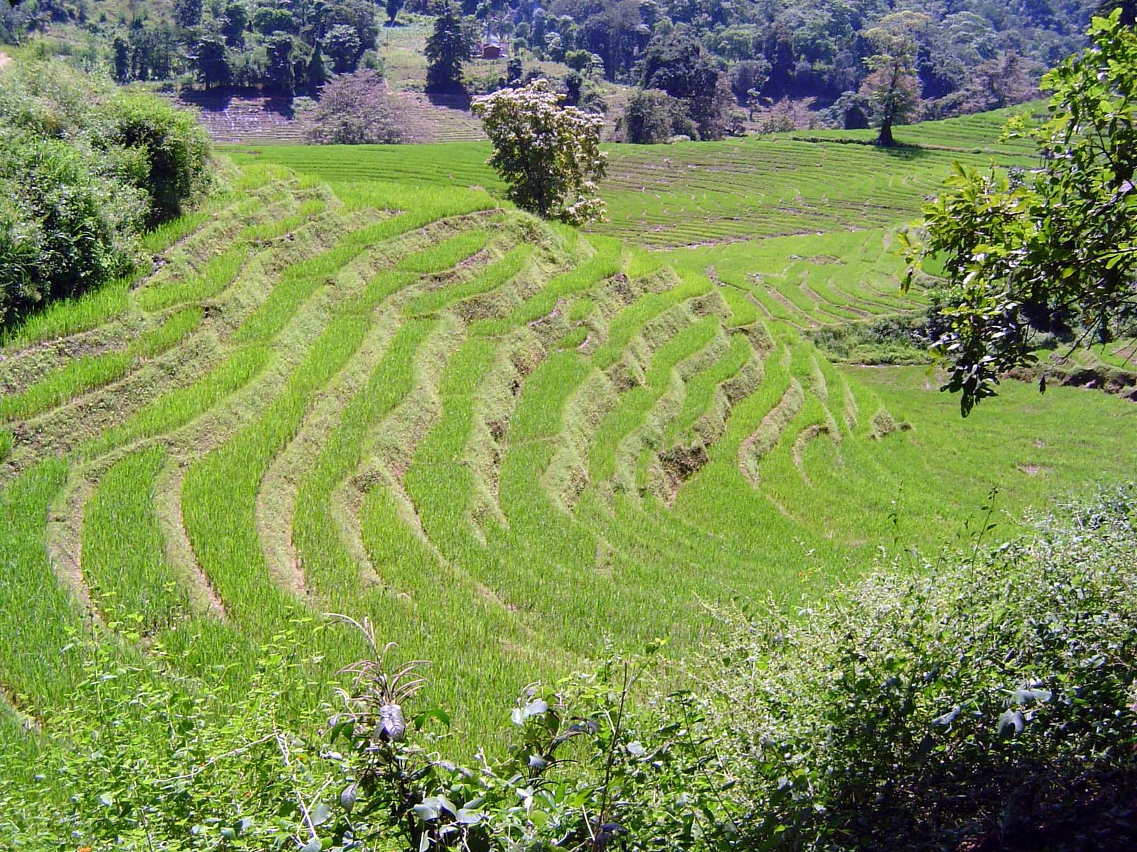
Here's a perspective that includes most of Lamesuriyagama. The view is south, towards Badulla, The stream comes down the valley in the distance and is ponded at a wier just above the cultivated area. Canals run toward the camera on contours on both sides of the irrigated area, while the stream continues north (toward the camera) along the line marked by trees.
We'll return to Lamesuriyagama shortly. Right now, we're approaching it from the west. Here: an arm of the Victoria Reservoir, part of the Mahaweli Ganga project.
The uplands have been cleared for chenas, periodically planted to unirrigated crops.
Some of the old clearings are very steep.
The Victoria Dam.
The road continues: it's new and strikingly deserted in comparison to the closely-settled roads west of Kandy.
A closeup of a *chena; *vegetables have become very popular here as cash crops.
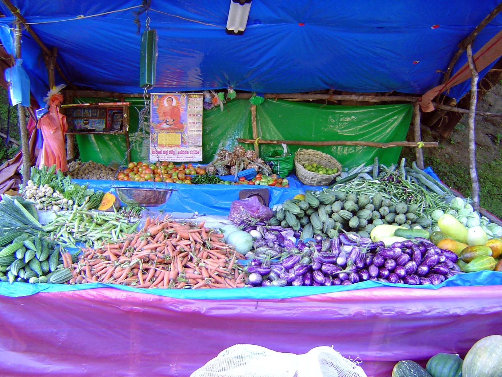
A roadside stand.
Sightings of paddy.
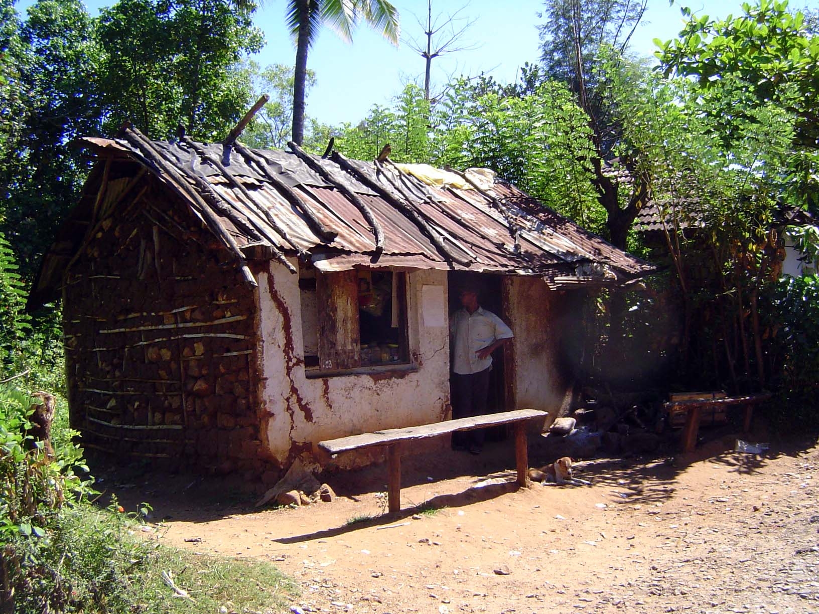
Shop at Lamesuriyagama.
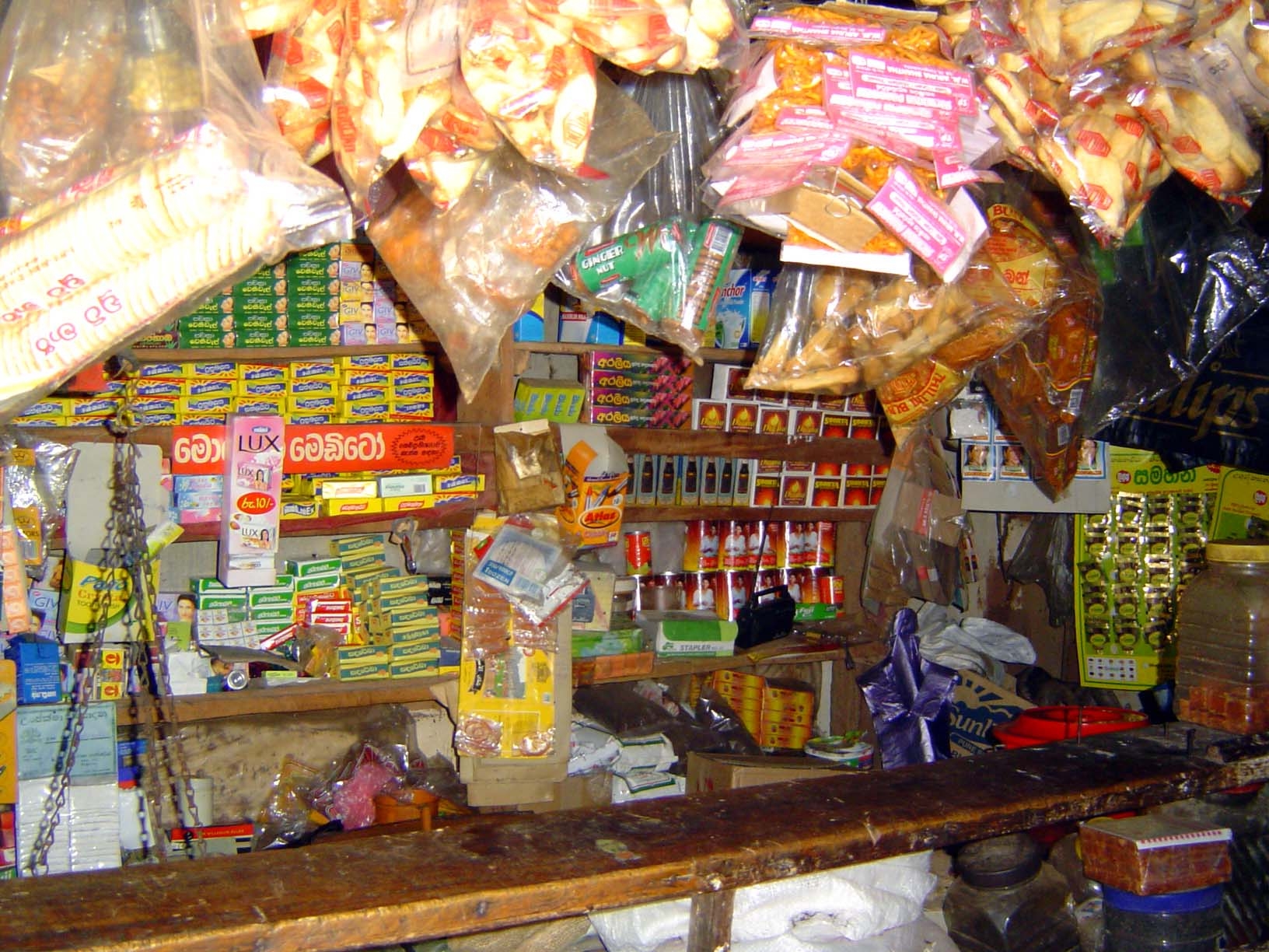
Shop contents.
Shop contents.
Shop contents.
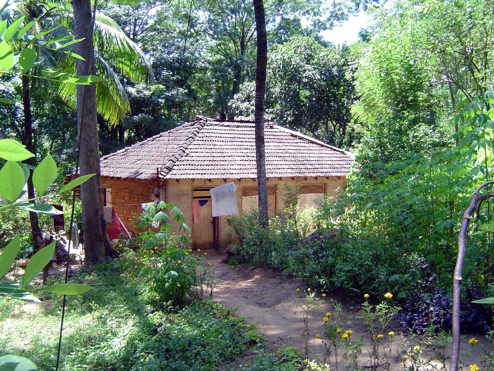
A village house.
Homestead gate. An upper bar can be drawn across, too.
House under construction.
Farmstead gate.
The sign advertises fertilizer for sale.
Many village houses are isolated like this one, rather than clustered.
Village road, almost with electricity.
Looking down to the village's paddy land.
The villagers also have vegetable patches.
Tobacco.
Path down to the paddy.
View of paddy and distant chenas.
*Chena *and paddy.
Steep slopes in cultivation.
Millet.
Paddy lands. The huts correspond closely to holdings: one per each.
The main canal, several miles long.
Head of a field ditch.
Canal-bank path, with terraces sloping away from it.
Terraced paddies.
Villagers say that Le Mesurier stayed at the house in the grove when he occasionally visited the village.
Terraced chenas in the upper right.
Looking upstream toward the canal's diversion wier.
The land grows hillier in that direction.
The terrace walls, steeper.
Tenants weeding by hand; they lived five miles away but came here to tend the field, in exchange for half the crop.