Despite its location at the outlet of Lake Victoria, Jinja in 1948 was a small place of only 6,000 people. Something of its future can be inferred, however, from Churchill's enthusiastic comment in 1908: "What fun to make the immemorial Nile begin its journey by diving through a turbine" (My African Journey, p. 170).
He wasn't the first to note that a dam could be built less than a mile from the start of the Nile, and he certainly wasn't the last, but another 20 years passed before an engineering survey was conducted. Yet another 20 years passed before the decision to build a dam was made. The Owen Falls Dam gates were closed in 1954, and power was soon flowing not only to local factories but west to Fort Portal, north to Gulu, and to Kenya. Thanks mostly to the dam and the factories driven by its power, Jinja grew to 30,000 people in 1961, a year before independence.
Who were those people? Only 1,500 of them were Europeans. They were served, it's little exaggeration to say, by 7,500 Asians and 21,000 Africans. The Asians were expelled or killed in 1972, but a census in 2014 counted a Jinja population of slightly over 70,000. Safe bet that the European and Asian populations were smaller than they had been 50 years before.
Here's the fabled outlet of the lake. The dam downstream has raised the lake level and flooded the low falls that were here, but we have the record of John Hannington Speke, who suffered greatly to get here in 1862 and who wrote about the scene at length: "Here at last I stood on the brink of the Nile; most beautiful was the scene, nothing could surpass it! It was the very perfection of the kind of effect aimed at in a highly kept park; with a magnificent stream from 600 to 700 yards wide, dotted with islets and rocks, the former occupied by fishermen's huts, the latter by sterns and crocodiles basking in the sun, flowing between the fine high grassy banks, with rich trees and plantains in the background, where herds of the nsunnu and hartebeest could be seen grazing, while the hippopotami were snorting in the water, and florikan [florican] and guinea-fowl rising at our feet."
Speke wrote that, "though beautiful, the scene was not exactly what I expected; for the broad surface of the lake was shut out from view by a spur of hill, and the falls, about 12 feet deep, and 400 to 500 feet broad, were broken by rocks. Still it was a sight that attracted one to it for hours—the roar of the waters, the thousands of passenger-fish, leaping at the falls with all their might, the Wasoga and Waganda fisherman coming out in boats and taking post on all the rocks with rod and hook, hippopotami and crocodiles lying sleepily on the water, the ferry at work above the falls, and cattle driven down to drink at the margin of the lake, made, in all, with the pretty nature of the country—small hills, grassy-topped, with trees in the folds, and gardens on the lower slopes—as interesting a picture as one could wish to see" (Chapter XV of Journal of the Discovery of the Source of the Nile, 1864).
The falls, of course, were obliterated by the Owen Falls Dam.
A monument (not to be confused with the obelisk erected in Kensington Gardens in 1866) stands on the bluff above.
Speke explained how he came to name several local features: "The expedition had now performed its functions. I saw that old father Nile without any doubt rises in the Victoria N'yanza, and, as I had foretold, that lake is the great source of the holy river which cradled the first expounder of our religious belief.... I now christened the 'stones' Ripon Falls, after the nobleman who presided over the Royal Geographical Society when my expedition was got up; and the arm of water from which the Nile issued, Napoleon Channel, in token of respect to the French Geographical Society, for the honour they had done me, just before leaving England, in presenting me with their gold medal for the discovery of the Victoria N'yanza."
Here's the dam, or rather a model of the dam in the national museum. It's seen here through plexiglass, a poor alternative to the real thing, but photography there is verboten.
Despite the dam, the river still appears powerful, with an appreciable current.
Churchill thought the site too magnificent for a town called Jinja: "In these circumstances," he wrote, "it is a pity to handicap the town with an outlandish name. It would be much better to call it Ripon Falls, after the beautiful cascades which lie beneath it, and from whose force its future prosperity will be derived" (p. 81). Ripon was a stalwart Liberal, as well as a viceroy of India, but really, is "Jinja" any more outlandish than "Ripon"?
Here's the town, a district and provincial headquarters, as shown in the national atlas of 1962. Ripon Falls are still marked, though flooded. The town center is at the upper right; government buildings are shown in black, and bungalows, mostly for government officers, are shown neat as a pin above the golf course. The reference manual of Thomas and Scott, published in 1935, states that the town is "spaciously laid out with broad tree-lined streets. Excellent piped water supply (pumping station below the Ripon Falls). Sanitation is by bucket system. No public electricity supply, oil lamps being still in use. There are a number of well-built residences, and the activities of Government have recently been concentrated into central offices in Busoga Square..." (Uganda, p. 435-6).
Nile Crescent runs at the top edge of the golf course. Several palms seem to have gone to their maker; the paving is shot.
The bungalows are in varying states of maintenance; razor wire is now de rigueur.
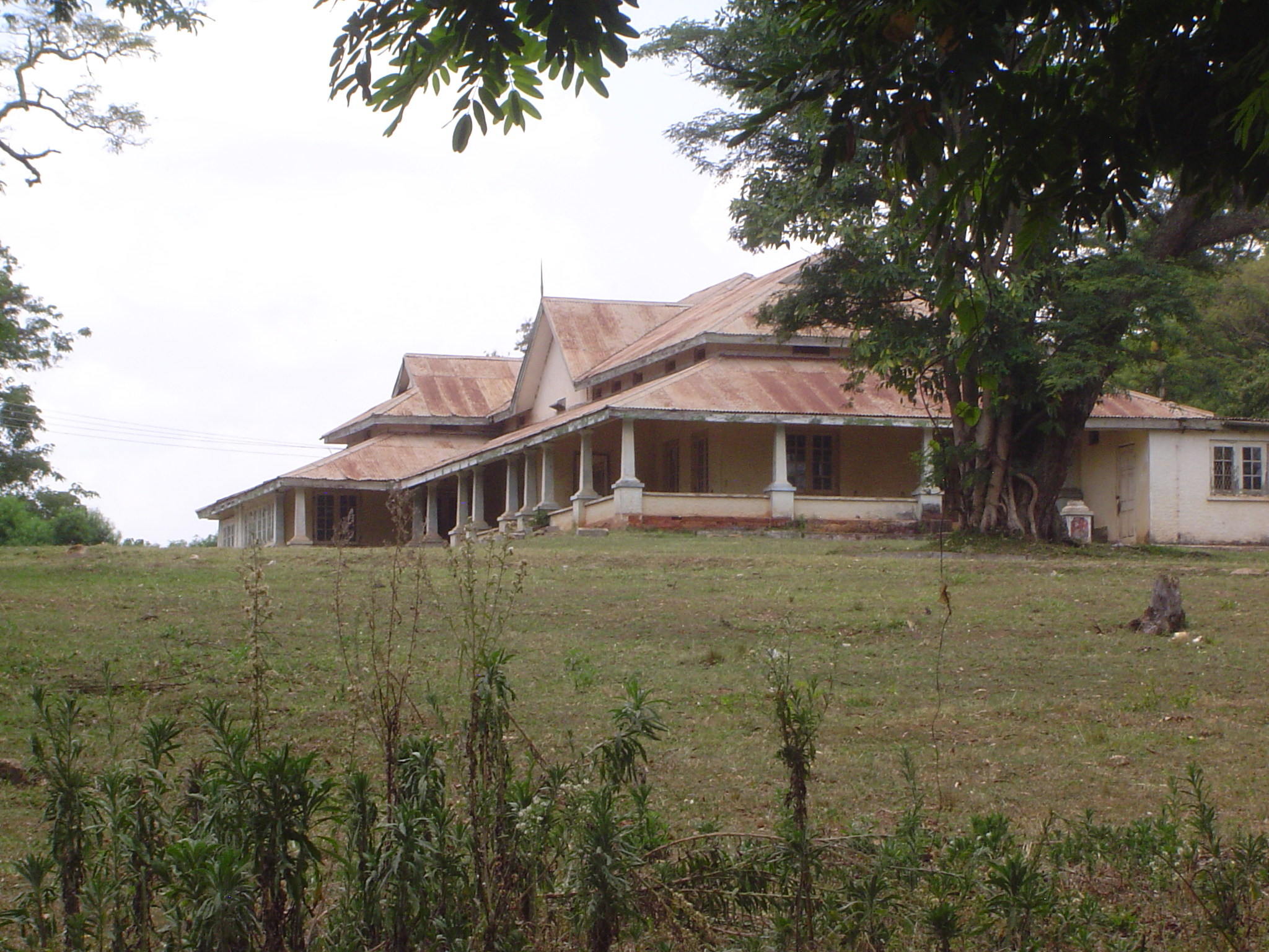
The hulk of the Ripon Falls Hotel, built in 1950 for the opening of the Owen Falls Dam.
A mansion presumably once belonging to an Indian family.
Detail.
The Asian community is remembered not only in the names of buildings but in the names of streets: Scindia, Nizam, Kutch, and Gokhale.
Here's Main Street.
The only customers were foreigners.
A bend-down boutique.
An apartment house with screened verandas.
The hand of government, minus its hands.
Jinja only became a legal municipality in 1957; the next year it got this town hall.
The penultimate governor of Uganda, Crawford may have considered himself lucky to have got out of Kenya, where he had been deputy governor in the Mau Mau years, but bad luck followed him. He retired to Southern Rhodesia only to get caught up in the troubles following its unilateral declaration of independence. In 1960 the House of Commons had a long, long debate after Crawford's passport was confiscated while he was on a visit to London.
Jinja's banks. The Orient Bank probably occupies the building that once housed Barclay's. Stanbic is a unit of South Africa's Standard Bank.
The district government offices, built in 1930.
Just in case you weren't sure.
The former residence of the governor. Couldn't get any closer: the guard was touchy.
Just down the hill: St. Andrew's church.
A plaque inside.
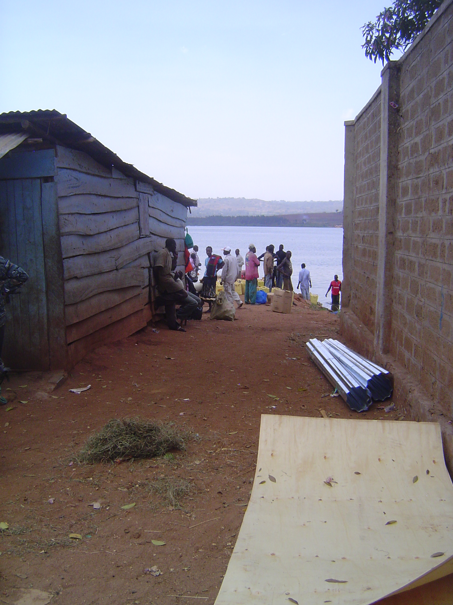
Down on the lakeshore, charcoal sellers had arrived by canoe, unloaded, and begun to wait for buyers.
There's a pier here, too. It handled a lot of cotton until the overland railroad arrived from Mombasa in 1929. There are still a number of local boats, but photography is, well, you know.
Continuing along the lake front, there's a little bazaar called Ripon.
And there, most informally, there's a landing.
A ferry arrives.
Men stand around with freight to be shipped. Wonder what the plastic jerrycans contain?
Try palm oil. It's tossed into the lake, floated over to a motorized canoe, then loaded.
How much will the boat carry?
Lots and lots.
Meanwhile, here's that rare thing: a road sign. Official ones, of metal, are promptly scavenged, but this one, of wood, survives. Behind it, tea and, in the background, sugarcane.
Plantains, the staple of southern Uganda.
Think there's any forest left?
Yes, there is. It's the Mabira Forest, and it's the largest surviving forest between Mt. Elgon, on the Kenya border, and the Rift Valley in western Uganda. It's been protected since British times. How big is it? Call it ten miles by ten.
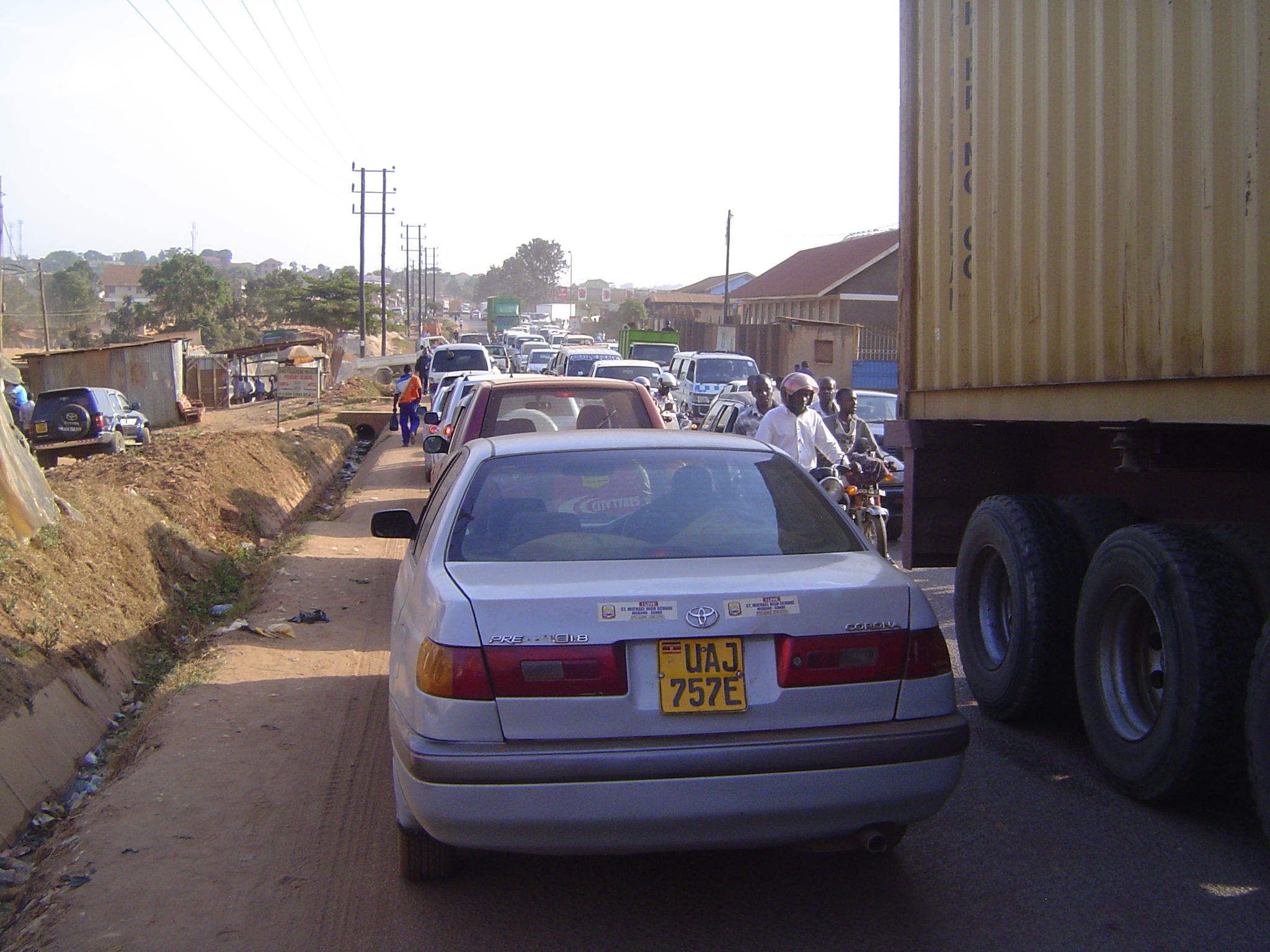
The road is a busy one, in part because it serves not only Kampala but parts of Rwanda and the eastern DRC.
It also helps these guys. Chop, chop; hack, hack.
A side road leads into the forest and brings to mind the adage: "the road is the enemy of the forest."
Meanwhile, back at Kampjam, it's a fight to the finish.