Location, location, location! It's not just about where to put your store; it's also about where to put your city. Laredo, Texas, is a good example of a place that wouldn't exist except for its location, location, location.
We're 150 miles southwest of San Antonio. Mesquite and prickly pear: a shrub savanna with about 16 inches of rain annually. That sounds tolerable, but the mercury exceeds 90 degrees Fahrenheit more than 120 days a year and potential evaporation exceeds 100 inches. The weeds, beneficiary of urban runoff (actually a Wal-Mart parking lot), are misleadingly green.
There is one modest resource: the not-so-grand Rio Grande, which (as the flag hints) marks the international border between Mexico and the United States.
It's that border that makes Laredo. The bridge is International Bridge No. 2; the parking lot is now closed but once was for truck customs. An older bridge—two lanes—is behind the camera a hundred yards or so.
Still farther upstream, there's an active railway bridge, with X-ray sensors to detect anyone trying to walk across.
No matter: the river isn't fenced or fortified. You can march right down and across, inhibited only by the Border Patrol.
See the figure splashing behind the stalks of grass in the center foreground? He said he was fishing. Translation: he'll cross as soon as the border-patrol officer goes away.
Laredo's not his destination.
Another bus station.
Still another.
Freight to move? No problem: here's a terminal on the American side.
Burger and fries? Not here.
The city itself is roughly divisible in two halves. The older one is a grid that runs about 40 blocks north-south and perhaps 50 east-west. It all starts at the San Agustin Plaza and Cathedral, very close to the river. Settlement began here in 1755.
Across the river, in Nuevo Laredo, the plaza has a twin. The two cities were separated in 1848.
Both cater to plenty of tourists, but the Laredo plaza explicitly welcomes visitors. Two blocks north, an old market has been converted to a Center for the Arts.
The downtown has its relics of a prosperous past.
The former Hamilton Hotel, 1923, is now on the register of historic places. With extensive federal help, it opened again in 2000 as affordable housing for senior citizens.
Decorative details on the facade.
Despite these efforts, most of the downtown commercial grid is both low-rise and low-rent.
More of the same.
Housing exhibits the usual range. Here's the lower end.
The plantation-style upper end.
Away from the core, commercial development in the older half of the town is weighted to people on the move.
A motel along U.S. 83, the old highway. Most road traffic now comes to Laredo over Interstate 35, which ends here after its long run south from Duluth and feeds directly into International Bridge No. 2.
The newer half of Laredo begins near the city's airport, at the northeast corner of the grid. The runway layout is disproportionately large for a city of 200,000 people, but there's a reason: between 1942 and 1974 it belonged to Laredo A.F.B. You can tell as much from the old base housing, like these duplexes.
Another former on-base duplex.
Farther north, the grid vanishes, and there are plenty of surprisingly expensive houses. Here's the elaborate entrance to a subdivision out by the country club.
Inside, a Missionesque fantasy.
A hint of the Mayan.
Some generic Italianate.
Square footage under tile.
Where did the roof go?
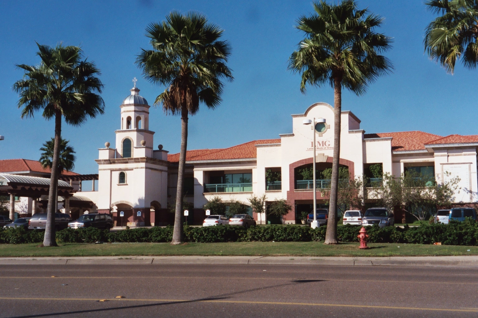
Nearby, a new medical center is loaded with instant heritage.
The city's public library has moved north. There's a regional shopping center nearby: MDM, or Mall Del Norte.
Laredo's apical meristem. Between 1990 and 2000, metro Laredo grew from 134,000 to 193,000 people—the fastest growth rate of any of Texas' largest 15 cities. By 2020 it's projected to have 400,000.