The Copperbelt, roaring into production about 1930, needed a commercial and administrative center. Ndola, established in 1909 along the line of the railroad built north from South Africa, was a logical choice.
The location was faintly known to the outside world as a spot on one of the slave-trading routes to the coast. The surviving emblem of that trade is a tree where slave caravans camped. The location is the intersection of Makoli, formerly Moffat, and Livingstone. Like most street names in Zambia, the name Moffat changed shortly after Independence. The name Livingstone survived, here and elsewhere, perhaps because Livingstone the man is remembered for his efforts to end slavery.
And here's the tree. A recently added memorial stone, which can't help nodding to the hotel that paid for it, is almost inaccessible behind the fence.
There was almost no town before the railroad, one of whose Garratt engines is parked across from the station. The boiler of the Garratts is on a middle section which can pivot between the engines at either end. The design looks odd but is well suited for narrow-gauge tracks (in this case Cape Gauge, 42 inches) and tight curves.
Here's the South Africa-style station, built by Rhodesian Railways, which was nationalized in Zambia in 1967, three years after independence: Southern Rhodesia was still white-ruled. Waiting for a train? Don't bother, though one apparently does come daily, with slow service (that's "slow" with three vowels) to Livingstone.
More likely, visitors come by road. Notice the picture of the slave tree? It's there, at the top of the city's shield.
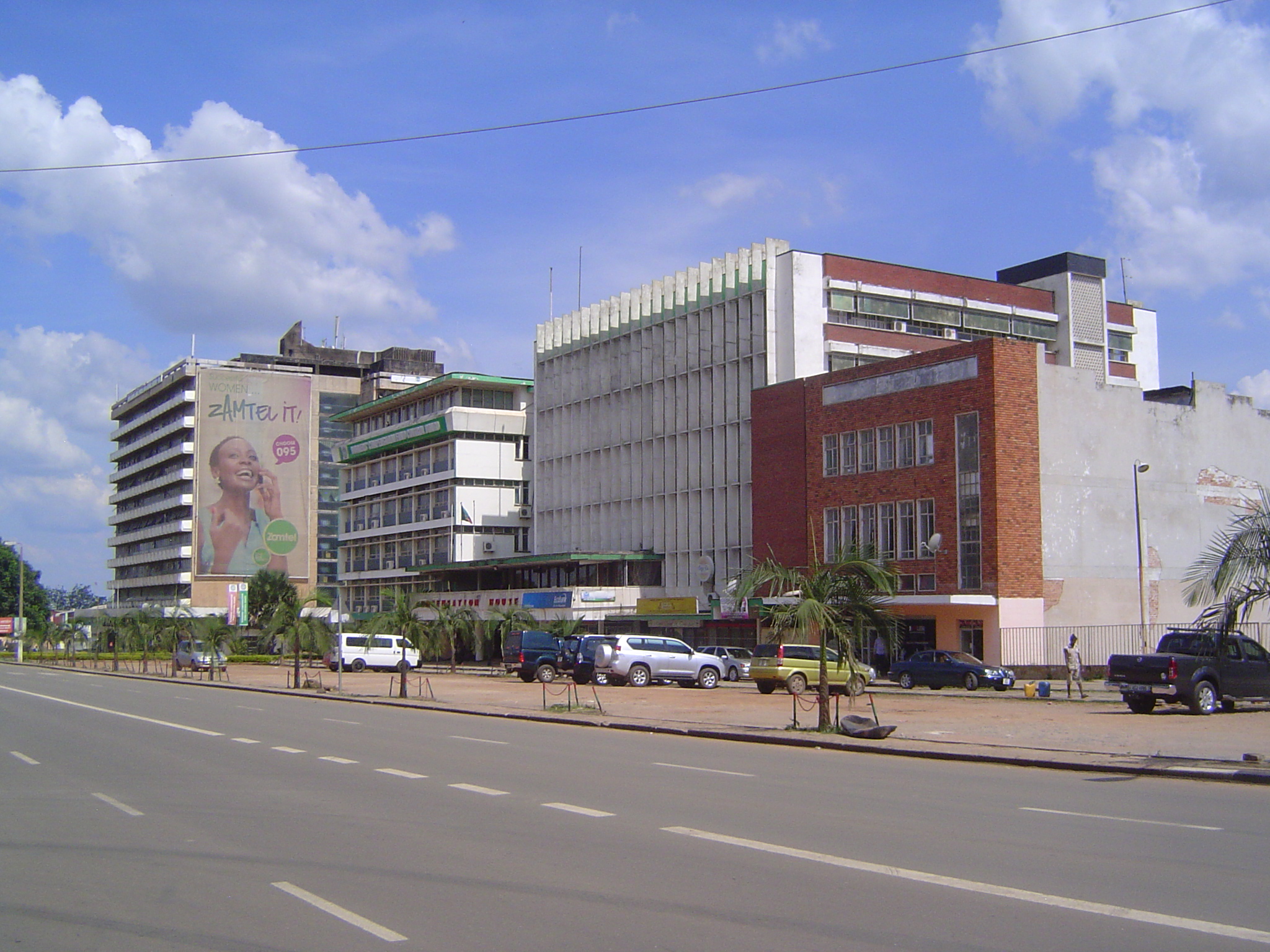
Same road: it's the highway through the Copperbelt, and it's been very well upgraded by the Chinese. It's also been unbelievably downgraded by a blizzard of billboards.
Here's the culprit.
No billboards here at the Copperbelt's one commercial airport, with daily international service to Johannesburg, Addis Ababa, and Nairobi. One runway, concrete, sufficient for 737s.
It's a Sunday afternoon, which partly explains why President (formerly First Street) is so quiet. It's also on the edge of the town, however, and links the center to the quiescent train station. Why is it so wide? Pretensions? Ox teams? Mormons? Your guess.
Here's Broadway, which for a couple of blocks is lined with the city's biggest office buildings, including Zamtel (yes, cell phones are ubiquitous) and Compensation House, the finned building dealing with injured miners. Dates? Maybe about 1960, in the last days of Northern Rhodesia.
A block to the south, this is the downtown hotel from that era. It's on Buteko (formerly King George) Avenue.
The other side of the street shows how modern buildings can age badly. The decay began with the collapse of copper prices in the 1970s and the near-simultaneous nationalization of the industry. Night has fallen more disastrously on other African countries, but conditions here have been grim enough.
The town has few old buildings built with an eye to style. Here's a Moderne exception at the intersection of President Avenue (formerly Cecil) at Maina Soko (formerly St. David's). The name Cecil of course refers to Rhodes.
Any bets about the purpose of this building, which hasn't changed since the days of the British? The location is on Independence Way (Queen Mary Avenue).
We can settle that quickly enough: it's the D.C.'s office, unchanged from the way it looked 50 years ago.
St. Andrew's Anglican Cathedral, on Blantyre Road (formerly St. George's) near Broadway. It was built in two stations, with the later addition of the high nave seen here in the background. The axis of the church was then rotated 90 degrees.
A watercolor of the original building.
Think we're in the bush? Think again. If somebody would cut the grass you'd have no doubts.
One bit of the grass has been very well tended. It's near that cross, familiar to anyone who's ever seen a Commonwealth War Graves cemetery.
Here you go, another for the collection.
As for the living, some were very comfortable in the old Northern Rhodesia. The paving hints at later decline.
So does the nasty fencing.
Here we are on Kasusu Road (formerly Cape Close). This is or was a very prosperous residential neighborhood.
A pair of lions try not to notice the pitiful street.
The same road leads to this, the Oval (its name is unchanged). Again, the neighborhood was and is prosperous, but now you can walk as fast as you can drive.
Still the Oval, this time a bit of village-Britain.
Security must be an issue. The location is Luneta Road (formerly Lanchester).
Still, there's money in town, and it shows up here on President (formerly Cecil) at a shopping center dominated (surprise!) by South African firms.
There's another center with a mall.
We're plugged in.
We're at the city's proudest retail center, the Jacaranda Mall.
Its supermarket. You're not impressed? Compare it with the shopping opportunities offered to blacks in the days of Northern Rhodesia, where "they stood in line out in the dust or rain in dark passageways on the side of or behind the shop, where a kind of peephole with a small ledge was built into the wall. Through this hatch they called out their wants, and merchandise was (if the white salesman inside chose to pay attention) pushed out to them through the slot." John Gunther, from whose Inside Africa this quote is taken, reported that the system was abolished at least in the Copperbelt towns early in 1954 (p. 633).
What's the staple food hereabouts? Try corn meal, served either sweet or savory. The brand (Antelope) refers not to the animal but to the Roan Antelope copper mine, about 20 miles to the west, at Luanshya.